Route from the Kerhervy ship graveyard to Lanester

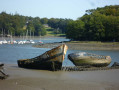
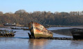
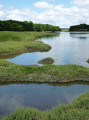
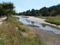
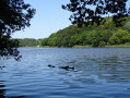
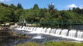
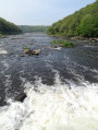
Explore the Blavet estuary, with its magnificent landscapes shaped by the sea. Discover the flora and fauna of the woodlands and salt meadows, as well as the historical heritage, including bridges, chapels and fountains… Lose yourself in reverie as you gaze upon the fascinating ship graveyard, with its old Groix tuna boats and their masts abandoned after 1945 in Kerhervy Cove.

Details

57674476
Creation:
Last update:
Last review:
  • Walking
    Activity: Walking
  • ↔
    Distance: 8.99 mi
  • ◔
    Average duration: 4h 25 
  • ▲
    Difficulty: Moderate

  • ⚐
    Back to start: Yes
  • ↗
    Ascent: + 344 ft
  • ↘
    Descent: - 325 ft

  • ▲
    Highest point: 157 ft
  • ▼
    Lowest point: 3 ft
  • ⚐ Country: France
  • ⚐ City: Lanester (56600)
  • ⚑
    Start/End: N 47.772878° / W 3.300756°
  • ❏
    IGN map(s): Ref. 0720ET
  • Hour-by-hour weather

Photos

Description of the walk

Parking is available at the Kerhervy Open-Air Theatre car park. Access via the D194 between Pont du Bonhomme and Lanester. Turn right at the roundabout if coming from the bridge, or left if coming from Lanester, then follow the signs (third road on the right). Park in the car park; the starting point sign is opposite the ship graveyard.

(S/E) Walk along the left-hand bank within the car park.

(1) Walk up the road and turn right onto the path that climbs straight ahead before turning right at the edge of the fields.

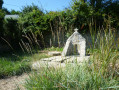
(2) Stay on the wide path, then take the third path on the right, then turn left to reach the wash house fountain at Le Petit Resto. Continue along this path, then turn right onto the road at Le Petit Resto.

(3) Go round the Petit Resto on the left and turn right to reach the Blavet. Continue along the riverbank, turning right four times. Carry on to the fifth junction.

(4) The site of an ancient Roman fish-processing facility. It was linked to salting vats on the promontory. Continue along the path.

(5) Turn left to discover the Resto Chapel.

(6) Retrace your steps and turn left.

(5) Carry on straight ahead at the hairpin bend on the descent. Don’t miss the viewpoint at the Rocher du Diable on the right before continuing left and then right, keeping as close as possible to the Blavet, until you reach a junction near Kermen.

(7) Leave the Blavet and turn left, then right, until you reach the road to Kermen.

(8) Turn left. At the bend, take the path leading to the left. At the road, turn left, then right. Continue along this road, ignoring the path on the left.

(9) Turn right at the next junction. Carry on straight ahead at the crossroads to reach a gate in Saint-Niau.

(10) Follow the path to the left, then turn right at the stream. At the junction, take the path on the left, then carry on straight ahead.

(11) Turn right and then left to reach Kerguer.

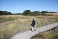
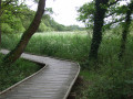
(12) Turn left and then right onto the path towards the Marais de la Goden. Turn left onto the boardwalk to reach the Pont du Bouc.

(13) Head back to the car park. Cross at the pedestrian crossing on the left. Turn left, cross the footbridge and head down to the right along the Ruisseau du Plessis. Follow this path, ignoring the tracks on the left. You’ll come to a road.

(14) Carry on straight ahead. Stay on the narrow path alongside the mouth of the Blavet until you reach the end at Saint-Guénaël.

(15) Turn left and walk uphill between the housing estates. At the road, carry on straight ahead, then turn right into Rue Saint-Guénaël until you reach Rue du Bol d’Air.

(16) Turn left. Don’t miss the chapel and its fountain on the riverbank straight ahead. Turn onto the path on the right and head right towards the Lanester Canoe-Kayak Club. Continue left along the Blavet to the Pont du Bonhomme.

(17) Climb the steps on the left, then go down the ones on the right to pass under the bridge. Stay on this path, which turns right, and head towards the Kerhervy Theatre, then back to your starting point (S/E).

Waypoints

  1. S/E : mi 0 - alt. 13 ft - Kerhervy Theatre
  2. 1 : mi 0.08 - alt. 13 ft - Ship graveyard - Blavet (fleuve)
  3. 2 : mi 0.25 - alt. 112 ft - Edge of the fields
  4. 3 : mi 0.58 - alt. 43 ft - Le Petit Resto
  5. 4 : mi 0.94 - alt. 30 ft - Junction and banks of the - Blavet (fleuve)
  6. 5 : mi 2.07 - alt. 36 ft - Junction - Blavet (fleuve)
  7. 6 : mi 2.3 - alt. 95 ft - The Restaurant
  8. 7 : mi 3.13 - alt. 16 ft - Junction - Blavet (fleuve)
  9. 8 : mi 3.65 - alt. 135 ft - Kermen
  10. 9 : mi 4.25 - alt. 102 ft - Junction
  11. 10 : mi 4.54 - alt. 115 ft - Saint-Niau
  12. 11 : mi 5.09 - alt. 89 ft - White path
  13. 12 : mi 5.44 - alt. 36 ft - Kerguer
  14. 13 : mi 5.8 - alt. 7 ft - Goden Marshes
  15. 14 : mi 6.54 - alt. 16 ft - Route - Blavet (fleuve)
  16. 15 : mi 7.31 - alt. 26 ft - Saint-Guénaël
  17. 16 : mi 7.61 - alt. 33 ft - Rue du Bol d’Air
  18. 17 : mi 8.35 - alt. 16 ft - Pont du Bonhomme
  19. S/E : mi 8.99 - alt. 13 ft - Kerhervy Theatre

Notes

This route is included in the Morbihan Departmental Plan for Walking and Hiking Routes and has been accredited by the French Hiking Federation. You can follow the yellow markings. There is an information board with a map and details of heritage sites at the start

Worth a visit

Ship graveyard: a wintering ground for Groix tuna boats from the 1920s onwards, hidden there by sailors during the war, damaged by bombing and abandoned, now a place where old boats are beached.
The Resto washhouse fountain: refurbished in the20th century.
Site of an ancient Roman fishery: associated with salting vats on the promontory.
Resto Chapel: a15th–16th-century building, rebuilt in pink granite around 1950.
Saint-Niau Educational Farm: established in 1992.
Goden Marshes: 22 ha of salt and brackish wetlands.
Dike of the former Plessis tidal mill: rebuilt between 1854 and 1867.
Saint-Guénaël Chapel and Fountain: a modern building with ancient features (13th–15th centuries).
Ponts du Bonhomme: 1904 (pillars and statues) and 1974.
Le Mané: former seigneury,19th-century castle.
Kerhervy open-air theatre: built in the 1980s.

Reviews and comments

4.8 / 5
Based on 2 reviews

Reliability of the description
5 / 5
Ease of following the route
5 / 5
Route interest
4.5 / 5
bernard coulomb
bernard coulomb

Overall rating : 4.5 / 5

Date of your route : Sep 25, 2025
Reliability of the description : Not used / Not applicable
Ease of following the route : ★★★★★ Very good
Route interest : ★★★★☆ Good
Very busy route : No

One of the most beautiful walks in the region, but the chapels here are still closed.

Machine-translated

louis35
louis35

Overall rating : 5 / 5

Date of your route : May 20, 2025
Reliability of the description : ★★★★★ Very good
Ease of following the route : ★★★★★ Very good
Route interest : ★★★★★ Very good
Very busy route : No

A lovely walking route – a few steep sections, but nothing too difficult if you take your time. We left our packed lunch in the car and came back for lunch, then did the second circular route in the afternoon. There were plenty of shaded paths.

Machine-translated

Other walks in the area

For more walks, use our search engine .

The GPS track and description are the property of this route's author. Please do not copy them without permission.