


Refine your search for walks in Blumberg
Blumberg walks


 Gorge Trail Stage 2 – from Blumberg to Schattenmühle
 Visorando Member
 12.86 mi
 +2,087 ft
 -2,185 ft
 7h 45
7h 45
 Moderate
 Departure from Blumberg (Regierungsbezirk Freiburg)
The Schluchtensteig trail runs for 119 km in 6 stages from Stühlingen to Wehr, right across the southern Black Forest.The second stage leads from Blumberg past the Schleifenbach waterfall to the River Wutach, through the magnificent Wutach Gorge, past the former spa town of Bad Ball and several waterfalls, and ends at Gasthof Schattenmühle.
Grand Canyon of the Black Forest
 8.10 mi
+1,581 ft
-1,299 ft
5h 05
Moderate
Departure from Wutach (Regierungsbezirk Freiburg)
8.10 mi
+1,581 ft
-1,299 ft
5h 05
Moderate
Departure from Wutach (Regierungsbezirk Freiburg)
One of the most beautiful hiking trails in the entire region is the Wutach Gorge (Wutachschlucht), nicknamed the "Grand Canyon of the Black Forest".
These are wild gorges, followed by footbridges, steps and paths carved into the rock, with a stream that is sometimes calm, sometimes cascading, and lush vegetation.
PLEASE NOTE: the road is currently closed for the return journey to Schattenmühle. Continue along the Lotenbach gorge for about 1.5 km until you reach the B315 road, where you will find the bus stop.
Schluchtensteig – 6 stages through the southern Black Forest
 87.77 mi
+13,340 ft
-16,319 ft
6 days
87.77 mi
+13,340 ft
-16,319 ft
6 days
 Difficult
Departure from Stühlingen (Regierungsbezirk Freiburg)
Difficult
Departure from Stühlingen (Regierungsbezirk Freiburg)
The Schluchtensteig trail runs in 6 stages over 119 km from Stühlingen to Wehr, right across the southern Black Forest.“Exposed paths along steep rocky gorges, some offering spectacular views down into the depths. The Wutachflühen, the Wutach Gorge, the Schleifenbach Falls, the Haslach Gorge, the Windberg Waterfall, the Hohwehras Gorge and the Wehras Gorge are destinations for all those who enjoy hiking through wild gorges, marvelling at thundering waterfalls, savouring the natural silence and wanting to switch off from everyday life for a week,” as stated on the Schluchtensteig website – and the trail certainly lives up to its promise.We’ve tweaked the third stage slightly, so you’ll avoid the hill between Lenzkirch and Fischbach. Instead, we’ll hike up to the Riesenbühlturm in Schluchsee, which offers a panoramic view in all directions.
Gorge Trail Stage 1 – from Stühlingen to Blumberg
 11.41 mi
+2,080 ft
-1,263 ft
7h 05
Moderate
Departure from Stühlingen (Regierungsbezirk Freiburg)
11.41 mi
+2,080 ft
-1,263 ft
7h 05
Moderate
Departure from Stühlingen (Regierungsbezirk Freiburg)
The Schluchtensteig trail leads in 6 stages over 119 km from Stühlingen to Wehr across the southern Black Forest.
The first stage takes us from Stühlingen to Blumberg along the Wutachflühen. High above the Wutach, we hike on narrow paths and exposed trails. We pass the Sauschwänzlebahn railway line several times and, with a bit of luck, we will see the museum train steam past.
The Buchberg with its long ascent challenges us in the last third of the tour before we descend to Blumberg.
Discover the Rhine Falls in Switzerland
 1.99 mi
+253 ft
-259 ft
1h 10
1.99 mi
+253 ft
-259 ft
1h 10
 Easy
Departure from Dachsen (Canton of Zürich)
Easy
Departure from Dachsen (Canton of Zürich)
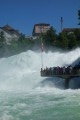
The Rhine Falls are waterfalls located between Neuhausen (right bank) and Flurlingen (left bank) in Switzerland, downstream from Schaffhausen. With a height of 23 metres and a width of 150 metres, they are among the largest in Europe. When the Rhine has its average flow, 750m3/s of water rushes over the rocks.
Gorge Trail Variation Stage 3 – From the Lotenbachklamm gorge to Lenzkirch
 8.98 mi
+1,283 ft
-1,188 ft
5h 15
Moderate
Departure from Bonndorf im Schwarzwald (Regierungsbezirk Freiburg)
8.98 mi
+1,283 ft
-1,188 ft
5h 15
Moderate
Departure from Bonndorf im Schwarzwald (Regierungsbezirk Freiburg)
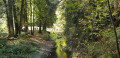
The Schluchtensteig trail runs for 119 km in 6 stages from Stühlingen to Wehr, right across the southern Black Forest. Our third stage starts at the upper entrance to the Lotenbach Gorge and ends in Lenzkirch, where there are plenty of places to stay and a bus service to the start of stage 4. Alternatively, you could stay overnight in Schluchsee and climb the Riesenbühl Tower – see the relevant tour.Anyone wishing to hike all the stages of the Schluchtensteig can stay overnight at the Schattenmühle between stages 2 and 3. From there, you can tackle the Lotenbach Gorge and hike uphill to the starting point of this walk.
In the Wutach and Lotenbach gorges
 Association / Club / Walk leader
 6.10 mi
+915 ft
-932 ft
3h 35
Moderate
Departure from Bonndorf im Schwarzwald (Regierungsbezirk Freiburg)
6.10 mi
+915 ft
-932 ft
3h 35
Moderate
Departure from Bonndorf im Schwarzwald (Regierungsbezirk Freiburg)
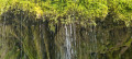
Sublime and magnificent gorges: the climb up the gorges is very cool.
Schluchtensteig supplement Stage 3 – Up to the Riesenbühlturm
 2.13 mi
+482 ft
-463 ft
1h 25
Easy
Departure from Schluchsee (Regierungsbezirk Freiburg)
2.13 mi
+482 ft
-463 ft
1h 25
Easy
Departure from Schluchsee (Regierungsbezirk Freiburg)
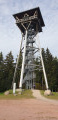
The Schluchtensteig trail leads in 6 stages over 119 km from Stühlingen to Wehr across the southern Black Forest. If you are staying in Schluchsee between stages 3 and 4, you should definitely climb the Riesenbühlturm tower and enjoy the magnificent view of Schluchsee and the Alps.
The Jägersteig trail starting from Schluchsee
 7.92 mi
+994 ft
-1,007 ft
4h 30
Moderate
Departure from Schluchsee (Regierungsbezirk Freiburg)
7.92 mi
+994 ft
-1,007 ft
4h 30
Moderate
Departure from Schluchsee (Regierungsbezirk Freiburg)
Schluchsee is known for its lake and attracts many tourists, especially in summer.
There are many hiking trails close to the lake. The Jägersteig (based on an old hunters' trail) alternates between paths along the lake and climbs into the surrounding forest overlooking the lake. There are several panoramic viewpoints along this route.
Walk around Schluch Lake (Schluchsee)
 11.10 mi
+659 ft
-676 ft
5h 40
Moderate
Departure from Schluchsee (Regierungsbezirk Freiburg)
11.10 mi
+659 ft
-676 ft
5h 40
Moderate
Departure from Schluchsee (Regierungsbezirk Freiburg)
Lake Schluch is the largest lake in the Black Forest, in Germany. It is a pleasant walk around the lake at any time of year. Most of this walk follows a fairly shaded path along the lakeshore.
The Genießerpfad – Schluchseer Jägersteig
 Tourist office
 7.42 mi
+876 ft
-879 ft
4h 10
Moderate
Departure from Schluchsee (Regierungsbezirk Freiburg)
7.42 mi
+876 ft
-879 ft
4h 10
Moderate
Departure from Schluchsee (Regierungsbezirk Freiburg)
A premium hiking trail offering magnificent views of the Schluchsee and idyllic, narrow paths amidst the stunning Upper Black Forest landscape.
Gorge Trail Stage 4 – from Fischbach to St. Blasien
 12.41 mi
+1,457 ft
-2,356 ft
7h 00
Moderate
Departure from Schluchsee (Regierungsbezirk Freiburg)
12.41 mi
+1,457 ft
-2,356 ft
7h 00
Moderate
Departure from Schluchsee (Regierungsbezirk Freiburg)
The Schluchtensteig trail leads in six stages over 119 km from Stühlingen to Wehr across the southern Black Forest.
The fourth stage of the Schluchtensteig is almost completely free of gorges and therefore quite easy to walk. However, you should not underestimate the altitude difference, especially after Unterkrummenhof, where a long climb awaits hikers, and after St. Blasien, where the forest road descends for a long time and is quite steep in places.
The southern Black Forest with its isolated farms shows its charming side on this stage, offering frequent views of the Alps. At the end, you can enjoy the Windeck waterfalls above St. Blasien.
Thanks to good bus connections, this stage can also be hiked very well as a single stage.
Titisee - Feldberg Passöhe
 8.48 mi
+1,670 ft
-430 ft
5h 20
Difficult
Departure from Titisee-Neustadt (Regierungsbezirk Freiburg)
8.48 mi
+1,670 ft
-430 ft
5h 20
Difficult
Departure from Titisee-Neustadt (Regierungsbezirk Freiburg)
This fifth stage will take you from Titisee to Feldberg Passöhe. The route follows the Westweg Schwartzwald. In the evening, you will stop at Feldberg Passhöhe, which, at 1,231 metres above sea level, is the second highest mountain pass in Germany.
Albsteig (E3) from Häusern to Feldberg Pass
 15.04 mi
+3,176 ft
-1,909 ft
9h 40
Difficult
Departure from Häusern (Regierungsbezirk Freiburg)
15.04 mi
+3,176 ft
-1,909 ft
9h 40
Difficult
Departure from Häusern (Regierungsbezirk Freiburg)
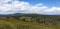
This variant of the Albsteig (Black Forest) trail takes you around 112 kilometres through the Alb valley along the river from Albbruck to the Feldberg, the roof of the southern Black Forest. The third stage of the Albsteig leads via St. Blasien and the Westweg trail to Bernau and the pass at the top of the Feldberg. The highlights of this stage, apart from the impressive landscape, are the Windberg waterfall, the view of the cathedral in St. Blasien and the Herzogenhorn, the highest point of the Albsteig. On a clear day, you can enjoy a magnificent panoramic view of the Black Forest and the Alps.
Albsteig (E5) from Höchenschwand to Waldshut
 14.65 mi
+1,352 ft
-3,507 ft
7h 55
Difficult
Departure from Höchenschwand (Regierungsbezirk Freiburg)
14.65 mi
+1,352 ft
-3,507 ft
7h 55
Difficult
Departure from Höchenschwand (Regierungsbezirk Freiburg)
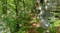
This variant of the Albsteig (Black Forest) trail takes you on a 112-kilometre journey through the Alb Valley along the river from Albbruck to the Feldberg, the highest peak in the southern Black Forest. Stage 5 is not formally part of the Albsteig. The Wolfssteig is both the continuation and the missing link needed to turn the Albsteig Black Forest into a multi-day circular tour. The Wolfsteig continues down into the Upper Rhine Valley to Waldshut and from there by public transport to the starting point of the tour in Albbruck.
Tour of Lake Titisee
3.58 mi
+315 ft
-308 ft
1h 55
Easy
Departure from Titisee-Neustadt (Regierungsbezirk Freiburg)
Walking around Lake Titisee prolongs the serenity it exudes.
Sankt Blasien - Wittenschwand
 10.04 mi
+1,962 ft
-1,440 ft
6h 20
Difficult
Departure from St. Blasien (Regierungsbezirk Freiburg)
10.04 mi
+1,962 ft
-1,440 ft
6h 20
Difficult
Departure from St. Blasien (Regierungsbezirk Freiburg)
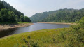
This seventh stage will take you from Sankt Blasien to Wittenschwand. The route follows the Albsteig Schwartzwald. You will follow the Alb and walk along the Albstausee to the dam. In the evening, you will stop in the charming village of Wittenschwand.
Gorge Trail Stage 5 – from St. Blasien to Todtmoos
 11.52 mi
+1,952 ft
-1,831 ft
7h 00
Moderate
Departure from St. Blasien (Regierungsbezirk Freiburg)
11.52 mi
+1,952 ft
-1,831 ft
7h 00
Moderate
Departure from St. Blasien (Regierungsbezirk Freiburg)
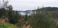
The Schluchtensteig trail runs for 119 km in 6 stages from Stühlingen to Wehr, right across the southern Black Forest.On the fifth stage, the route climbs 300 metres in altitude straight after the start to the Lehenbachkopf. And the route continues to climb steeply as it progresses.A new route now runs alongside the Klosterweiher pond and briefly follows the Bergbaurundweg circular trail. It then crosses the Horbacher Heide and the Ibacher Höhe, from where, on clear days, you can see as far as the Swiss Jura. The crowning glory of this stage is the stunning Hochwehraschlucht gorge.
 From Bärenthal to Titisee
17.75 mi
+1,572 ft
-1,946 ft
Duration unknown
Moderate
Departure from Feldberg (Regierungsbezirk Freiburg)
This walk, starting from Bärental station, passes through Feldsee and Hinterzarten and ends at Titisee. From Titisee, you can return to the starting point by train on the Titisee–Seebrugg line. You can take your bike on the train free of charge.
From Embrach to Uesslingen-Buch
 16.28 mi
+968 ft
-945 ft
8h 20
16.28 mi
+968 ft
-945 ft
8h 20
 Very difficult
Departure from Embrach (Canton of Zürich)
Very difficult
Departure from Embrach (Canton of Zürich)
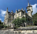
Seventeenth stage From Les Rousses to Lake Constance via the Jura ridges. Through the landscapes of northern Zurich, this stage takes you from Embrach to Uesslingen-Buch, following the rivers and villages that line the Huguenot Trail. From hamlet to hamlet, you will walk along well-marked footpaths, between discreet forests, peaceful farms and typical bell towers. Gradually, the scenery opens up onto the vast agricultural expanses of the Thur Valley, signalling the proximity of the German border. This route, rich in heritage and contrasts, ends gently by the river, in the peaceful countryside of Uesslingen.
From Uesslingen-Buch to Amlikon-Bissegg
 13.83 mi
+259 ft
-128 ft
6h 35
Difficult
Departure from Uesslingen-Buch (Thurgau)
13.83 mi
+259 ft
-128 ft
6h 35
Difficult
Departure from Uesslingen-Buch (Thurgau)
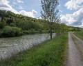
Stage 18 From Les Rousses to Lake Constance via the Jura ridges. This stage, starting from Uesslingen, first takes you through peaceful agricultural pastures before skirting the vineyards of an old monastery. You then reach Warth, home to the Ittingen Charterhouse, which bears witness to more than 850 years of history and spirituality. Passing through Frauenfeld, the capital of the canton of Thurgau, you leave the hustle and bustle of the city behind and return to the tranquillity of the banks of the Thur. The route takes you to Pfyn, then offers a beautiful immersion along the river, punctuated by the passage of the superb Eschikofen customs bridge. A stage combining heritage, nature and the gentle flow of the river.
Lake Titisee from Hinterzarten
 8.70 mi
+1,024 ft
-1,040 ft
4h 55
Moderate
Departure from Hinterzarten (Regierungsbezirk Freiburg)
8.70 mi
+1,024 ft
-1,040 ft
4h 55
Moderate
Departure from Hinterzarten (Regierungsbezirk Freiburg)
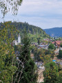
Starting from Hinterzarten, this hiking route offers beautiful views. The trail first winds through pine and beech forests, in a peaceful and shady atmosphere, before reaching the shores of Lake Titisee. The circular route takes you around the lake, alternating between wooded passages and paved paths, with opportunities to take a break by the water's edge and enjoy beautiful views of the lake and the surrounding mountains.
Hinterzarten–Feldberg
13.07 mi
+2,185 ft
-2,192 ft
7h 55
Difficult
Departure from Hinterzarten (Regierungsbezirk Freiburg)
A very lovely walk leading to the highest peak in the Black Forest. You’ll pass close to the beautiful glacial lake, the Feldsee. Half of the walk (the first and last quarters) is through woodland, but the rest is very open, offering magnificent views across the entire mountain range.
For those who’d like to split the walk into two, it’s easy to find accommodation in the Feldberg ski resort, which is roughly halfway along the route.
Wittenschwand - Görwihl
 10.98 mi
+1,493 ft
-2,293 ft
6h 20
Difficult
Departure from Dachsberg (Südschwarzwald) (Regierungsbezirk Freiburg)
10.98 mi
+1,493 ft
-2,293 ft
6h 20
Difficult
Departure from Dachsberg (Südschwarzwald) (Regierungsbezirk Freiburg)
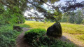
This eighth stage will take you from Wittenschwand to Görwihl. The route follows the Albsteig Schwartzwald. You will cross the beautiful Dachsberg forest and follow the Alb. In the evening, you will stop in the pleasant village of Görwihl.
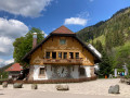
Breitnau gorges and Hinterzarten village
 3.91 mi
+597 ft
-594 ft
2h 20
Moderate
Departure from Breitnau (Regierungsbezirk Freiburg)
3.91 mi
+597 ft
-594 ft
2h 20
Moderate
Departure from Breitnau (Regierungsbezirk Freiburg)
This circular walk starts from Breitnau where you can enjoy local products (glass art shop, cuckoo clocks, etc.) and heritage. Then, enjoy the walk along the gorges where you will find watermills via Hinterzarten village.
A lovely discovery in the Black Forest at Breitnau
 4.58 mi
+745 ft
-735 ft
2h 45
Easy
Departure from Breitnau (Regierungsbezirk Freiburg)
4.58 mi
+745 ft
-735 ft
2h 45
Easy
Departure from Breitnau (Regierungsbezirk Freiburg)
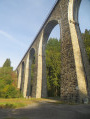
Enter the magnificent Ravenna Gorge, where the torrent winds its way through numerous waterfalls and beautiful wooden bridges. The return route, the ‘Jakobusweg’, follows the Rotbach stream past several sawmills and mills, and the magnificent viaduct over which the Höllental train passes.A varied outing full of contrasts!
Circular walk from and to Finsterlingen, above the Ibach and in Hierholz
5.96 mi
+915 ft
-899 ft
3h 30
Easy
Departure from Dachsberg (Südschwarzwald) (Regierungsbezirk Freiburg)
More than half of the route takes you through a shady, picturesque forest. Part of the route runs high above the Ibach, whilst another part runs deep below it. You can go for a swim in the Hierholzer Weiher. Part of the route is along the road in Hierholz. Most of the paths are unmarked forest tracks that do not appear on hiking maps, but can be found on the Visorando app.
Circular walk to and from Finsterlingen through the woods above Hierholz
3.79 mi
+453 ft
-436 ft
2h 10
Easy
Departure from Dachsberg (Südschwarzwald) (Regierungsbezirk Freiburg)
A short walk, mostly in the shade of the dense forest. The paths are largely unmarked, but as forest tracks they are very easy to follow using the app. There are two spots offering lovely views of the Alps and also of the Hierholzer Weiher further down.
From Winterthur to Rapperswil via the Züri Oberland-Höhenweg
 46.71 mi
+8,235 ft
-8,287 ft
4 days
Difficult
Departure from Winterthur (Canton of Zürich)
46.71 mi
+8,235 ft
-8,287 ft
4 days
Difficult
Departure from Winterthur (Canton of Zürich)
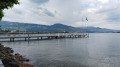
Four-day tour through the cantons of Zurich and St. Gallen.
This route offers views of Lake Zurich and the peaks of the Bernese Alps, the Glärnisch massif and the Alpstein, including the Säntis
Winterthur, the starting point, and Rapperswil, the finish, both have remarkable historic centres.
Winterthur - Gyrenbad via the Züri Oberland-Höhenweg
 11.51 mi
+1,955 ft
-1,033 ft
7h 00
Difficult
Departure from Winterthur (Canton of Zürich)
11.51 mi
+1,955 ft
-1,033 ft
7h 00
Difficult
Departure from Winterthur (Canton of Zürich)
For this first stage, starting from Winterthur station, after exploring the old town, you will very quickly find yourself in the countryside. You will cross an animal park. The route is quite varied, following the Töss river and passing through the peaceful village of Kollbrunn. Then, a ridge path will lead you to Gyrenbad, a place of tranquillity and rest.
Dielsdorf - Embrach
 13.66 mi
+1,050 ft
-1,161 ft
7h 10
Difficult
Departure from Dielsdorf (Canton of Zürich)
13.66 mi
+1,050 ft
-1,161 ft
7h 10
Difficult
Departure from Dielsdorf (Canton of Zürich)
Sixteenth stage From Les Rousses to Lake Constance via the Jura ridges. This transitional stage marks the departure from the Jura ridges and their mountainous panoramas to begin the descent towards Lake Constance. You leave the Jura Höhenweg to cross a more urban landscape, bypassing the metropolis of Zurich while skirting the runways of its imposing international airport. This contrast between nature and infrastructure gives the route a unique character. The stage ends gently on the banks of the peaceful Töss Valley, where the river meanders between woods and meadows, offering a relaxing setting after a varied day's walking.
Zweribach Waterfalls from Sankt-Märgen
 7.09 mi
+1,529 ft
-1,526 ft
4h 35
Difficult
Departure from St. Märgen (Regierungsbezirk Freiburg)
7.09 mi
+1,529 ft
-1,526 ft
4h 35
Difficult
Departure from St. Märgen (Regierungsbezirk Freiburg)
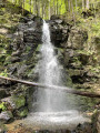
From Sankt-Märgen to the Zweribach waterfalls via the Hischbach waterfall and back via the Kapfen chapel.
Schönwald – Blindensee route
 8.13 mi
+1,155 ft
-1,155 ft
4h 45
Moderate
Departure from Schönwald im Schwarzwald (Regierungsbezirk Freiburg)
8.13 mi
+1,155 ft
-1,155 ft
4h 45
Moderate
Departure from Schönwald im Schwarzwald (Regierungsbezirk Freiburg)
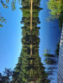
A route exploring the Blindensee (translation: ‘blind lake’), a natural peat bog – an elevated moorland lake with a dense population of trees and poor visibility due to its shallow depth. Beautiful views over part of the Southern Black Forest Nature Park.
Nußhurtkapelle and Triberger Wasserfälle from Triberg (Germany)
 7.21 mi
+1,421 ft
-1,437 ft
4h 35
Moderate
Departure from Triberg im Schwarzwald (Regierungsbezirk Freiburg)
7.21 mi
+1,421 ft
-1,437 ft
4h 35
Moderate
Departure from Triberg im Schwarzwald (Regierungsbezirk Freiburg)
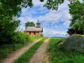
This loop will take you from Triberg (Baden-Württemberg) which, as well as being a major cuckoo factory, is also famous for its waterfall, the highest in Germany. A hike for everyone.
The route is in two parts:
The long 9 km loop takes you through forests and mountain meadows to discover some magnificent scenery.
The shorter 2.3 km loop takes you to the waterfall, which unfortunately is very popular with tourists, so there is a charge for admission (€8).
Albsteig (E1) from Albbruck to Göhrwihl
 8.53 mi
+2,077 ft
-955 ft
5h 45
Moderate
Departure from Albbruck (Regierungsbezirk Freiburg)
8.53 mi
+2,077 ft
-955 ft
5h 45
Moderate
Departure from Albbruck (Regierungsbezirk Freiburg)
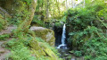
This version of the Albsteig (Black Forest) takes you on a 112-kilometre journey through the Alb Valley along the river from Albbruck to the Feldberg, the highest peak in the southern Black Forest. The first stage takes you upstream from Albbruck through and along the picturesque Alb Valley and, towards the end, through the Höllbach Valley up to Göhrwihl.
In 5 stages from Albbruck to Feldberg and back
 69.61 mi
+11,762 ft
-11,696 ft
5 days
Difficult
Departure from Albbruck (Regierungsbezirk Freiburg)
69.61 mi
+11,762 ft
-11,696 ft
5 days
Difficult
Departure from Albbruck (Regierungsbezirk Freiburg)
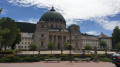
This variant of the Albsteig (Black Forest) takes you through the Alb Valley along the river from Albbruck to the Feldberg, the roof of the southern Black Forest, covering around 111 kilometres. Along the route, the Albsteig crosses two other long-distance hiking trails, the Schluchtensteig near St. Blasien and the Westweg on the Feldberg. The multi-day tour described here takes you along the western route to the Feldberg and back down to Höchenschwand via the eastern route. From there, the Wolfssteig (23 km) takes you down to Waldshut-Tiengen and finally by train back to the starting point in Albbruck.
Albsteig (E2) from Göhrwihl to Häusern
 15.71 mi
+3,320 ft
-2,746 ft
10h 05
Difficult
Departure from Görwihl (Regierungsbezirk Freiburg)
15.71 mi
+3,320 ft
-2,746 ft
10h 05
Difficult
Departure from Görwihl (Regierungsbezirk Freiburg)
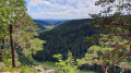
This variant of the Albsteig (Black Forest) takes you on a 112-kilometre journey through the Alb Valley along the river from Albbruck to the Feldberg, the roof of the southern Black Forest. Stage 2 takes you from Göhrwihl back down into the Alb Valley, then over the Dachsberg, to the Albstausee reservoir and up to Häusern.
Triberg Black Forest Railway Trail
 3.64 mi
+1,050 ft
-1,047 ft
2h 35
Moderate
Departure from Triberg im Schwarzwald (Regierungsbezirk Freiburg)
3.64 mi
+1,050 ft
-1,047 ft
2h 35
Moderate
Departure from Triberg im Schwarzwald (Regierungsbezirk Freiburg)
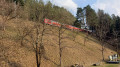
An interesting route that follows the Black Forest railway line. Several vantage points showcase the ingenuity used to overcome the difference in height with the help of double circular loops. Along the way, you’ll see the world’s largest cuckoo clock.
Görwihl - Albbruck
 8.25 mi
+1,184 ft
-2,365 ft
4h 50
Moderate
Departure from Görwihl (Regierungsbezirk Freiburg)
8.25 mi
+1,184 ft
-2,365 ft
4h 50
Moderate
Departure from Görwihl (Regierungsbezirk Freiburg)
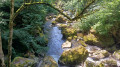
This ninth stage will take you from Görwihl to Albbruck. The route follows the Albsteig Schwartzwald. You will enjoy the pretty waterfalls of the Höllbach and follow the Alb to its confluence with the Rhine. Once you arrive in Albbruck, the end of the hike, you can choose between Albbruck or Laufenburg, a beautiful German-Swiss village, for your overnight stay.
Circular route around Schonach via the Blindensee
 7.25 mi
+1,010 ft
-1,014 ft
4h 15
Moderate
Departure from Schonach im Schwarzwald (Regierungsbezirk Freiburg)
7.25 mi
+1,010 ft
-1,014 ft
4h 15
Moderate
Departure from Schonach im Schwarzwald (Regierungsbezirk Freiburg)
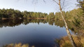
A pleasant route in the hills above Schonach. You will pass through the Blindensee nature reserve. This deep black lake is surrounded by marshy wetlands, home to many rare plant species.
Genießerpfad – Rohrhardsberg U(h)rwald Trail
 5.39 mi
+1,240 ft
-1,230 ft
3h 35
Moderate
Departure from Schonach im Schwarzwald (Regierungsbezirk Freiburg)
5.39 mi
+1,240 ft
-1,230 ft
3h 35
Moderate
Departure from Schonach im Schwarzwald (Regierungsbezirk Freiburg)
This premium hiking trail through the Rohrhardsberg Nature Reserve offers everything that makes the Black Forest so special. From lush pastures and meadows to woods and moors, a waterfall and, time and again, stunning views. Cuckoo clocks in all shapes and colours adorn the woods and make for a truly special hiking experience!
The Braunhörnle and the Rohrhardsberg via the Genießerpfade
 8.81 mi
+1,804 ft
-1,811 ft
5h 35
Moderate
Departure from Schonach im Schwarzwald (Regierungsbezirk Freiburg)
8.81 mi
+1,804 ft
-1,811 ft
5h 35
Moderate
Departure from Schonach im Schwarzwald (Regierungsbezirk Freiburg)
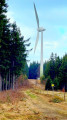
A pleasant route leading to the Braunhörnle. This summit offers a panoramic view of the Yach valley. The route also passes through the Rohrhardsberg nature reserve. The landscapes here are varied, alternating between forests, pastures and meadows.
Elzhof–Schonacher Wälderweg circular loop via Blindensee
 7.89 mi
+1,070 ft
-1,047 ft
4h 35
Moderate
Departure from Schonach im Schwarzwald (Regierungsbezirk Freiburg)
7.89 mi
+1,070 ft
-1,047 ft
4h 35
Moderate
Departure from Schonach im Schwarzwald (Regierungsbezirk Freiburg)
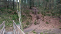
A pleasant route that initially follows the Elz stream past a beautiful waterfall. The route then follows part of the Schonach forest path, then passes through the Blindenhöhe nature reserve and around Blindensee.
Brugg - Dielsdorf
 14.93 mi
+2,428 ft
-2,192 ft
9h 00
Very difficult
Departure from Windisch (Aargau)
14.93 mi
+2,428 ft
-2,192 ft
9h 00
Very difficult
Departure from Windisch (Aargau)
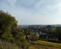
Fifteenth stage From Les Rousses to Lake Constance via the Jura ridges. This stage marks the end of the ridge trail, running from west to east through the typical landscapes of the Swiss Jura. To conclude, a gentle descent winds its way through the vineyards, taking you to Dielsdorf, a charming village nestled at the foot of the Lägern, the last rocky outcrop of the eastern Jura.
Gyrenbad - Hulftegg via the Züri Oberland-Höhenweg
 13.05 mi
+2,674 ft
-1,936 ft
8h 20
Difficult
Departure from Turbenthal (Canton of Zürich)
13.05 mi
+2,674 ft
-1,936 ft
8h 20
Difficult
Departure from Turbenthal (Canton of Zürich)
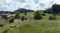
This second stage will take you from Gyrenbad to the Hulftegg Pass. The Schauenberg offers a magnificent view of the Alps. The route to Sitzberg offers more interesting views, particularly of the Bichelsee. From Sitzberg (on the border between the cantons of Zurich and St. Gallen) to Allenwinden, the route follows a small road, which fortunately is not very busy. When you arrive at the Hulftegg Pass, you will enjoy a superb view of the Toggenburg and the Appenzell region.
On the Great Hornberg Mill Trail
 9.11 mi
+2,136 ft
-2,119 ft
6h 05
Moderate
Departure from Hornberg (Regierungsbezirk Freiburg)
9.11 mi
+2,136 ft
-2,119 ft
6h 05
Moderate
Departure from Hornberg (Regierungsbezirk Freiburg)
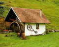
On this walker-friendly circular route through the Reichenbach and Schwanenbach valleys, we pass numerous traditional Black Forest farm mills. Along the way, we’ll find beautiful viewpoints and a romantic rock labyrinth.A family-friendly walk near Hornberg.
Circular route from Schöne Aussicht and the Hauenstein Rock
 5.58 mi
+1,198 ft
-1,171 ft
3h 35
Moderate
Departure from Hornberg (Regierungsbezirk Freiburg)
5.58 mi
+1,198 ft
-1,171 ft
3h 35
Moderate
Departure from Hornberg (Regierungsbezirk Freiburg)
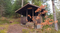
The Hauenstein rock offers a magnificent view (Schöne Aussicht) of the southern and eastern parts of the Black Forest. This route follows part of the Schwarzwald West Weg and passes through beautiful forests above Niederwasser.
Shepherd’s Trail (Hirtenweg) starting from Yach
12.80 mi
+2,986 ft
-2,982 ft
8h 30
Very difficult
Departure from Elzach (Regierungsbezirk Freiburg)
A long hike with significant elevation gain. Follow the sign featuring a shepherd, then the unmistakable Yellow Diamond. Please note that the signs are sometimes a few dozen metres past the junctions, so keep an eye out!