The Genießerpfad – Schluchseer Jägersteig

A premium hiking trail offering magnificent views of the Schluchsee and idyllic, narrow paths amidst the stunning Upper Black Forest landscape.

Details

20943873
Creation:
Last update:
Last review:
  • Walking
    Activity: Walking
  • ↔
    Distance: 7.42 mi
  • ◔
    Average duration: 4h 10 
  • ▲
    Difficulty: Moderate

  • ⚐
    Back to start: Yes
  • ↗
    Ascent: + 876 ft
  • ↘
    Descent: - 879 ft

  • ▲
    Highest point: 3,842 ft
  • ▼
    Lowest point: 3,028 ft

Photos

Description of the walk

(Start/Finish) We begin our walk at the “Im Wolfsgrund” car park. Alternatively, we can start the walk at Schluchsee-Aha railway station (signpost at the Seglerheim junction). From the “Im Wolfsgrund” car park, we walk through the underpass beneath the B500, follow the footpath to the left and cross the L156 towards Lenzkirch.

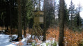
(1) After the junction, we follow the hiking and cycle path alongside the B500. After a few metres, we see the entrance to the Schluchsee Jägersteig. Here, we enter the Bannwald and follow the narrow path, past a timber yard, up to the right towards the Stutzhütte.

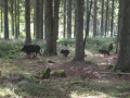
(2) From here, we walk to the Hanselefelsen and then turn left. After a short while, a fantastic view opens up! We head right and then immediately left again. Over the Ahaberg, we follow the path towards Bildstein. You can either continue along this section of the path to Bildstein or take the “Pirschpfad” for some exciting discoveries, especially for children.

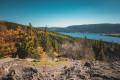
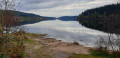
(3) We carry on straight ahead and then turn left. At the Bildstein viewpoint, we enjoy the breathtaking view of the Schluchsee and, with a bit of luck, we can see as far as the 3,614-metre-high Tödi in the Swiss Alps.

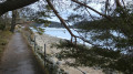
(4) After a break, we head down a narrow path towards Unteraha. We first take the Bildstein rock path and then turn right onto the Unterer Bildsteinweg. In Aha, we walk to the boat landing stage and follow the lakeside circular path to the Amalienruhe.

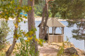
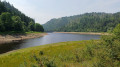
(5) Here, a magnificent view across the lake opens up. We continue towards Schluchsee village, over the footbridge and along the lake to the hikers’ car park (start/finish).

Waypoints

  1. S/E : mi 0 - alt. 3,077 ft - “Im Wolfsgrund” hiking car park
  2. 1 : mi 1.39 - alt. 3,524 ft - Stutzhütte
  3. 2 : mi 2.68 - alt. 3,802 ft - Stalking Trail
  4. 3 : mi 3.6 - alt. 3,629 ft - Bildstein
  5. 4 : mi 4.87 - alt. 3,074 ft - Aha boat landing stage
  6. 5 : mi 5.49 - alt. 3,048 ft - Schluchsee
  7. S/E : mi 7.42 - alt. 3,077 ft - “Im Wolfsgrund” hiking car park

Notes

  • There are public toilets at the Kurhaus Schluchsee and the railway stations at Schluchsee. Equipment
  • We recommend sturdy footwear!

Safety information

  • The Jägersteig is not suitable for pushchairs! – Backpacks can be hired from the Schluchsee Tourist Information Centre.
  • The trail is suitable for dogs. Please keep your dog on a lead on narrow sections of the path and be considerate of other walkers.
  • Please follow the signposts and walk in the correct direction along the trail.
  • ‘Keep your eyes peeled’ is the motto on the Upper Black Forest Premium hiking trails. That’s because there’s a stamp point in the shape of a cuckoo clock on every trail. These allow you to document your hikes by collecting stamps in the Upper Black Forest Hiking Pass. Further information can be found at https://www.hochschwarzwald.de/Wandern/wanderpass

Worth a visit

  • Tip: Combine a section of the Jägersteig trail from Aha to Schluchsee with a boat trip around the lake and a stop for refreshments at the Unterkrummenhof
  • If you enjoy a dip in the water, don’t forget your swimming gear. There are plenty of opportunities to cool off by the lakeside.

Sights to see during the hike

  • Pirschpfad viewpoint (2)
  • Amalienruhe viewpoint
  • Bildstein viewpoint (3)

Reviews and comments

5 / 5
Based on 1 review

Reliability of the description
5 / 5
Ease of following the route
5 / 5
Route interest
5 / 5
laika1963
laika1963

Overall rating : 5 / 5

Date of your route : Aug 10, 2025
Reliability of the description : ★★★★★ Very good
Ease of following the route : ★★★★★ Very good
Route interest : ★★★★★ Very good
Very busy route : Yes

This route is very busy on Sundays.
Start the walk in the forest, where the climb is gentler.

Machine-translated

Other walks in the area

For more walks, use our search engine .

The GPS track and description are the property of this route's author. Please do not copy them without permission.