


Britanicus100

 Visorando Member
 Premium user
 - Location: Briançon (05100)
- Gender: man
- Website: https://www.youtube.com/channel/UCTJOLm8F7-ekusY65Kyenpg
Sign up:
Published route(s)
 Le Grand Charvia
 5.96 mi
 +2,484 ft
 -2,477 ft
 4h 55
4h 55
 Difficult
 Departure from Cervières (Hautes-Alpes)
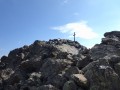
A lovely hike in the Fonts de Cervières near Briançon, featuring a summit climb and the discovery of three lakes, including the magnificent turquoise-blue Lac Gignoux.360-degree panoramic views of the surrounding peaks: Izoard, Ecrins and Cerces.I recommend supplementing the description by using the Visorando app.
⚠️ GPS tracking recommended.
The Pointe des Cerces
 8.82 mi
+4,003 ft
-3,993 ft
7h 35
Difficult
Departure from Valloire (Savoie)
8.82 mi
+4,003 ft
-3,993 ft
7h 35
Difficult
Departure from Valloire (Savoie)
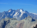
Near the Grand Galibier, another stunning peak in the Cerces massif offering an exceptional 360° panorama of the Ecrins, the Thabor, the Aiguilles d’Arves, Mont Blanc, the Viso, etc.A summit that has to be earned but is well worth the detour.An absolutely magnificent hike with a surprise at the summit that invites contemplation.
Pissette Waterfall
 2.52 mi
+1,680 ft
-1,680 ft
2h 35
2.52 mi
+1,680 ft
-1,680 ft
2h 35
 Moderate
Departure from Pelvoux (Hautes-Alpes)
Moderate
Departure from Pelvoux (Hautes-Alpes)
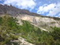
Hike in a high mountain setting on a summer trail passing at the foot of a cliff where a majestic waterfall flows, with a magnificent panorama of the high peaks of the Écrins.
The Crête des Brusas circular loop
 5.41 mi
+2,336 ft
-2,336 ft
4h 30
Moderate
Departure from Villar-Saint-Pancrace (Hautes-Alpes)
5.41 mi
+2,336 ft
-2,336 ft
4h 30
Moderate
Departure from Villar-Saint-Pancrace (Hautes-Alpes)
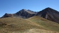
A trail hike offering spectacular views of the surrounding ridges and peaks, as well as the Briançonnais and the Cerces as far as the Aiguilles d’Arves.
I recommend supplementing the route description by using the Visorando app.
Le Grand Peygu
 2.83 mi
+2,159 ft
-2,159 ft
3h 10
Difficult
Departure from Cervières (Hautes-Alpes)
2.83 mi
+2,159 ft
-2,159 ft
3h 10
Difficult
Departure from Cervières (Hautes-Alpes)
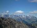
This is a very striking pyramid that irresistibly catches the eye as you climb the Col d’Izoard. Yet this small, cramped summit reveals an extraordinary panorama of the Ecrins, the Vanoise, the Cerces and the Queyras, and even Mont Blanc. Its short but very challenging ascent is well worth the detour.
Pic de Beaudouis
 5.09 mi
+3,087 ft
-3,084 ft
5h 00
Difficult
Departure from Arvieux (Hautes-Alpes)
5.09 mi
+3,087 ft
-3,084 ft
5h 00
Difficult
Departure from Arvieux (Hautes-Alpes)
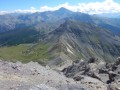
Hike to a little-visited peak in Queyras offering a 360° panorama of unrivalled beauty.
Crête de Chalvet via the Tête des Fournéous
 7.57 mi
+2,782 ft
-2,782 ft
5h 55
Moderate
Departure from Montgenèvre (Hautes-Alpes)
7.57 mi
+2,782 ft
-2,782 ft
5h 55
Moderate
Departure from Montgenèvre (Hautes-Alpes)
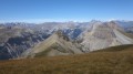
Hike to one of the most beautiful viewpoints in the Écrins, from Sirac to Meije and Cerces. Panoramic view of the Italian peaks of Piedmont and some of the peaks of Queyras.
La Tête de Jacquette
 4.80 mi
+3,005 ft
-3,005 ft
4h 50
Moderate
Departure from Ceillac (Hautes-Alpes)
4.80 mi
+3,005 ft
-3,005 ft
4h 50
Moderate
Departure from Ceillac (Hautes-Alpes)
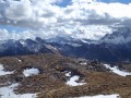
Hike on a very accessible trail leading to one of the most beautiful viewpoints in Queyras.
Tête de la Draye
 3.37 mi
+2,070 ft
-2,080 ft
3h 20
Difficult
Departure from Pelvoux (Hautes-Alpes)
3.37 mi
+2,070 ft
-2,080 ft
3h 20
Difficult
Departure from Pelvoux (Hautes-Alpes)
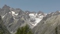
Hike above Ailefroide with a beautiful panoramic view of the Vallouise valley, the small pass of Rascrouset, the Selé, the Pelvoux and the Glacier Blanc. Excellent viewpoint, especially of the Pelvoux.
The Croix d’Aquila
 4.16 mi
+1,998 ft
-1,995 ft
3h 40
Moderate
Departure from Puy-Saint-André (Hautes-Alpes)
4.16 mi
+1,998 ft
-1,995 ft
3h 40
Moderate
Departure from Puy-Saint-André (Hautes-Alpes)
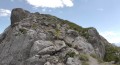
A climb to a summit offering a stunning panoramic view of the surrounding mountains of the Briançonnais and some of the peaks of the Écrins.
Le Lasseron
 4.09 mi
+2,726 ft
-2,726 ft
4h 15
Moderate
Departure from Cervières (Hautes-Alpes)
4.09 mi
+2,726 ft
-2,726 ft
4h 15
Moderate
Departure from Cervières (Hautes-Alpes)
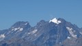
A route away from the crowds, towards a summit located on the border between the Fonts de Cervières and Izoard valleys. Magnificent panoramic views of the surrounding peaks, as well as the Ecrins, Cerces and Italy.
Summit of the Grand Vallon
 6.06 mi
+2,684 ft
-2,684 ft
5h 10
Moderate
Departure from Cervières (Hautes-Alpes)
6.06 mi
+2,684 ft
-2,684 ft
5h 10
Moderate
Departure from Cervières (Hautes-Alpes)
A hike to a summit situated on the border between Queyras and Briançonnais, offering a stunning panoramic view of the Italian Piedmont, the Queyras, the Ubaye, as well as the Cerces and the Vanoise.
Glacier Noir to the Balmes de François Blanc
 4.92 mi
+2,192 ft
-2,192 ft
4h 10
Difficult
Departure from Pelvoux (Hautes-Alpes)
4.92 mi
+2,192 ft
-2,192 ft
4h 10
Difficult
Departure from Pelvoux (Hautes-Alpes)
A high-mountain route following the edge of a moraine ridge with breathtaking views of the high peaks of the Écrins.
⚠️ Please note:User 2678463 reported on 9 September 2026 that there are various issues on this hike, including access, paths and footbridges.> following damage caused by bad weather in late August 2026. The road and path leading from Ailefroide to Pré Madame Carle have been destroyed in many places. Vehicles can no longer pass.It is possible to reach Madame Carle’s meadow on foot via the road: an unofficial path marked by cairns between the remaining sections of road.>Via the footpath: currently being created by the national park teams, also marked by cairns.Please note that in both cases, the paths cross the beds of rivers and torrents which were the ‘cause’ of the damage.
Ancient Fort of Gondran or Sommet des Anges via Lac des Sarailles
 6.01 mi
+2,730 ft
-2,726 ft
5h 10
Difficult
Departure from Cervières (Hautes-Alpes)
6.01 mi
+2,730 ft
-2,726 ft
5h 10
Difficult
Departure from Cervières (Hautes-Alpes)
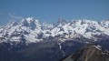
A historic hike with a visit to two Maginot forts, a ridge walk with views of a multitude of peaks in the Écrins, Cerces, Italy and Queyras ranges, a descent to two pretty lakes and a return through a landscape of chimneys with another view of the Écrins. These are the ingredients of one of the most beautiful routes in the Briançonnais.
The Cime de la Charvie
 6.45 mi
+3,379 ft
-3,386 ft
5h 55
Difficult
Departure from Cervières (Hautes-Alpes)
6.45 mi
+3,379 ft
-3,386 ft
5h 55
Difficult
Departure from Cervières (Hautes-Alpes)
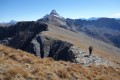
This is one of the mountain guides' favourite hikes to a summit with a ridge trail offering exceptional views of the Alps and returning to a valley that is very popular with chamois.
I recommend using the Visorando app.
The Sugar Loaf
 3.73 mi
+1,946 ft
-1,946 ft
3h 25
Difficult
Departure from Molines-en-Queyras (Hautes-Alpes)
3.73 mi
+1,946 ft
-1,946 ft
3h 25
Difficult
Departure from Molines-en-Queyras (Hautes-Alpes)
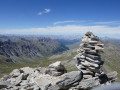
A short, challenging hike to a first-class viewpoint on Mont Viso, which, at an altitude of 3,208 metres, offers a magnificent 360° panorama of Italy and the Queyras.
Peyrolle ridges
 7.72 mi
+1,936 ft
-1,942 ft
5h 15
Moderate
Departure from Saint-Chaffrey (Hautes-Alpes)
7.72 mi
+1,936 ft
-1,942 ft
5h 15
Moderate
Departure from Saint-Chaffrey (Hautes-Alpes)
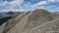
A hike to one of the most beautiful ridges in the Briançonnais region, starting from the Col du Granon, taking in four peaks and offering a stunning panorama of the Écrins and the Cerces.A trail route with sections that may be daunting for hikers prone to vertigo.
Pic Blanc du Galibier via the Vallon de Roche Noire
 2.76 mi
+1,703 ft
-1,706 ft
2h 45
Moderate
Departure from Le Monêtier-les-Bains (Hautes-Alpes)
2.76 mi
+1,703 ft
-1,706 ft
2h 45
Moderate
Departure from Le Monêtier-les-Bains (Hautes-Alpes)
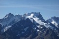
The most popular ski summit in the Alps, offering breathtaking 360° views of the great peaks of the Écrins massif, the Cerces, the Vanoise and Mont Blanc.
Le Signal de la Grave
 5.25 mi
+2,182 ft
-2,165 ft
4h 20
Moderate
Departure from La Grave (Hautes-Alpes)
5.25 mi
+2,182 ft
-2,165 ft
4h 20
Moderate
Departure from La Grave (Hautes-Alpes)
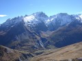
Hike to a first-class viewpoint of La Meije.
Mont de la Plane or Sommet de la Loubatière
 5.69 mi
+2,421 ft
-2,405 ft
4h 45
Moderate
Departure from Montgenèvre (Hautes-Alpes)
5.69 mi
+2,421 ft
-2,405 ft
4h 45
Moderate
Departure from Montgenèvre (Hautes-Alpes)
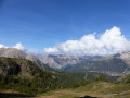
A hike starting from the Montgenèvre resort towards a border peak offering a fantastic panorama of the surrounding French-Italian summits.
Rocher de Barrabas or Guglia Di Mezzodi
 9.75 mi
+3,743 ft
-3,720 ft
7h 45
Difficult
Departure from Névache (Hautes-Alpes)
9.75 mi
+3,743 ft
-3,720 ft
7h 45
Difficult
Departure from Névache (Hautes-Alpes)
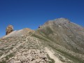
The Rocher de Barrabas or Guglia di Mezzodi is a peak on the Italian border with a particularly striking profile. It forms part of a veritable amphitheatre of Dolomite rocks on the Italian side. The view it offers is simply breathtaking.
Tour de Roche Robert
 4.11 mi
+2,083 ft
-2,100 ft
3h 40
Difficult
Departure from Le Monêtier-les-Bains (Hautes-Alpes)
4.11 mi
+2,083 ft
-2,100 ft
3h 40
Difficult
Departure from Le Monêtier-les-Bains (Hautes-Alpes)
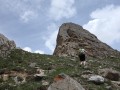
A wild hike, partly off-trail, to an area popular with ibex, offering first-class views of the Montagne des Agneaux, the Pic de Combeynot and some of the Cerces peaks.
I recommend using the Visorando app.
Pointe de Pécé
 9.14 mi
+4,094 ft
-4,094 ft
7h 45
Difficult
Departure from Névache (Hautes-Alpes)
9.14 mi
+4,094 ft
-4,094 ft
7h 45
Difficult
Departure from Névache (Hautes-Alpes)
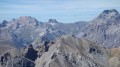
A hike to one of the dominant peaks of the Clarée Valley, offering panoramic views of the Écrins, Cerces and Queyras massifs, as well as some Italian peaks.
Lac de la Cula circular
 3.81 mi
+1,542 ft
-1,542 ft
3h 05
Moderate
Departure from Névache (Hautes-Alpes)
3.81 mi
+1,542 ft
-1,542 ft
3h 05
Moderate
Departure from Névache (Hautes-Alpes)
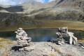
Here is a short hike, with a section off the beaten track, to a magnificent lake, a real vantage point over the Cerces massif. I recommend using the Visorando app.
Lac Rouge via Lac des Béraudes
 3.85 mi
+2,087 ft
-2,096 ft
3h 35
Difficult
Departure from Névache (Hautes-Alpes)
3.85 mi
+2,087 ft
-2,096 ft
3h 35
Difficult
Departure from Névache (Hautes-Alpes)
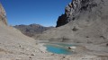
This is a hike where you will certainly be captivated by the unfailing beauty of the turquoise blue Lac des Béraudes and the equally blue Lac Rouge, which owes its name solely to the colour of the candle that dominates it. The route includes a few metres off the trail. One section may be tricky for some people; see the practical information and reviews.
Pic de Peyre Eyraute
 4.78 mi
+2,890 ft
-2,890 ft
5 hrs
4.78 mi
+2,890 ft
-2,890 ft
5 hrs
 Very difficult
Departure from Villar-Saint-Pancrace (Hautes-Alpes)
Very difficult
Departure from Villar-Saint-Pancrace (Hautes-Alpes)
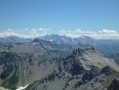
A summit situated above the village of Les Ayes and Lac de l’Orceyrette, offering a breathtaking 360° panorama of the Écrins, the Cerces and the Queyras. A challenging ascent leading to a very scenic ridge.
Le Grand Galibier
 11.85 mi
+4,252 ft
-4,236 ft
9h 10
Very difficult
Departure from Valloire (Savoie)
11.85 mi
+4,252 ft
-4,236 ft
9h 10
Very difficult
Departure from Valloire (Savoie)
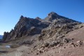
This legendary summit offers spectacular views of the Écrins mountains dominated by La Barre and La Meije, Goléon, the Aiguilles d'Arves, Mont Blanc, Viso, Queyras and the Swiss Valais, where Liskamm and Monte Rosa rise up. It is also a popular area for ibex.
Pic de Rochebrune
 6.21 mi
+3,707 ft
-3,707 ft
8 hrs
Very difficult
Departure from Cervières (Hautes-Alpes)
6.21 mi
+3,707 ft
-3,707 ft
8 hrs
Very difficult
Departure from Cervières (Hautes-Alpes)
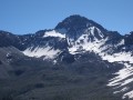
This legendary summit in the Briançonnais region offers exceptional views of the Écrins, Cerces, Queyras and Italy. Please note: this is a challenging route, partly off-trail in scree, with steep slopes and exposed sections.
Clot la Cime via the Col d'Izoard
 3.03 mi
+1,237 ft
-1,237 ft
2h 30
Moderate
Departure from Cervières (Hautes-Alpes)
3.03 mi
+1,237 ft
-1,237 ft
2h 30
Moderate
Departure from Cervières (Hautes-Alpes)
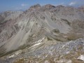
A low-altitude hike offering a 360° panorama of Queyras, Cerces and Briançonnais. This well-ventilated high-altitude route is ideal in hot weather.
Combeynot Lake
 4.99 mi
+3,071 ft
-3,071 ft
5h 00
Difficult
Departure from Le Monêtier-les-Bains (Hautes-Alpes)
4.99 mi
+3,071 ft
-3,071 ft
5h 00
Difficult
Departure from Le Monêtier-les-Bains (Hautes-Alpes)
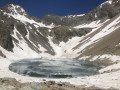
Hike to a high-altitude lake nestled in a glacial basin at the foot of the Pics de Combeynot.
Mont Chenaillet
 6.22 mi
+2,507 ft
-2,516 ft
5h 05
Moderate
Departure from Cervières (Hautes-Alpes)
6.22 mi
+2,507 ft
-2,516 ft
5h 05
Moderate
Departure from Cervières (Hautes-Alpes)
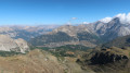
Le Chenaillet, an ancient volcano located under the ocean, is of exceptional geological interest. It is an easy hike with two lakes to discover and a 360° panoramic view of Italy, the Écrins, the Briançonnais and some of the peaks of the Queyras.
Dormillouse Ridge
 6.74 mi
+3,356 ft
-3,337 ft
6h 00
Difficult
Departure from Cervières (Hautes-Alpes)
6.74 mi
+3,356 ft
-3,337 ft
6h 00
Difficult
Departure from Cervières (Hautes-Alpes)
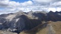
A hike off the beaten track towards a border ridge offering exceptional panoramic views of Italy, the Queyras, the Cerces and the Vanoise.Use of the Visorando app is recommended.
Col de Côte Plaine
 2.02 mi
+1,033 ft
-1,033 ft
1h 50
Moderate
Departure from Le Monêtier-les-Bains (Hautes-Alpes)
2.02 mi
+1,033 ft
-1,033 ft
1h 50
Moderate
Departure from Le Monêtier-les-Bains (Hautes-Alpes)
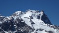
A short hike with a section off the beaten track towards a ridge offering one of the most beautiful panoramic views of the Meije massif.
Pic Lombard
 4.98 mi
+3,015 ft
-3,015 ft
4h 55
Difficult
Departure from Cervières (Hautes-Alpes)
4.98 mi
+3,015 ft
-3,015 ft
4h 55
Difficult
Departure from Cervières (Hautes-Alpes)
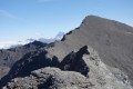
A hike partly off the beaten track, in a very wild and unspoilt setting, towards a summit above the hamlet of Les Fonts de Cervières, offering sweeping views over the Queyras, the Ubaye, the Cerces, the Vanoise, the Écrins and Italy. A little surprise box at the foot of the cross.
For this route, I recommend using the Visorando app.
Tête du Puy via L'Oriol Sainte-Marguerite
 5.98 mi
+3,645 ft
-3,655 ft
5h 55
Difficult
Departure from Saint-Martin-de-Queyrières (Hautes-Alpes)
5.98 mi
+3,645 ft
-3,655 ft
5h 55
Difficult
Departure from Saint-Martin-de-Queyrières (Hautes-Alpes)
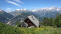
A hike off the beaten track in the hills above Argentière-la-Bessée, leading to a ridge and then a summit offering a magnificent panorama of the Écrins, the Durance valley and the Queyras.
As this route includes sections off the beaten track, I recommend using the Visorando app
Mont Guillaume
 8.01 mi
+3,114 ft
-3,114 ft
6h 25
Moderate
Departure from Embrun (Hautes-Alpes)
8.01 mi
+3,114 ft
-3,114 ft
6h 25
Moderate
Departure from Embrun (Hautes-Alpes)
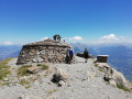
A pleasant walk to one of the main and most beautiful viewpoints over Lake Serre-Ponçon.Due to the large number of junctions, I recommend using the Visorando app.
Summit of the Eychauda via the Crête de Serre-Chevalier
 6.86 mi
+2,730 ft
-2,730 ft
5h 30
Difficult
Departure from Puy-Saint-André (Hautes-Alpes)
6.86 mi
+2,730 ft
-2,730 ft
5h 30
Difficult
Departure from Puy-Saint-André (Hautes-Alpes)
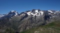
A traverse through a nature reserve in the Écrins National Park, rich with wildflowers; a ridge walk and an ascent to a summit offering a vast and stunning panorama of the Écrins, the Cerces, Italy and the Queyras. These are the ingredients of this magnificent hike.
I recommend using the Visorando app for this route.
Tête de Pradieu via the Pas d'Anna Falque
 7.88 mi
+3,796 ft
-3,796 ft
6 hrs
Very difficult
Departure from Villar-d'Arêne (Hautes-Alpes)
7.88 mi
+3,796 ft
-3,796 ft
6 hrs
Very difficult
Departure from Villar-d'Arêne (Hautes-Alpes)
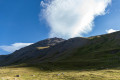
A hike in a high-mountain setting on the slopes above the Refuge de l'Alpe, offering a breathtaking panorama of the high peaks of the Écrins massif.Partly off-trail hiking on steep slopes, where I recommend using the Visorando app.
Pic du Mas de la Grave
 6.46 mi
+3,399 ft
-3,399 ft
5h 55
Difficult
Departure from La Grave (Hautes-Alpes)
6.46 mi
+3,399 ft
-3,399 ft
5h 55
Difficult
Departure from La Grave (Hautes-Alpes)
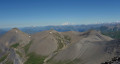
Hike to a 3,000-metre peak offering a complete 360° panorama of the Écrins, the Grandes Rousses, Savoie, Mont Blanc and the Aiguilles d'Arves.To take this route, you will need a high-clearance vehicle.
(!) User comment on 2 September 2025: >Very beautiful hike, but in my opinion the route should be revised. The track from Le Chazelet is closed to traffic( reserved for authorised persons and alpine farmers only).
Punta Rognosa de Sestrières
 7.70 mi
+4,022 ft
-4,019 ft
7h 05
Difficult
Departure from Sestriere (Torino)
7.70 mi
+4,022 ft
-4,019 ft
7h 05
Difficult
Departure from Sestriere (Torino)
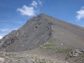
A hike to a stunning 3,000-metre peak in the Italian Piedmont, adorned with a statue of the Madonna, offering sweeping views of the French and Italian Alps and the Swiss Valais on a clear day.
Cima Dorlier
 7.63 mi
+2,802 ft
-2,802 ft
5h 55
Difficult
Departure from Cervières (Hautes-Alpes)
7.63 mi
+2,802 ft
-2,802 ft
5h 55
Difficult
Departure from Cervières (Hautes-Alpes)
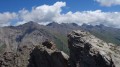
A hike away from the crowds towards a pass where lovely meadows stretch out and towards a pretty Italian summit offering panoramic views of the Écrins, the Cerces, Piedmont and some of the Queyras peaks.
The route includes a few off-trail sections where I recommend using the Visorando app.
Roche Colombe
 8.46 mi
+3,678 ft
-3,694 ft
7h 05
Difficult
Departure from Le Monêtier-les-Bains (Hautes-Alpes)
8.46 mi
+3,678 ft
-3,694 ft
7h 05
Difficult
Departure from Le Monêtier-les-Bains (Hautes-Alpes)
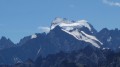
A hike to one of the most beautiful lakes in the Cerces, with its turquoise-blue waters, and to a summit offering an exceptional panorama of the Écrins, the Cerces, the Queyras and Mont Blanc.
As this route includes sections off the beaten track, I recommend supplementing the description by using the Visorando app.
La Blanche via Lac de Puy Aillaud and the Belvédère des Trois Refuges viewpoint
 8.49 mi
+4,751 ft
-4,731 ft
8h 00
Difficult
Departure from Vallouise (Hautes-Alpes)
8.49 mi
+4,751 ft
-4,731 ft
8h 00
Difficult
Departure from Vallouise (Hautes-Alpes)
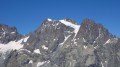
This is a must-do hike in Vallouise, offering views of the Écrins, the Cerces and the Queyras, and in particular, thanks to its proximity, the Pelvoux, the Pic sans Nom and the Ailefroide.
Crête de la Pendine via the Col du Bal
 6.06 mi
+3,025 ft
-3,018 ft
5h 25
Difficult
Departure from Puy-Saint-Vincent (Hautes-Alpes)
6.06 mi
+3,025 ft
-3,018 ft
5h 25
Difficult
Departure from Puy-Saint-Vincent (Hautes-Alpes)
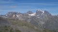
Hike to a rocky ridge that separates the Fournel valley from the Combe de Narreyroux, leading to a magnificent viewpoint overlooking the Écrins, Queyras, Haute Ubaye and Italy.
Monte Albergian
 6.18 mi
+4,934 ft
-4,934 ft
7h 10
Difficult
Departure from Pragelato (Torino)
6.18 mi
+4,934 ft
-4,934 ft
7h 10
Difficult
Departure from Pragelato (Torino)
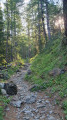
A 3,000-metre peak very popular with Italian visitors, offering sweeping panoramic views of the Alpine massifs on a clear day: Queyras, Ubaye, Écrins, Cerces, Savoie, Vanoise and the Swiss Valais.
Crête des Pénitents via the Col and Crête de l'Alpavin
 8.26 mi
+3,793 ft
-3,763 ft
7h 05
Difficult
Departure from Saint-Martin-de-Queyrières (Hautes-Alpes)
8.26 mi
+3,793 ft
-3,763 ft
7h 05
Difficult
Departure from Saint-Martin-de-Queyrières (Hautes-Alpes)
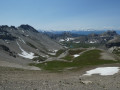
A hike away from the crowds to one of the most beautiful ridges in the Hautes-Alpes, offering a sweeping 360° panorama of the Écrins and the Queyras, with a bird’s-eye view of the magnificent Lacs d’Escur and de l’Ascension. You’ll be captivated by the timeless beauty of the rocks of the Aiguille des Pénitents massif.
A high-clearance crossover-type vehicle is essential to reach the starting point.
The foot of the Jean Gauthier Glacier via the Glacier Blanc refuge
 6.87 mi
+2,959 ft
-2,930 ft
5h 45
Difficult
Departure from Pelvoux (Hautes-Alpes)
6.87 mi
+2,959 ft
-2,930 ft
5h 45
Difficult
Departure from Pelvoux (Hautes-Alpes)
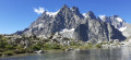
Hike in a high mountain setting overlooking the Glacier Blanc and the surrounding peaks.
Rocca Bianca
 6.34 mi
+2,438 ft
-2,434 ft
5h 00
Difficult
Departure from Saint-Véran (Hautes-Alpes)
6.34 mi
+2,438 ft
-2,434 ft
5h 00
Difficult
Departure from Saint-Véran (Hautes-Alpes)
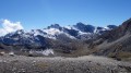
A hike to a 3,000-metre peak, offering magnificent views of Mont Viso, the high peaks of the Ubaye and the Écrins, with the chance to discover some lovely lakes.
A route with a few exposed sections, one of which requires you to use your hands.
Tête de la Fréma
 12.67 mi
+4,121 ft
-4,117 ft
9h 25
Difficult
Departure from Saint-Paul-sur-Ubaye (Alpes-de-Haute-Provence)
12.67 mi
+4,121 ft
-4,117 ft
9h 25
Difficult
Departure from Saint-Paul-sur-Ubaye (Alpes-de-Haute-Provence)
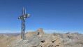
A hike to a very accessible 3,000-metre peak on the border, offering a stunning panoramic view ofItaly and the high peaks of the Ubaye.The route is enhanced by visits to several lakes, including the Lac des Neufs Couleurs, nestled in its basinat the foot of the Fréma, the Brec and the Aiguille de Chambeyron.
Secondary summit of the Pic de Montbrison
 5.19 mi
+3,612 ft
-3,615 ft
7 hrs
Very difficult
Departure from Saint-Martin-de-Queyrières (Hautes-Alpes)
5.19 mi
+3,612 ft
-3,615 ft
7 hrs
Very difficult
Departure from Saint-Martin-de-Queyrières (Hautes-Alpes)
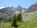
A circular off-trail hike with a distinctly alpine character, offering panoramic views over the Durance and Vallouise valleys, the Écrins, Mont Blanc, the Queyras and the Viso. A challenging hike requiring a good sense of direction, but also a very beautiful route.
I recommend using the Visorando app.