Monte Albergian

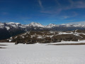
A 3,000-metre peak very popular with Italian visitors, offering sweeping panoramic views of the Alpine massifs on a clear day: Queyras, Ubaye, Écrins, Cerces, Savoie, Vanoise and the Swiss Valais.

Details

338743
Creation:
Last update:
Last review:
  • Walking
    Activity: Walking
  • ↔
    Distance: 6.18 mi
  • ◔
    Average duration: 7h 10 
  • ▲
    Difficulty: Difficult

  • ⚐
    Back to start: Yes
  • ↗
    Ascent: + 4,934 ft
  • ↘
    Descent: - 4,934 ft

  • ▲
    Highest point: 9,882 ft
  • ▼
    Lowest point: 4,948 ft

Photos

Description of the walk

Access: From Briançon, cross the Col de Montgenèvre and, at Cesana Torinese, head towards Sestrière. Drive through the resort along the main road or Via Pinerolo towards Bergata Sestrière. Head down towards Pragelato and, at the end of the village, turn right onto Via Trieste towards the Pista Auto and the Mercato.
Park either in the Market Square car park on the left-hand side of the road, or at the edge of the forest after crossing the bridge.

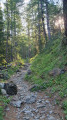
(S/E) From the Market Square, cross the bridge over the Torrente Chisone and then take the path that climbs to the right of the information board. The path climbs up a steep, south-facing wooded slope before veering left and reaching a junction.

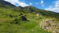
(1) Follow the path up to the left towards the north-east. After a steep climb, the gradient eases; the path, marked as aGR®® with red-and-white paint markings, leads out into the pastures where it joins the lane leading to the sheepfold.

(2) Follow the lane to the right up to the Pré Damont sheepfold.

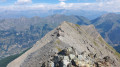
(3) At the crossroads of paths above the sheepfold, take the path on the right, following the red-and-white markings. Cross a lane that is not shown on the map. Head east, carefully following the red-and-white markings, then, after a switchback climb, reach the western ridge of the peak.

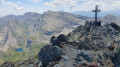
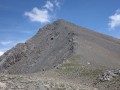
(4) Climb up the ridge, then follow a ledge on the left to go round a rocky outcrop. The markings wind their way through the boulders before reaching the right-hand flank of the summit bastion’s ridge. Climb towards the cross as the terrain suggests, pass through the small gap, then, with a few very easy climbing moves using your hands, reach the summit.

(5) Return in the opposite direction via the same route to the car park (S/E).
Waypoints

  1. S/E : mi 0 - alt. 4,948 ft - Car park at Place du Marché
  2. 1 : mi 0.29 - alt. 5,443 ft - Unmarked trail junction
  3. 2 : mi 1.03 - alt. 6,371 ft - Trail junction, path
  4. 3 : mi 1.21 - alt. 6,493 ft - Trail junction
  5. 4 : mi 2.72 - alt. 9,035 ft - Junction point on the main ridge
  6. 5 : mi 3.1 - alt. 9,859 ft - Summit of Mont Albergian
  7. S/E : mi 6.18 - alt. 4,948 ft - Car park at Place du Marché

Notes

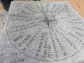
I have made a video commentary of the route, showing the key points along the way, as well as the panorama and the names of some of the peaks.

Map: Fraternali No. 2 Alta Valle Susa, Alta Val Chisone

The climb to the summit is very easy and requires no special skills.

The route is very well marked with red-and-white markings, which you simply need to follow to the summit. The route is therefore easy and even obvious.

However, due to the elevation gain and the steep gradients, this route requires a good level of fitness.

The summit plateau is large enough to accommodate a group of walkers.

Worth a visit

A génépi-based liqueur is named after the summit and is produced in Pragelato.

Always be cautious and plan ahead when you're outdoors. Visorando and the author of this route cannot be held responsible for any accidents occurring on this route.

The GR® and PR® markings are the intellectual property of the Fédération Française de Randonnée Pédestre.

Reviews and comments

5 / 5
Based on 1 review

Reliability of the description
5 / 5
Ease of following the route
5 / 5
Route interest
5 / 5
Britanicus100
Britanicus100
• Edited:

I am the author of the hike.
Thank you for your feedback and for the photos.

Machine-translated

Liru
Liru

Overall rating : 5 / 5

Date of your route : Jul 15, 2025
Reliability of the description : ★★★★★ Very good
Ease of following the route : ★★★★★ Very good
Route interest : ★★★★★ Very good
Very busy route : No

This is a physically demanding hike due to the steep elevation gain over a short distance, with some very steep slopes. Be aware of this.
But the scenery is magnificent! The first part is in the forest (with lots of wild strawberries), then there is an open section with beautiful flowers (at this time of year), followed by a more rocky section and finally the last part (very short) with large rocks where you need to use your hands to help you.
At the summit, there is space for a picnic (not for a group of 20 people though) and the 360° view is breathtaking!
A beautiful 3,000-metre peak!
Thanks to the author for this guide.

Machine-translated

Other walks in the area

For more walks, use our search engine .

The GPS track and description are the property of this route's author. Please do not copy them without permission.