Tête de la Maye

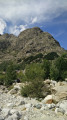
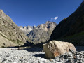
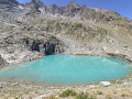
La Tête de la Maye is the most beautiful viewpoint in the Écrins, accessible via a hike from La Bérarde.

Details

805129
Creation:
Last update:
Last review:
  • Walking
    Activity: Walking
  • ↔
    Distance: 2.72 mi
  • ◔
    Average duration: 3h 30 
  • ▲
    Difficulty: Difficult

  • ⚐
    Back to start: Yes
  • ↗
    Ascent: + 2,579 ft
  • ↘
    Descent: - 2,579 ft

  • ▲
    Highest point: 8,173 ft
  • ▼
    Lowest point: 5,594 ft

Photos

Description of the walk

On the D109, after leaving Bourg d’Oisans, heading towards the Col du Lautaret, turn right onto the D530 towards La Bérarde.
Park in the car park located at the entrance to the hamlet on the right-hand side of the road before the Vénéon bridge.

(S/E) From the car park, walk down the road for a few metres then take the well-marked Tête de la Maye path on the left. Follow this path as it winds its way up above the hamlet and then reaches a first junction.

(1) Ignore the path on the left leading towards the climbing routes and take the right-hand branch towards the Tête de la Maye. Climb up the north-northeast-facing slope above the Étançons valley until you reach a second junction.

(2) Pass the path to the Chatelleret refuge on your right and turn left towards the Tête de la Maye. Follow this path, which passes through sections with safety cables, to reach the foot of the north-western cliff face, then head westwards to a gap. Climb up the notch towards the north and reach a large grassy plateau overlooked by the summit bastion.

(3) Follow an almost horizontal path across the slope towards the west to go round the bastion on the left. After a steep climb over a few slabs to the north, reach the large summit area with its orientation table.

(4) Return in the opposite direction via the same route to your car park (S/E).

Alternative return route:
(2) Turn right at the sign for the Chatelleret refuge and the Etançons valley.
Cross a bridge. Turn right towards the south and the village of La Bérarde. Leave the Bonne Pierre path on your right and continue down towards La Bérarde.
Do not follow the old wooden sign for La Bérarde, but turn right onto the small path running alongside the stream to reach the car park at the start (S/E).

Waypoints

  1. S/E : mi 0 - alt. 5,594 ft - Car park - La Bérarde - Chalet Alpin du Club Alpin Français
  2. 1 : mi 0.25 - alt. 5,935 ft - Trail junction, turn right
  3. 2 : mi 0.41 - alt. 6,181 ft - Trail junction, turn left
  4. 3 : mi 1.07 - alt. 8,022 ft - Grassy clearing
  5. 4 : mi 1.37 - alt. 8,173 ft - Summit of the - Tête de la Maye (2518m)
  6. S/E : mi 2.72 - alt. 5,594 ft - Car park. Near the - Vénéon (torrent) - Affluent de la Romanche

Notes

I have made a video with the names of the peaks, which shows the route and the atmosphere of this trail.
This route includes some fairly steep sections equipped with handrails, which require caution. Watch the video.

You are hiking in the heart of the Écrins National Park.

The Écrins massif is an exceptional area, open to all, with a natural, cultural and scenic heritage that is truly unique. To protect these treasures, the heart of the park is marked by blue, white and red flags, where certain regulations must be observed. Please familiarise yourself with these rules when planning your hike to help preserve this shared heritage, at https://www.ecrins-parcnational.fr.

Reviews and comments

5 / 5
Based on 3 reviews

Reliability of the description
5 / 5
Ease of following the route
5 / 5
Route interest
5 / 5
RAND19
RAND19
• Edited:

Overall rating : 5 / 5

Date of your route : Aug 30, 2019
Reliability of the description : ★★★★★ Very good
Ease of following the route : ★★★★★ Very good
Route interest : ★★★★★ Very good

A lovely hike, though somewhat challenging; the climb is steep and the descent is very pleasant. Beautiful views from the summit.

Machine-translated

ValentinRoussel
ValentinRoussel

Overall rating : 5 / 5

Date of your route : Aug 18, 2019
Reliability of the description : ★★★★★ Very good
Ease of following the route : ★★★★★ Very good
Route interest : ★★★★★ Very good

A superb hike, with magnificent views from the summit and a very interesting information board.
The distance is ‘short’, but the route is still quite challenging (significant elevation gain over a short distance, with sections where you need to use your hands).
It was quite windy at the summit compared to the car park at the start; I was glad I’d brought a windbreaker with me.

Machine-translated

CathLegras
CathLegras

Overall rating : 5 / 5

Date of your route : Aug 20, 2018
Reliability of the description : ★★★★★ Very good
Ease of following the route : ★★★★★ Very good
Route interest : ★★★★★ Very good

Not being used to this sort of climb (cables, ladders, etc.), I found the hike difficult, even though the elevation gain isn’t particularly steep on paper. I arrived at the summit feeling tired, no doubt because the slight stress had sapped my energy. That said, there’s no danger, and what a joy it is up there! A breathtaking view, truly magnificent; you find yourself in the heart of legendary peaks and mountain ranges.
The weather was glorious on 15 August too, so it was perfect!
On the way down, we extended the route a little by turning left to cross the gentle Etençon stream, then the more impetuous Bonne Pierre stream, before returning to La Bérarde via La Plantation.
A magnificent hike that I’m very glad to have done

Machine-translated

Other walks in the area

For more walks, use our search engine .

The GPS track and description are the property of this route's author. Please do not copy them without permission.