Country:

 City:
City:


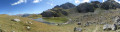

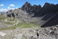
Access: at the southern junction of Briançon (on the Route des Grandes Alpes between the petrol station and the ski lift access point), take the D35 towards Puy-Saint-André and then Puy Chalvin. The road turns into a track. Head for the hamlet of Les Combes, pass through it, then park 1 km further on at the car park at the end of the track.
(S/E) Take the path continuing from the track, then head for the junction at a hairpin bend (barrier, sign).
(1) Leave the lane, head uphill to the left and, after the picnic area (benches, tables), follow the lane uphill to the right until you come to a sign 300 m further on.
(2) At the sign, turn left towards the Col de la Trancoulette. The well-marked path climbs through the
larch trees before opening out to the west into a valley. It curves widely to the left before heading south.
Follow a winding ascent in this direction to reach the Col de la Trancoulette.
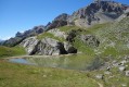
(3) Take the path heading off horizontally to the right (south-west). You will come to two small lakes.
The path bends very slightly to the right (west-south-west) into the Peyre du Fey valley.
Climb up through the mountain pasture along this path, then follow the cairns towards the Col de Vallouise.
(4) 200 m before the pass, head off-trail to the left towards the south-east along the ridge line (i.e. where the slope is gentlest). This winding ridge then heads broadly south.
Follow the cairns and then, via a small path you come across, make your way to the summit.
The summit, marked by a cairn, is situated on an almost horizontal ridge facing south-west, about 70 m from the start of the ridge.
(5) From the summit, retrace your steps to the start of the ridge.
(6) Descend to the right down the grassy terraces, skirting the scree slope that leads down from the summit towards a grassy plateau below the Pic de Montbrison.
Once you have reached this flat area, cross it so that you head onto the wide saddle linking the summit on the left to the Pic de Montbrison (east).
Climb up this saddle, keeping as far to the right as possible towards the Pic de Montbrison.
Cross the boulders and then gradually veer to the left.
Descend through the pastures, keeping to the left (north-west) and then (north) towards the Col de la Trancoulette, which is visible from above.
Cross beneath the Tête des Lauzières; do not descend too far and do not cross the Trancoulette torrent.
Join one of the small summer pasture tracks that climbs back up towards the Col de la Trancoulette.
(3) From the pass, descend via the route you took on the way up to your car park (S/E).


 Visorando Member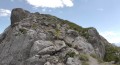
 Moderate