


 Country:

 City:
City:


Access: Head towards the Col d’Izoard and Cervières via the D902.
In Cervières, just after the entrance chicane, head up towards the higher part of the village via the first junction on your left, to join the D89T at the Church of Saint-Michel.
Cross the Bourget plain, then take the lane on the left leading to the Chapel of the Transfiguration, which is visible from the road. Park near the chapel.
(S/E) From the chapel, follow the lane up towards the hamlet of Le Bourget and then on to Cabot.
(1) After crossing the stream, turn left onto the path heading north-east.
This path climbs steeply over a series of grassy hummocks in the pastures, then turns into a footpath and leads to a sign showing a map of the border trails.
(2) A few metres past the sign, at the fork, turn right.
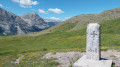
The path climbs as it crosses a series of small hills before opening out onto a vast, almost level meadow bordered on the right by the Crête de Dormillouse and on the left by the Cime de Fournier. Eventually, you’ll spot the Col de Chabaud signpost and boundary marker 37 to your right.
(3) Leave the path and head towards the boundary marker.
(4) Head once more towards a small path that does not appear on maps, heading east-southeast.
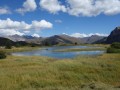
It climbs gently along the hillside through grassland before becoming a steeper ascent towards a small ridge leading to a horizontal valley through which a small stream flows.
Continue along the path that runs alongside the stream on the left bank.
Cross the valley, then head leftwards uphill for a few metres to reach a fence.
(5) Follow the fence and, via a steep climb through the grassy slopes, reach a small pass leading into a second valley.
Take the small cattle track for about a hundred metres, then turn left, following the course of a stream. Cross the stream, then head towards the vertical posts visible in the distance, the remains of an old ruin.
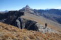
Climb eastwards up the grassy base of the summit to reach a path that is clearly visible from below.
(6) Follow this path up to the right. It climbs up the south-southeast slope, then turns north-east before joining the summit path.
(7) Follow the path upwards to the right. The path is lost in the grassy slopes in places, but it is possible to make your way from cairn to cairn.
It passes close to some old ruins before reaching the base of the summit ridge.
(8) Climb this ridge to the summit.
Return along the same route to your car park (S/E).

 Visorando Member

 Moderate
 Easy
Easy 
