Punta Rognosa de Sestrières

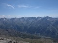
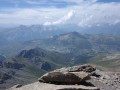
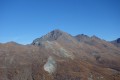
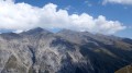
A hike to a stunning 3,000-metre peak in the Italian Piedmont, adorned with a statue of the Madonna, offering sweeping views of the French and Italian Alps and the Swiss Valais on a clear day.

Details

317418
Creation:
Last update:
Last review:
  • Walking
    Activity: Walking
  • ↔
    Distance: 7.70 mi
  • ◔
    Average duration: 7h 05 
  • ▲
    Difficulty: Difficult

  • ⚐
    Back to start: Yes
  • ↗
    Ascent: + 4,022 ft
  • ↘
    Descent: - 4,019 ft

  • ▲
    Highest point: 10,614 ft
  • ▼
    Lowest point: 6,647 ft

Photos

Description of the walk

From Briançon, cross the Col de Montgenèvre and, at Cesana Torinese, head towards Sestrière. Cross the resort via the main road or Via Pinerolo towards Bergata Sestrière. Park in the car parks located between the shopping centre and the golf course.

(S/E) From the car park, walk along the north-eastern edge of the golf course, then take the track on the right heading south-east.
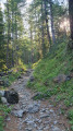
This track climbs through a larch forest and joins a cable car station, the starting point of a downhill ski run. It then joins a small tarmac road.

(1) Take this road to the left. After a horizontal traverse along the mountainside through the forest, it emerges into the mountain pastures and leads to a small lake visible on the left. Continue straight ahead along the track, towards Punta Rognosa which rises up ahead of you, whilst following the course of the Chisonetto stream on your left until you reach the signposted junction.

(2) At the signpost, take the path on the right towards Passo Della Banchetta, Monte Banchetta N45. This path is very well signposted with red-and-white paint markings, like aGR®®. Path N45 climbs steeply through the pastures and joins path N47.

(3) Follow path N47 up to the left, heading east, then north-east (ignore the track leading up to the right 50 m from the junction) for a distance of 350 m, then leave the path.

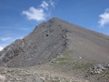
(4) Climb south-eastwards through the pastures and then over the scree, heading for the small pass (a flattened area at the foot of the right-hand ridge or the western slope of Punta Rognosa), until you come across some cairns. Following these cairns leads to a path that joins the small pass, where there is a cairn topped with a red stake.

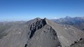
(5) Head up the ridge to your left to the summit, marked by a cross and a statue of the Madonna.

(6) Return in the opposite direction via the same route to the car park (S/E).
Waypoints

  1. S/E : mi 0 - alt. 6,673 ft - Car park
  2. 1 : mi 0.7 - alt. 6,985 ft - Turn left at the junction where the track meets the road
  3. 2 : mi 2.02 - alt. 7,244 ft - Turn right at the junction onto path N45
  4. 3 : mi 2.63 - alt. 8,189 ft - Turn left at the junction: path N45, path N47
  5. 4 : mi 2.82 - alt. 8,169 ft - Leave the N47 path and head off-trail towards the south-east
  6. 5 : mi 3.53 - alt. 9,885 ft - Turn left at the small pass
  7. 6 : mi 3.87 - alt. 10,607 ft - Summit of La Rognosa
  8. S/E : mi 7.7 - alt. 6,673 ft - Car park

Notes

It’s possible to cycle up to the small lake on a mountain bike.
The summit is large enough to accommodate a group of walkers.
Map: Fraternali No. 2 Alta Valle Susa, Alta Valle Chisone.
This map shows trails N45 and N47.
However, Italian maps lack precision. You should therefore rely on the route I recorded with my GPS on the way back.

I’ve made a video with the names of the peaks, which captures the atmosphere of the route.
You can find it here: https://youtu.be/HFS47PO4S64?si=tkpCKrjC...
In the video, we reached the small pass via the ridges. This route is more difficult, longer and passes through an exposed section.

Always be cautious and plan ahead when you're outdoors. Visorando and the author of this route cannot be held responsible for any accidents occurring on this route.

The GR® and PR® markings are the intellectual property of the Fédération Française de Randonnée Pédestre.

Reviews and comments

4.7 / 5
Based on 1 review

Reliability of the description
4 / 5
Ease of following the route
5 / 5
Route interest
5 / 5
Britanicus100
Britanicus100
• Edited:

Yes, thank you. I can clearly see your route, which partly matches the one we took on the ascent, as shown in the video, and which follows the ridge path. In this video, we joined the ridge path directly by also turning right – not at point (3), but after passing point (3) by about 60 metres. This route quickly joins the path coming from Passo Jacomo (without actually passing through it), but at a point that can be seen in the video, which is exposed. I therefore didn’t post it on Visorando (a general hiking website) but on Altitude Rando (a site for mountaineers), and I preferred the route we took on the descent.
The route you suggest is certainly very good, as it follows this magnificent ridge walk before reaching the small pass near the Colleto della Rognosa.
However, did you complete the route in a circular fashion, descending via the route shown on the map?

Machine-translated

zouloudesmontagnes
zouloudesmontagnes

Since that description was written, the terrain has changed, and a route via Passo San Giacomo is safer and more enjoyable
When you reach the crossroads with the signs, it’s better to turn right rather than take the direct route, as there have been a few rockfalls. It’s only slightly longer but safer.

Machine-translated

Britanicus100
Britanicus100
• Edited:

Hello, and thank you for leaving your review.
I completed this walk in July 2015.
Of course, the route may have changed since then.
However, it appears to follow, more or less, the paths shown on the current digital map of OpenStreetMap on Visorando.
Starting from Sestrières, I can’t think of any other route that would take you to this summit.
Could you please describe it? (Starting point, paths taken, etc.)
Kind regards

Machine-translated

zouloudesmontagnes
zouloudesmontagnes

Overall rating : 4.7 / 5

Date of your route : Aug 12, 2023
Reliability of the description : ★★★★☆ Good
Ease of following the route : ★★★★★ Very good
Route interest : ★★★★★ Very good
Very busy route : Yes

Since that description was written, the situation has changed, and a route via Passo San Giacomo is now safer and more enjoyable

Machine-translated

Other walks in the area

For more walks, use our search engine .

The GPS track and description are the property of this route's author. Please do not copy them without permission.