Roche Colombe

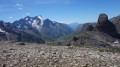
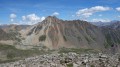
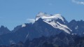
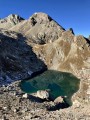
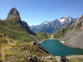
A hike to one of the most beautiful lakes in the Cerces, with its turquoise-blue waters, and to a summit offering an exceptional panorama of the Écrins, the Cerces, the Queyras and Mont Blanc.
As this route includes sections off the beaten track, I recommend supplementing the description by using the Visorando app.

Details

325869
Creation:
Last update:
Last review:
  • Walking
    Activity: Walking
  • ↔
    Distance: 8.46 mi
  • ◔
    Average duration: 7h 05 
  • ▲
    Difficulty: Difficult

  • ⚐
    Back to start: Yes
  • ↗
    Ascent: + 3,678 ft
  • ↘
    Descent: - 3,694 ft

  • ▲
    Highest point: 9,199 ft
  • ▼
    Lowest point: 5,594 ft

Photos

Description of the walk

From Monêtier-les-Bains, take the D1091 towards the Col du Lautaret as far as the Pont de l’Alpe.
Park in the car park on the right-hand side of the road. Spaces are in high demand during the summer, so set off early.

(S/E) From the car park, walk down the road a few metres, cross the Torrent du Rif bridge, then head east along the wide path beneath the Aiguillette du Lauzet.
After a few bends, this path turns north and opens out into a wide valley, leading to the hamlet of Alpe du Lauzet.
Once you have passed the hamlet and reached the end of the valley, take the path on the left and cross the bridge.

(1) At the sign for Côte Pacard, take the path on the right.
The path climbs through the pastures, following the course of the Plan Chevalier stream.
After a steeper climb with tight hairpin bends, it reaches a pass equipped with a cable-assisted crossing leading to the Verrou du Grand Lac.

(2) Descend and then go round the lake to the right.

(3) From its north-eastern end, take the path to the right which climbs northwards up a valley where a stream flows. This path, which is not shown on the map, heads north-north-west, following the course of the stream.
Cross the stream just as it bends 90° to the right, then continue off-trail in the same direction.

(4) Cross a second stream to join a mountain pasture track.
This path climbs across the terrain in the same direction, then turns west for a distance of 100 metres before heading south-west and then south.
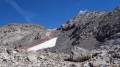
The path leads onto a vast rocky plateau beneath the Tête de Colombe and the Pic de la Ponsonnière.
Cross this plateau heading south.
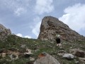
Ahead of you stand the Roche Colombe and, to its right, its secondary summit.
Climb the gully to the left of the secondary summit.
This leads onto a second rocky plateau where there is a neat cairn.

(5) Head south-east to reach the base of the summit bastion.

(6) Follow the path and, after a steeper climb, reach the summit.

(7) Return in the opposite direction via the same route to the car park (S/E)
Waypoints

  1. S/E : mi 0 - alt. 5,627 ft - Car park
  2. 1 : mi 0.94 - alt. 6,358 ft - Trail junction
  3. 2 : mi 1.93 - alt. 7,546 ft - Verrou du Grand Lac
  4. 3 : mi 2.26 - alt. 7,503 ft - Trail junction
  5. 4 : mi 2.82 - alt. 7,792 ft - Starting point of the cattle track
  6. 5 : mi 4.04 - alt. 8,957 ft - Cairn, second rocky plateau
  7. 6 : mi 4.09 - alt. 8,986 ft - Starting point of the summit trail
  8. 7 : mi 4.22 - alt. 9,186 ft - Roche Colombe summit
  9. S/E : mi 8.46 - alt. 5,627 ft - Car park

Notes

Photo of the route up the couloir: couloir photo.

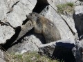
I’ve made a video showing the names of the peaks where you’ll see the ibex, as well as the route and key waypoints.

A very spacious summit capable of accommodating a group of walkers.

This route requires a good sense of direction, which is made easier here by using the Visorando app.

Reviews and comments

4.4 / 5
Based on 3 reviews

Reliability of the description
4.7 / 5
Ease of following the route
3.7 / 5
Route interest
5 / 5
Britanicus100
Britanicus100

Thank you for your comments. I’m really glad you enjoyed it.

Machine-translated

billgenaize
billgenaize
• Edited:

Overall rating : 4.7 / 5

Date of your route : Aug 07, 2018
Reliability of the description : ★★★★★ Very good
Ease of following the route : ★★★★☆ Good
Route interest : ★★★★★ Very good

Thank you for the GPX track. By following the track on my GPS, we reached the summit without any trouble.
A really lovely, unspoilt walk. We didn’t see any other walkers after Grand Lac.
Watch out for the marshy areas after the lake (there was a heavy storm the day before!)
No ibex, but two eagles at the summit!
Thanks again for the route description!

Machine-translated

gerardleo
gerardleo

Overall rating : 4.3 / 5

Date of your route : Jul 30, 2018
Reliability of the description : ★★★★★ Very good
Ease of following the route : ★★★☆☆ Average
Route interest : ★★★★★ Very good

We were watched by two ibex throughout our ascent of Roche Colombe, which helped us make good progress and, once at the summit, enjoy the 360-degree view across all the Alpine massifs. We returned via Lac de la Ponsonnière. A very pleasant but very physically demanding hike. The guidebook by Britannique is very useful.

Machine-translated

ONEROMNADRE
ONEROMNADRE

Overall rating : 4.3 / 5

Date of your route : Jul 31, 2017
Reliability of the description : ★★★★☆ Good
Ease of following the route : ★★★★☆ Good
Route interest : ★★★★★ Very good

The climb up to the Grand Lac pass is a really enjoyable hike. From the Grand Lac, we were on our own until we returned there, and we really enjoy pottering about in this sort of rocky landscape, searching for the right path, as we find it difficult to follow a suggested route to the letter. And yet, when we later compared our GPS track with Britannicus’s on the computer, they matched up surprisingly well for the most part. The climb up to the final bastion seemed very short to us, and there’s a choice of routes to follow. On the descent, between points 5 and 4 on the map, near the latter, you can take a path that avoids going round a small hillock, but it doesn’t really add anything. Thanks to Britannicus for this walk.

Machine-translated

Other walks in the area

For more walks, use our search engine .

The GPS track and description are the property of this route's author. Please do not copy them without permission.