Aiguille Large via the Lower Lake of Marinet

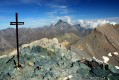
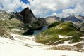
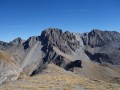
A route leading to a magnificent lake and then to a summit offering a breathtaking panoramic view of the high peaks of the Queyras and the Haute Ubaye.
Navigation is made easier by the Visorando app.

Details

n°807877
Creation:
Last update:
Last review:
  • Walking
    Activity: Walking
  • ↔
    Distance: 9.07 mi
  • ◔
    Average duration: 6h 55 
  • ▲
    Difficulty: Difficult

  • ⚐
    Back to start: Yes
  • ↗
    Ascent: + 3,156 ft
  • ↘
    Descent: - 3,140 ft

  • ▲
    Highest point: 9,314 ft
  • ▼
    Lowest point: 6,243 ft

Photos

Description of the walk

On the climb up to the Col de Vars on the D902, take the exit for Saint-Paul-sur-Ubaye. After passing through the village, take the D25. Follow this road to Maljasset. Park in the designated car park on the left-hand side of the road at the entrance to the hamlet.

(S/E) From the car park, walk through Maljasset, past the chapel, to reach the Maljasset mountain hut.

(1) Head to the Y-junction signposted for Maurin.

(2) Turn right towards the Cols de Mary and Marinet. Cross the Ubaye river then follow theGRP® trail to the vicinity of the Bergerie Inférieure de Mary.

(3) Follow the signposts for the Mary and Marinet passes.

Cross the Mary torrent to reach the sign for the Bergerie Supérieure de Mary, which is on the opposite bank.

(4) Turn right towards the Col de Marinet, heading for the Aiguille Large (Bergerie Supérieure de Mary on the left).

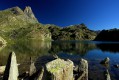
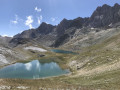
Follow the path, after crossing a few steep sections, to reach a flat area. Walk alongside the Béal de Marinet, following the cairns, then head for the Lac Inférieur de Marinet.

(5) Ford the Béal de Marinet at the southern end of the lake, then climb up the grassy hillock. Following the cairns, rejoin a path that winds its way westwards above the lake.
Follow this path uphill until you reach the base of a wide valley to the left of the Aiguille Large. Look out for the path on the right-hand side of the valley (see video).

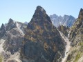
Near a cairn on a rock, turn right onto this path, which climbs the north-north-western slope beneath the Aiguille Large.

Once you reach the end of this path, ascend the remaining third of the valley off-trail to the ridge. Take the summit path to the right. After crossing some moss-covered rocks and then a gentle ridge, reach the summit slab marked by its cairn.

(6) Return in the opposite direction via the same route to your car park (S/E).

Waypoints

  1. S/E : mi 0 - alt. 6,243 ft - Car park
  2. 1 : mi 0.13 - alt. 6,257 ft - Head to the signposted Y-junction at Maurin - Refuge de Maljasset
  3. 2 : mi 0.43 - alt. 6,302 ft - Trail junction, path
  4. 3 : mi 2.33 - alt. 7,434 ft - Bergerie Inférieure de Mary
  5. 4 : mi 3.09 - alt. 7,753 ft - Trail junction - Bergerie Supérieure du Marinet
  6. 5 : mi 3.77 - alt. 8,314 ft - Lower Lake - Lacs de Marinet
  7. 6 : mi 4.53 - alt. 9,222 ft - Summit of the Aiguille Large
  8. S/E : mi 9.07 - alt. 6,243 ft - Car park

Notes

This summit, which appears impregnable, is in fact easily accessible via its southern face.
This route isn’t technically difficult. Only the final stretch to the summit requires a bit of care.

I’ve made a video, labelling the peaks, which shows the route and captures the atmosphere of this lovely walk.

Reviews and comments

5 / 5
Based on 1 review

Reliability of the description
5 / 5
Ease of following the route
5 / 5
Route interest
5 / 5
Chaudet-Féral
Chaudet-Féral

A really lovely walk, but I did it a bit differently as I went down the path that runs alongside the Aiguille Pierre André. This turns the walk into a circular route, so you don’t have to walk there and back.

Machine-translated

Mancari Pierre
Mancari Pierre

Overall rating : 5 / 5

Date of your route : Aug 24, 2025
Reliability of the description : ★★★★★ Very good
Ease of following the route : ★★★★★ Very good
Route interest : ★★★★★ Very good
Very busy route : Yes

Very beautiful hike

Machine-translated

Other walks in the area

For more walks, use our search engine .

The GPS track and description are the property of this route's author. Please do not copy them without permission.