Tête de Cialancioun via the Upper Roure Lake

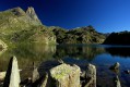
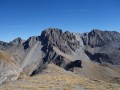
A visit to a lovely lake followed by the ascent of a 3,000-metre peak on the border, offering a stunning panoramic view of Italy, the Ubaye, the Queyras and the Écrins.
Navigation is made easier here by the Visorando app.

Details

n°816082
Creation:
Last update:
Last review:
  • Walking
    Activity: Walking
  • ↔
    Distance: 12.04 mi
  • ◔
    Average duration: 8h 45 
  • ▲
    Difficulty: Difficult

  • ⚐
    Back to start: Yes
  • ↗
    Ascent: + 3,675 ft
  • ↘
    Descent: - 3,671 ft

  • ▲
    Highest point: 9,823 ft
  • ▼
    Lowest point: 6,234 ft

Photos

Description of the walk

On the climb up to the Col de Vars on the D902, take the exit for Saint-Paul-sur-Ubaye. After passing through the village, take the D25. Follow this road to Maljasset. Park in the designated car park on the left-hand side of the road at the entrance to the hamlet.

(S/E) From the car park, walk through Maljasset, past the chapel and the Maljasset refuge (1), then keep to the right to reach the Y-junction signposted for Maurin.

(2) Turn right towards the Cols de Mary and Marinet. Cross the Ubaye river, then follow theGRP® trail to the vicinity of the Bergerie de Mary

(3) Head south-east, following the signposts for the Col de Mary and Col de Marinet. Cross the Torrent de Mary to reach the sign for the Bergerie Supérieure de Mary, which is on the opposite bank.

(4) At the signpost, turn left towards the Col de Mary.

(5) At an altitude of around 2,600 metres and 350 metres before the pass, leave theGR®. Head up to the left towards the Tête de Cialancioun, following the faintest of gullies heading east (see video).

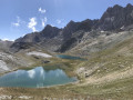
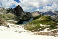
A gentle climb takes you to a wide, flat area where you can see a few cairns. Turn 90° to the left, following the cairns, then rejoin the path (which does not appear on the IGN map) leading to the Lac Supérieur du Roure, the round one. Follow this path to reach the Lac Supérieur du Roure from the north.

(6) Go round the southern end of the lake on the right, then climb slightly up the slope on the left bank of the Béal du Roure valley, following the cairns.
Then descend a few metres and climb back up its central section (cairns), heading east.

(7) Following the cairns, leave the valley floor and climb up the slope to the right. Make your way from cairn to cairn through the scree to reach the foot of the gully descending from the Col de Cialancoun. Via a steep climb to the south-east up this gully, reach the Pas de Cialancioun.

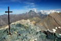
(8) Climb up to the right along the north-eastern ridge of the peak. Reach a first secondary summit on the ridge, then descend a few metres towards La Madone. After signing the visitors’ book, make a final short ascent up the broad ridge to reach the summit, marked by its cairn.

(9) Return in the opposite direction via the same route (S/E).

Waypoints

  1. S/E : mi 0 - alt. 6,234 ft - Car park
  2. 1 : mi 0.17 - alt. 6,257 ft - Refuge de Maljasset
  3. 2 : mi 0.47 - alt. 6,302 ft - Crossroads: track, path
  4. 3 : mi 2.43 - alt. 7,434 ft - Head south-east - Bergerie Inférieure de Mary
  5. 4 : mi 3.21 - alt. 7,792 ft - Bergerie Supérieure du Marinet
  6. 5 : mi 4.44 - alt. 8,494 ft - GR junction, off the trail
  7. 6 : mi 4.96 - alt. 8,704 ft - Lac Supérieur du Roure
  8. 7 : mi 5.35 - alt. 8,917 ft - Junction point at the thalweg, off the path
  9. 8 : mi 5.86 - alt. 9,488 ft - No Cialancioun
  10. 9 : mi 6.02 - alt. 9,823 ft - Tête de Cialancioun
  11. S/E : mi 12.04 - alt. 6,234 ft - Car park

Notes

I’ve made a video that captures the atmosphere of this route well and shows the points we passed through.

What can I say about this hike?
This route is quite physically demanding due to its length and the steepness of the slope leading up to the pass. Otherwise, there are no technical difficulties. You don’t need to use your hands. It’s just walking. The ascent along the ridge isn’t exposed, provided you stay as close to the centre of the ridge as possible. The summit area can accommodate a group of walkers.

On the scree, you need to keep a close eye out for the cairns.
To save time, I strongly recommend using a smartphone for navigation with the Visorando app, which is excellent.

Always be cautious and plan ahead when you're outdoors. Visorando and the author of this route cannot be held responsible for any accidents occurring on this route.

The GR® and PR® markings are the intellectual property of the Fédération Française de Randonnée Pédestre.

Reviews and comments

5 / 5
Based on 1 review

Reliability of the description
5 / 5
Ease of following the route
5 / 5
Route interest
5 / 5
J?rôme
J?rôme

Overall rating : 5 / 5

Date of your route : Jun 20, 2023
Reliability of the description : ★★★★★ Very good
Ease of following the route : ★★★★★ Very good
Route interest : ★★★★★ Very good
Very busy route : No

Hello
A lovely walk – I followed jldeval’s advice and took the path that runs alongside the Roure irrigation channel; this lets you do a circular walk and pass through a stunning, less-frequented area
On the way back, we took a detour via the pass and the Marinet lakes; it adds 150 metres of elevation gain, but when the scenery’s this beautiful, you don’t mind

Machine-translated

Britanicus100
Britanicus100
• Edited:

Thank you for this information, which, however, still needs to be verified. We followed the route suggested by Bernard Ranc
, a mountain guide, in his book *The Most Beautiful Walks in the Southern Alps*
However, you could have given your opinion on how enjoyable the walk was.
Kind regards

Machine-translated

jldeval
jldeval

Hello,
thank you for this lovely route. You can shorten it slightly by turning left 700 metres after Mary’s upper sheepfold (at an altitude of 2,421 metres) onto the path that follows the Roure irrigation channel, which is easy to follow up to around 2,700 metres.
This can also be used as an alternative route for the descent.
Kind regards
jldeval

Machine-translated

Other walks in the area

For more walks, use our search engine .

The GPS track and description are the property of this route's author. Please do not copy them without permission.