Pic de la Farnéiréta via the Col de la Noire

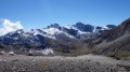
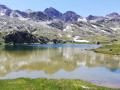
This is one of the most beautiful routes in the Southern Alps, leading to a 3,000-metre peak dotted with greenery, from which a panorama of exceptional beauty unfolds over the various Alpine massifs.

Details

n°380533
Creation:
Last update:
Last review:
  • Walking
    Activity: Walking
  • ↔
    Distance: 5.54 mi
  • ◔
    Average duration: 4h 55 
  • ▲
    Difficulty: Difficult

  • ⚐
    Back to start: Yes
  • ↗
    Ascent: + 2,720 ft
  • ↘
    Descent: - 2,720 ft

  • ▲
    Highest point: 10,236 ft
  • ▼
    Lowest point: 7,516 ft

Photos

Description of the walk

Access: Follow the road from Saint-Véran south-eastwards, then turn right onto the Route du Villard and, continuing along this road, follow the Route de Clausis for 5 km to the car park situated below the old marble quarry, just before the Clausis Chapel.
This unpaved but easily passable road is closed during the summer holidays between 6.00 am and 6.00 pm (July and August). During this period and outside these hours, a shuttle bus runs to the car park.

(S/E) From the car park, head up the track towards the south-east

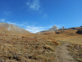
(1) Cross the Clausis bridge and pass beneath the chapel of the same name. 200 metres after passing the chapel, a sign directs you to continue along the track towards the Refuge de la Blanche and the Col de la Noire. The track climbs gently through the south-south-eastern then south-eastern pastures.

(2) At the Moutière crossroads, leave the track and take the path on the right towards the Col de la Noire. This leads to the next junction of signposted paths.

(3) At the sign for La Blanche, leave the Col Blanchet path on your left and take the Col de la Noire path on your right.
This path winds its way up through a boulder field beneath the Tête des Toillies before reaching a flat area at the foot of the Col de la Noire. Cross this grassy plateau, then follow a steep climb with tight hairpin bends to reach the Col de la Noire.

(4) From the pass, head westwards, following the ridge line of the peak’s southern face. To do this, pass the marbled rocks and follow the cairns.
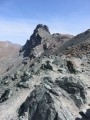
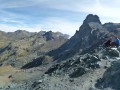
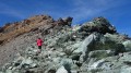
Climb up a grassy area and, after negotiating a few steep sections that are occasionally slightly exposed, reach the summit bastion. Climb up the small gap to the right of the bastion and then reach the summit slab marked by its cairn.

(5) Return in the opposite direction via the same route to the marble quarry car park (S/E).

Waypoints

  1. S/E : mi 0 - alt. 7,516 ft - Car park - Ancienne carrière de marbre
  2. 1 : mi 0.34 - alt. 7,671 ft - Aigue blanche
  3. 2 : mi 1.5 - alt. 8,136 ft - Crossroads: ski run, La Moutière trail
  4. 3 : mi 1.66 - alt. 8,202 ft - Crossroads of the Blanche trails
  5. 4 : mi 2.56 - alt. 9,688 ft - Col de la Noire
  6. 5 : mi 2.78 - alt. 10,236 ft - Pic de la Farnéiréta
  7. S/E : mi 5.54 - alt. 7,516 ft - Car park at the marble quarry.

Notes

I’ve made a video, labelling the peaks, which shows the route and the atmosphere of this beautiful walk.

The final ascent to the summit requires a bit of care. The path tends to fade away at times, but the few cairns help you find your way along the ridge.

From the summit, on a clear day, the view stretching across the entire Alpine range is fabulous. Mont Blanc, Viso, Écrins, Ubaye, Cerces, Vanoise, the Swiss Valais, etc.

Worth a visit

The green marble is reminiscent of that from the Maurin quarry, situated in the same area on the Ubaye side,
which was used to build the base of the altar at Napoleon I’s tomb at Les Invalides.
At the Col de la Noire, the marbled rocks, a magnificent green colour and weathered smooth by the elements, are truly beautiful.
On the Ubaye side, a seat has been carved out, allowing visitors to take a contemplative break with views of Mont de Salsa and the Bric de Rubren. An ideal spot for a picnic.

Reviews and comments

5 / 5
Based on 1 review

Reliability of the description
5 / 5
Ease of following the route
5 / 5
Route interest
5 / 5
aladin13
aladin13

Overall rating : 5 / 5

Date of your route : Sep 21, 2022
Reliability of the description : ★★★★★ Very good
Ease of following the route : ★★★★★ Very good
Route interest : ★★★★★ Very good
Very busy route : No

A lovely walk, with an exceptional view from the summit. Thank you for this very detailed description – there’s no risk of getting lost!
We did this walk on 20 September 2022. It’s worth noting that non-residents are now banned from driving through Saint Véran (even out of season)... but the tourist office had told me that some leeway was allowed for access to the track leading to the marble quarry car park, which is what we were able to do. There were lots of people at the car park and all the way to the Refuge de la Blanche… after that, we were on our own!
The climb up to the pass is steep but easy; the section through the polished marble boulders on the way to the summit is magnificent, followed by a short, tricky section over slightly crumbly rock, but it’s very brief. The ascent to the summit is straightforward; the path is clearly visible even though the cairns are inconspicuous.
In the route description, point 4 (the summit) is listed as 3,099 m, but it’s actually 3,134 m on the IGN map and on my altimeter

Thanks again – the video really helped us spot all the summits!

Machine-translated

Other walks in the area

For more walks, use our search engine .

The GPS track and description are the property of this route's author. Please do not copy them without permission.