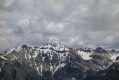
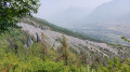
Secondary summit of the Pic de Montbrison

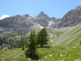
A circular off-trail hike with a distinctly alpine character, offering panoramic views over the Durance and Vallouise valleys, the Écrins, Mont Blanc, the Queyras and the Viso. A challenging hike requiring a good sense of direction, but also a very beautiful route.
I recommend using the Visorando app.

Details

407407
Creation:
Last update:
Last review:
  • Walking
    Activity: Walking
  • ↔
    Distance: 5.19 mi
  • ◔
    Duration according to the author: 7 hrs 
  • ▲
    Difficulty: Very difficult

  • ⚐
    Back to start: Yes
  • ↗
    Ascent: + 3,612 ft
  • ↘
    Descent: - 3,615 ft

  • ▲
    Highest point: 9,065 ft
  • ▼
    Lowest point: 5,610 ft

Photos

Description of the walk

Access: From Briançon: take the RN94 towards Gap. At Prelles, turn right onto the D4 towards Les Vigneaux. A few kilometres further on, at the letterboxes, head up the track on your right to Bouchier. Continue along the track heading north (GR®50) to La Blétonnée. Follow the track for 450 metres to park near the Combe Brune stream.

(S/E) Follow the path up the left bank (on your right) of the Combe Brune stream. The path climbs through a larch forest and then crosses the stream.

(1) Leave the path and set off, following the course of the stream and then the few cairns in the Combe Brune.
Scramble across grassy slopes and scree.
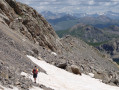
Pass the Tenailles de Montbrison on your left, then climb a very steep section to reach the ridge.
You’ll emerge onto a flat area near the Pas de Montbrison, where the 180° view is complemented by a splendid panorama of the Écrins.

(2) Continue along the ridge northwards, then north-eastwards (narrow path). On your left, you’ll see a small, bare peak: this is the secondary summit of the Pic de Montbrison (altitude 2765). After a short climb, reach the secondary summit. The Pic de Montbrison, also known as the Château du Gouverneur, is the rocky peak situated nearby to the north.

(3) Head down and cross northwards towards the Pic de Montbrison, which you will skirt to the right.
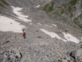
Descend along the slope via a faint track to a small pass leading to a field of large boulders. Descend through this to a flat area below the Tête des Lauzières (cairns).

(4) Continue heading north-east until you reach the Torrent de la Trancoulette.

(5) Head down following the course of the stream until you cross the track which also forms part of theGR®50.

(6) Turn right onto it and head down to your car park. (S/E).

Waypoints

  1. S/E : mi 0 - alt. 5,614 ft - Car park near the stream
  2. 1 : mi 0.32 - alt. 6,198 ft - Torrent junction
  3. 2 : mi 1.4 - alt. 8,530 ft - Ridge, Pas de Montbrison
  4. 3 : mi 1.66 - alt. 9,058 ft - Secondary summit
  5. 4 : mi 2.36 - alt. 7,887 ft - Flat section below the Tête des Lauzières
  6. 5 : mi 3.55 - alt. 6,572 ft - Torrent de Trancoulette
  7. 6 : mi 4.01 - alt. 6,129 ft - Track and GR50
  8. S/E : mi 5.19 - alt. 5,610 ft - Car park near the stream

Notes

I’ve made a video, including the names of the peaks, which shows the route and the atmosphere of our journey.

Always be cautious and plan ahead when you're outdoors. Visorando and the author of this route cannot be held responsible for any accidents occurring on this route.

The GR® and PR® markings are the intellectual property of the Fédération Française de Randonnée Pédestre.

Reviews and comments

5 / 5
Based on 2 reviews

Reliability of the description
5 / 5
Ease of following the route
5 / 5
Route interest
5 / 5
Chauvelinus
Chauvelinus

Overall rating : 5 / 5

Date of your route : Jul 11, 2024
Reliability of the description : ★★★★★ Very good
Ease of following the route : ★★★★★ Very good
Route interest : ★★★★★ Very good
Very busy route : No

Thank you for this superb off-trail hike, which is only suitable for experienced hikers and mountaineers.
The route up is fairly straightforward, with a few small cairns marking the way through the rocky outcrops at Combe Brune. For the descent after the secondary summit, you really need to follow the route carefully as you have to pass through a small pass to the east of the peak – don’t miss it, or you’re guaranteed to end up on rocky outcrops. A very beautiful, wild area, just us, the birds, the marmots and the chamois (we saw five of them). We couldn’t see Mont Blanc as it was shrouded in cloud. We set off from Bouchier to avoid the track by car, which added about 1 hour 30 minutes to the hike, with an elevation gain of 1,220 metres and a distance of 15.70 km, taking a total of 7 hours 30 minutes (including a 1-hour break around 12.30 pm).

Machine-translated

morvanmartine2@gmail.com

Overall rating : 5 / 5

Date of your route : Sep 27, 2019
Reliability of the description : ★★★★★ Very good
Ease of following the route : ★★★★★ Very good
Route interest : ★★★★★ Very good

A really lovely walk; the scenery is magnificent before you reach the ridge, and once you’re there too – and on the secondary summit – it’s a real treat: you can see as far as Mont Blanc, Le Viso and so on. On the other hand, the path to get there isn’t great – you’re constantly walking through scree. Luckily there are cairns to mark the way, as there are no signposts, but it’s still worth the effort – it’s absolutely stunning up there.

Machine-translated

Other walks in the area

For more walks, use our search engine .

The GPS track and description are the property of this route's author. Please do not copy them without permission.