bibi

 Association / Club / Walk leader
 Administrator
 Premium user
Sign up:
Published route(s)
 On and below Mont d'Or
 10.53 mi
 +3,087 ft
 -3,091 ft
 7h 30
7h 30
 Moderate
 Departure from Métabief (Doubs)
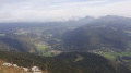
This hike will take you up Mont d'Or, where you can enjoy the view, then look down on it from below. You will pass through different environments and see a rich and diverse range of flora depending on the season.
 Saumonards Forest, Boyardville and the marshes
16.01 mi
+23 ft
-23 ft
2.5 hrs
 Easy
Departure from Saint-Georges-d'Oléron (Charente-Maritime)
Easy
Departure from Saint-Georges-d'Oléron (Charente-Maritime)
A cycle route that crosses the Saumonards forest, the town of Boyardville and the marshes of the Île d'Oléron, this very varied route mostly follows cycle paths or small roads.
The tour of Lac du Mont Charvin
 6.72 mi
+2,995 ft
-2,995 ft
5h 40
Moderate
Departure from Manigod (Haute-Savoie)
6.72 mi
+2,995 ft
-2,995 ft
5h 40
Moderate
Departure from Manigod (Haute-Savoie)
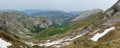
This hike will introduce you to the flora and fauna of the Alps. Depending on the time of year, you can meet the inhabitants of these mountains and taste their delicious cheeses.
The tour of the Pic du Jalouvre
 6.00 mi
+3,274 ft
-3,274 ft
5h 35
6.00 mi
+3,274 ft
-3,274 ft
5h 35
 Difficult
Departure from Le Grand-Bornand (Haute-Savoie)
Difficult
Departure from Le Grand-Bornand (Haute-Savoie)
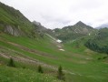
This tour will undoubtedly allow you to spot ibex, which are often in the area, but also to observe a wide range of alpine flora, including Saint Bruno's lilies, Liotard's stars, soldanellas, and more. With a little luck, you may even spot a ptarmigan or chamois.
A hike around the four lakes
 7.16 mi
+387 ft
-377 ft
3h 40
Easy
Departure from Le Frasnois (Jura)
7.16 mi
+387 ft
-377 ft
3h 40
Easy
Departure from Le Frasnois (Jura)
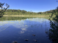
A hike to do preferentially during fall to admire the beautiful colors of the Indian summer reflecting off the lakes.
 L’Herba
7.56 mi
+741 ft
-751 ft
5 hrs
Easy
Departure from Les Fourgs (Doubs)
A cross-country ski tour that allows you to explore areas rarely visited in winter and enjoy a sense of freedom on the descent.
The mirrors
 5.27 mi
+784 ft
-748 ft
3h 05
Easy
Departure from Pontarlier (Doubs)
5.27 mi
+784 ft
-748 ft
3h 05
Easy
Departure from Pontarlier (Doubs)
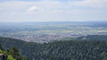
This hike will take you through a protected area and offer you a beautiful view of the town of Pontarlier.
Moderator's note A GPS device may be useful for this hike. See reviews.
Chalets on Mont d'Or
 8.19 mi
+1,365 ft
-1,335 ft
4h 55
Easy
Departure from Rochejean (Doubs)
8.19 mi
+1,365 ft
-1,335 ft
4h 55
Easy
Departure from Rochejean (Doubs)
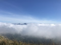
This hike will take you from one alpine chalet to another on Mont d'Or.
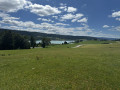
Circuit around Saint-Point-Lac
 11.53 mi
+607 ft
-604 ft
5h 50
Easy
Departure from Labergement-Sainte-Marie (Doubs)
11.53 mi
+607 ft
-604 ft
5h 50
Easy
Departure from Labergement-Sainte-Marie (Doubs)
The route around the lake is a long hike but on good roads. Saint-Point-Lac is the third-largest natural lake in France. The path will take you along and close to the lake but also rises up a little and leads away from it at times for better views.
This trail is littered with signs to better understand your environment.
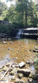
Les cascades du Hérisson / The Hérisson (Hedgehog) Waterfalls
 7.53 mi
+1,388 ft
-1,411 ft
4h 40
Moderate
Departure from La Chaux-du-Dombief (Jura)
7.53 mi
+1,388 ft
-1,411 ft
4h 40
Moderate
Departure from La Chaux-du-Dombief (Jura)
The walk descends the Hérisson ('hedgehog') River with its series of rapids and waterfalls, then returns via Bonlieu, passing through the Dame Blanche viewpoint, with a panoramic view over lakes Val and Chambly and the Herisson valley.
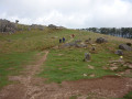
La Rhune
 7.70 mi
+2,497 ft
-2,497 ft
5h 45
Moderate
Departure from Ascain (Pyrénées-Atlantiques)
7.70 mi
+2,497 ft
-2,497 ft
5h 45
Moderate
Departure from Ascain (Pyrénées-Atlantiques)
This hike will take you to one of the first peaks in the Pyrenees, offering views of the entire French and Spanish Basque Country.
 Fort de Joux No. 80
13.90 mi
+1,575 ft
-1,585 ft
2.5 hrs
Difficult
Departure from La Cluse-et-Mijoux (Doubs)
This is a well-marked mountain bike trail. Number 80.A very varied and technical circuit, very interesting from a mountain biking point of view.
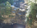
The Saut du Doubs and Le Châtelard
 6.81 mi
+1,768 ft
-1,798 ft
4h 40
Easy
Departure from Villers-le-Lac (Doubs)
6.81 mi
+1,768 ft
-1,798 ft
4h 40
Easy
Departure from Villers-le-Lac (Doubs)
The Saut du Doubs is a major tourist attraction in the region. This hike will allow you to discover it and also enjoy the surrounding landscapes, continuing on to the Chatelot dam.
The Death Ladders from La Cendrée
 5.20 mi
+1,772 ft
-1,795 ft
3h 55
Moderate
Departure from Charquemont (Doubs)
5.20 mi
+1,772 ft
-1,795 ft
3h 55
Moderate
Departure from Charquemont (Doubs)
Beautiful views, a lovely setting and an unusual part of the hike, crossing the death ladders.
The Cerf rocks
 7.13 mi
+879 ft
-843 ft
4h 05
Moderate
Departure from Hauterive-la-Fresse (Doubs)
7.13 mi
+879 ft
-843 ft
4h 05
Moderate
Departure from Hauterive-la-Fresse (Doubs)
This route will take you from the forest to the cliff via the pastures of the Haut Doubs.
Le Petit Ballon from the Boenlesgrab pass
 5.56 mi
+1,631 ft
-1,640 ft
4h 00
Easy
Departure from Rouffach (Haut-Rhin)
5.56 mi
+1,631 ft
-1,640 ft
4h 00
Easy
Departure from Rouffach (Haut-Rhin)
This is a very pleasant hike that also offers views of the Alsace plain. The different environments you will pass through will delight walkers who take the time to look around.
From Calenzana to the Ortu di U Piobu refuge
 7.39 mi
+4,961 ft
-623 ft
7h 45
Difficult
Departure from Calenzana (Haute-Corse)
7.39 mi
+4,961 ft
-623 ft
7h 45
Difficult
Departure from Calenzana (Haute-Corse)
This is the first stage ofthe GR®20in Corsica when travelling from north to south.
A difficult stage due to the significant elevation gain, and above all because it is the first day of a long series...
La Dent d'Oche from Novel
 8.89 mi
+4,478 ft
-4,475 ft
8 hrs
8.89 mi
+4,478 ft
-4,475 ft
8 hrs
 Very difficult
Departure from Novel (Haute-Savoie)
Very difficult
Departure from Novel (Haute-Savoie)
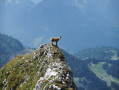
La Dent d'Oche is accessible via various routes. This one starts from a place called "La Planche" above Novel. It passes through "les chalets de Neuteu", the Pavis pass, the portes d'Oche, the lac de la case, the planchamp pass, the dent d'Oche and returns via the Rebollion pass, the Neuve pass, the Neuva dessous, the enclos, and finally "la Planche".
This route allowed us to see many ibex in different places and the local flora.
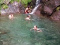
From the Ortu di u Piobu refuge to the Carrozu refuge
 4.52 mi
+2,297 ft
-3,205 ft
4h 05
Difficult
Departure from Calenzana (Haute-Corse)
4.52 mi
+2,297 ft
-3,205 ft
4h 05
Difficult
Departure from Calenzana (Haute-Corse)
This is the second stage ofthe GR®20when travelling from north to south.
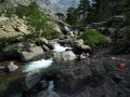
From the Carrozzu refuge to the Asco Stagnu refuge
 2.77 mi
+2,677 ft
-2,149 ft
3h 35
Difficult
Departure from Calenzana (Haute-Corse)
2.77 mi
+2,677 ft
-2,149 ft
3h 35
Difficult
Departure from Calenzana (Haute-Corse)
The third stage ofthe GR®20is a beautiful climb through scree. And magnificent orange lilies add colour to the mountain.
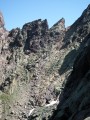
From the Asco Stagnu refuge to the Tighiettu refuge
 3.89 mi
+3,484 ft
-2,638 ft
6 hrs
3.89 mi
+3,484 ft
-2,638 ft
6 hrs
 Extremely difficult
Departure from Haute-Corse
Extremely difficult
Departure from Haute-Corse
Fourth stage ofthe GR®20with the Cirque de la Solitude pass. A place that leaves no one indifferent.
Please note: the facilities for descending and ascending the Cirque de la Solitude have been removed, making this a very challenging route.
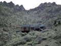
From the Tighiettu Refuge to Castellu di Vergio
 9.04 mi
+2,703 ft
-3,648 ft
6h 30
Difficult
Departure from Albertacce (Haute-Corse)
9.04 mi
+2,703 ft
-3,648 ft
6h 30
Difficult
Departure from Albertacce (Haute-Corse)
Fifth stage ofthe GR®20, pushing on to the Col de Vergio, we are doing two 6-hour stages rather than one 4-hour and one 8-hour stage, and we will be using the accommodation at the Col de Vergio.
From the Col de Vergio to the Manganu Refuge
 9.39 mi
+2,123 ft
-1,450 ft
6h 10
Moderate
Departure from Albertacce (Haute-Corse)
9.39 mi
+2,123 ft
-1,450 ft
6h 10
Moderate
Departure from Albertacce (Haute-Corse)
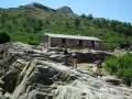
The sixth stage of ourGR®20. We pass by the beautiful Lake Nino. It is a long hike in terms of distance, but the elevation gain is easier than on previous days.
From the Manganu refuge to the Onda refuge
 9.30 mi
+4,186 ft
-4,724 ft
7h 55
Difficult
Departure from Orto (Corse-du-Sud)
9.30 mi
+4,186 ft
-4,724 ft
7h 55
Difficult
Departure from Orto (Corse-du-Sud)
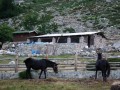
Our seventh stage ofthe GR®20. This route consists of two stages, the first to the Petra Piana refuge, and the second via the ridge variant.
The Couloirs circuit starting from Les Bouchoux
 4.75 mi
+1,486 ft
-1,506 ft
3h 30
Moderate
Departure from Les Bouchoux (Jura)
4.75 mi
+1,486 ft
-1,506 ft
3h 30
Moderate
Departure from Les Bouchoux (Jura)
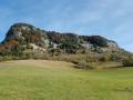
A short hike from the village of Les Bouchoux, which allows you to gain some height to see the surrounding area and take a short detour to a superb waterfall.
From the Onda refuge to Vizzavona station
 6.39 mi
+2,208 ft
-3,934 ft
4h 50
Moderate
Departure from Vivario (Haute-Corse)
6.39 mi
+2,208 ft
-3,934 ft
4h 50
Moderate
Departure from Vivario (Haute-Corse)
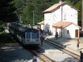
Our eighth day on theGR®20. A steep climb before an equally steep descent, but with a beautiful view... You will admire the Cascade des Anglais as you approach Vizzavona.
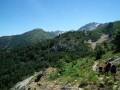
From Vizzavona to the E Capannelle refuge
 9.53 mi
+3,757 ft
-1,457 ft
7h 40
Moderate
Departure from Vivario (Haute-Corse)
9.53 mi
+3,757 ft
-1,457 ft
7h 40
Moderate
Departure from Vivario (Haute-Corse)
On the ninth stage of ourGR® 20 hike, the landscape becomes gentler, greener and more wooded.
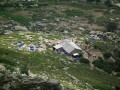
From the Usciolu Refuge to the Asinau Refuge
 9.71 mi
+3,091 ft
-3,743 ft
7h 10
Moderate
Departure from Cozzano (Corse-du-Sud)
9.71 mi
+3,091 ft
-3,743 ft
7h 10
Moderate
Departure from Cozzano (Corse-du-Sud)
Our twelfth day of walking on the legendaryGR®20in Corsica, another day with ridges, but also a nice stretch on a plateau and therefore a big change of scenery.
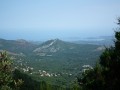
From the Asinau refuge to Conca
 17.38 mi
+3,356 ft
-7,631 ft
10h 55
Moderate
Departure from Quenza (Corse-du-Sud)
17.38 mi
+3,356 ft
-7,631 ft
10h 55
Moderate
Departure from Quenza (Corse-du-Sud)
Our thirteenth and final stage on theGR®20. The landscapes are magnificent and very different from what we have seen so far. The mountains are red and the vegetation much drier.
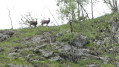
The source of the Saine
 9.22 mi
+1,467 ft
-1,483 ft
5h 30
Moderate
Departure from Foncine-le-Haut (Jura)
9.22 mi
+1,467 ft
-1,483 ft
5h 30
Moderate
Departure from Foncine-le-Haut (Jura)
A trail starting out from Foncine le Haut that will take you to the source of the Saine and various viewpoints. A themed trail and a botanical trail...
La Blonnière
 5.49 mi
+3,757 ft
-3,714 ft
5h 50
Difficult
Departure from Manigod (Haute-Savoie)
5.49 mi
+3,757 ft
-3,714 ft
5h 50
Difficult
Departure from Manigod (Haute-Savoie)
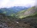
An alpine hike to the Pointe de Merdassier which will give you a taste of alpine hiking with short traverses across slabs and boulders. You’ll be rewarded with stunning scenery in good weather.
La Montagne du Sulens
 7.88 mi
+2,293 ft
-2,293 ft
5h 35
Moderate
Departure from Les Clefs (Haute-Savoie)
7.88 mi
+2,293 ft
-2,293 ft
5h 35
Moderate
Departure from Les Clefs (Haute-Savoie)
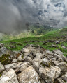
Un itinéraire assez facile, mais qui offre une jolie vue arrivé au sommet, avec une table d'orientation.
Le Grand Bois
 8.22 mi
+636 ft
-633 ft
4h 20
Easy
Departure from Le Russey (Doubs)
8.22 mi
+636 ft
-633 ft
4h 20
Easy
Departure from Le Russey (Doubs)
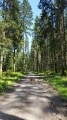
A short hike through the Grand Bois forest in the commune of Le Russey. Here you will see one of the largest fir trees and farms with the typical tuyé (or tué), a kind of large chimney for smoking meat.
Plaimbois du Miroir and Laval le Prieuré
 7.66 mi
+1,355 ft
-1,329 ft
4h 40
Moderate
Departure from Plaimbois-du-Miroir (Doubs)
7.66 mi
+1,355 ft
-1,329 ft
4h 40
Moderate
Departure from Plaimbois-du-Miroir (Doubs)
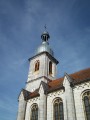
This route will take you on a journey of discovery through the Dessoubre valley, where you will be enchanted by the landscapes and religious heritage. This route covers a large part of circular 43 and is marked in yellow and blue.
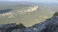
Pic Saint Loup
 3.39 mi
+1,214 ft
-1,207 ft
2h 35
Moderate
Departure from Cazevieille (Hérault)
3.39 mi
+1,214 ft
-1,207 ft
2h 35
Moderate
Departure from Cazevieille (Hérault)
This hike is best done on a sunny afternoon, so that you can contemplate the view from the summit, which can be truly breathtaking if the air is dry.
This hike may be prohibited depending on the level of fire risk. Please consult the map.
View of Saint-Guilhem-le-Désert
 1.23 mi
+443 ft
-443 ft
0h 55
Easy
Departure from Saint-Guilhem-le-Désert (Hérault)
1.23 mi
+443 ft
-443 ft
0h 55
Easy
Departure from Saint-Guilhem-le-Désert (Hérault)
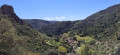
A short walk to do when visiting Saint-Guilhem-le-Désert to get a bird's eye view and discover the medieval village in its entirety.
From Saint Georges d'Oléron to the Chassiron lighthouse
 16.34 mi
+23 ft
-23 ft
3 hrs
Easy
Departure from Saint-Georges-d'Oléron (Charente-Maritime)
16.34 mi
+23 ft
-23 ft
3 hrs
Easy
Departure from Saint-Georges-d'Oléron (Charente-Maritime)
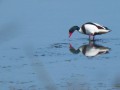
A very pleasant bike ride that mostly follows cycle paths. This tour will take you across a large part of the island of Oléron, but you will also ride along the shore for much of the way, going to the end of the island, the Chassiron lighthouse.
Stroll through La Rochelle
 2.28 mi
+23 ft
-23 ft
1h 05
Easy
Departure from La Rochelle (Charente-Maritime)
2.28 mi
+23 ft
-23 ft
1h 05
Easy
Departure from La Rochelle (Charente-Maritime)
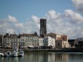
A very pleasant stroll through the streets of La Rochelle will allow you to discover the old town and all its charms.
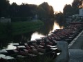
 A short trip on the Green Venice
 3.10 mi
+3 ft
-3 ft
2 hrs
Easy
Departure from Coulon (Deux-Sèvres)
3.10 mi
+3 ft
-3 ft
2 hrs
Easy
Departure from Coulon (Deux-Sèvres)
A boat trip on the Green Venice towards Coulon.
GR®20 from Calenzana to Conca in 13 days
106.39 mi
+40,794 ft
-40,778 ft
13 days
Very difficult
Departure from Calenzana (Haute-Corse)
The legendaryGR®20, done in a north-south direction... renowned as the most difficult ofthe GR® trails... Quite dizzying aerial passages alternate with easier passages, especially in the south. Very beautiful landscapes.
Mont Dore in New Caledonia
 4.28 mi
+2,257 ft
-2,257 ft
3h 55
Moderate
Departure from New Caledonia
4.28 mi
+2,257 ft
-2,257 ft
3h 55
Moderate
Departure from New Caledonia
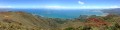
The climb up Mont Dore offers a bird’s-eye view of Nouméa and the bay. The colours are magnificent: the turquoise blue of the sea, the green of the vegetation and the red of the earth… A superb blend.
The old Dumbea dam
 7.07 mi
+620 ft
-604 ft
3h 45
Easy
Departure from Dumbéa (New Caledonia)
7.07 mi
+620 ft
-604 ft
3h 45
Easy
Departure from Dumbéa (New Caledonia)
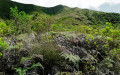
A walk focusing on the old dam with explanations; the scenery is mainly woodland, and a refreshing swim midway through the walk is a great way to cool off.
The Three Bays Trail
 2.48 mi
+515 ft
-495 ft
1h 35
Moderate
Departure from Bourail (New Caledonia)
2.48 mi
+515 ft
-495 ft
1h 35
Moderate
Departure from Bourail (New Caledonia)
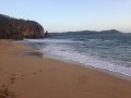
This trail allows you to walk from bay to bay on a round trip, as well as to reach some rather lovely viewpoints. Also worth seeing is the Rocher du Bonhomme.
The Saint Pairais
 4.99 mi
+157 ft
-148 ft
2h 25
Easy
Departure from Saint-Pair-sur-Mer (Manche)
4.99 mi
+157 ft
-148 ft
2h 25
Easy
Departure from Saint-Pair-sur-Mer (Manche)
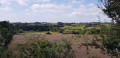
This short walk will take you around Saint Pair sur Mer, alternating between different types of paths/small roads and landscapes, including bocage, town and shopping areas, allowing you to discover the surrounding area.
The stirrup
 4.29 mi
+249 ft
-256 ft
2h 10
Easy
Departure from Saint-Pair-sur-Mer (Manche)
4.29 mi
+249 ft
-256 ft
2h 10
Easy
Departure from Saint-Pair-sur-Mer (Manche)
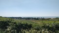
The Étrier is a route that takes you through the countryside of Lower Normandy. Slightly undulating, with hedgerows, meadows and pastures – this is the landscape and atmosphere of this walk, not forgetting Kairon Church at the start.
Charlemagne's buttocks
 3.23 mi
+551 ft
-551 ft
2h 00
Easy
Departure from Lagrasse (Aude)
3.23 mi
+551 ft
-551 ft
2h 00
Easy
Departure from Lagrasse (Aude)
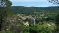
This short hike takes you up to a vantage point where you can admire the village of Lagrasse and its listed abbey. The name "fesses de Charlemagne" (Charlemagne's buttocks) comes from a legend which tells how Charlemagne's horse stumbled, throwing him onto the hill where he landed on his backside.
Notre Dame du Carla
 6.60 mi
+922 ft
-958 ft
3h 50
Moderate
Departure from Lagrasse (Aude)
6.60 mi
+922 ft
-958 ft
3h 50
Moderate
Departure from Lagrasse (Aude)
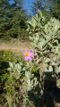
This hike, a little longer than Charlemagne's buttocks, takes you to a chapel and a viewpoint overlooking the surrounding area, all surrounded by wild vegetation.
Pointe de la Grande Vigie
 0.39 mi
+20 ft
-20 ft
0h 10
Easy
Departure from Anse-Bertrand (Guadeloupe)
0.39 mi
+20 ft
-20 ft
0h 10
Easy
Departure from Anse-Bertrand (Guadeloupe)
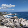
This path circles the Pointe de la Grande Vigie, offering views of the ocean’s power as it crashes against the cliffs. At the tip of the headland, you’ll see the ‘Turtle Rock’ on your left. And if you’re lucky, you might spot some whales.