Royal Waterloo Golf and the Lasne plain

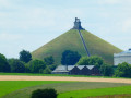
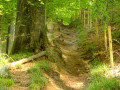
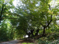
From here, we set off on a pleasant walk across the battlefield of Napoleon’s final war, far from the hustle and bustle of the 1815 tourist site. Dirt tracks – some of which are compacted – and grassy or sandy paths take us across the fields to the Waterloo golf course, which we’ll cross via a dirt track shaded by magnificent old trees before rejoining the paths through the fields. This circular route can be done on foot or by bike.

Details

n°34416488
Creation:
Last update:
Last review:
  • Walking
    Activity: Walking
  • ↔
    Distance: 4.25 mi
  • ◔
    Average duration: 2h 05 
  • ▲
    Difficulty: Easy

  • ⚐
    Back to start: Yes
  • ↗
    Ascent: + 171 ft
  • ↘
    Descent: - 167 ft

  • ▲
    Highest point: 417 ft
  • ▼
    Lowest point: 315 ft

Photos

Description of the walk

A few parking spaces are available on Chaussée de Louvain after entering the ring road and on the same side, or at the supermarket located a few hundred metres towards Chaussée de Charleroi.
The following TEC bus services stop here: 39 to Louvain-la-Neuve, 57 and 127 to La Hulpe, 58 to Genval, 128 to Rosières and 125 to Wavre.

(S/E) Cross the road and follow the cobbled path that opens up shortly after the bus stop on the same side, the Chemin des Catamouriaux. This turns into a sandy dirt track. Continue until you reach footpath no. 39, the Sentier du Champ des Fossés.

(1) Turn left onto this path and follow it until it emerges onto Rue de la Sablière.

(2) Carry on straight ahead until you reach the Sentier de l’Abbaye, trail no. 57, which starts on the right. At thefirst junction, carry on straight ahead. Cross the Royal Waterloo Golf Course. Take a moment to admire the magnificent trees on your left. Continue to the exit of the golf course.

(3) Turn right onto the hard-surfaced road – the path furthest to the left – and continue to the small Notre-Dame-du-Rosaire Chapel.

(4) Turn left onto Chemin du Mont and, quite soon after, left again onto path 32, Sentier du Piroi. At the Fork in the road, keep right onto path 33 du Tour, leading to another junction.

(5) Turn right onto path no. 36, Chemin du Charron. This bumpy track leads to a few houses. Continue straight ahead along the poorly paved road, the Chemin de la Sablonnière, to reach the junction with the Chemin des Catamouriaux.

(6) Turn right onto it and carry on straight ahead to reach the original junction, at the ‘Sentier du Champ des Fossés’.

(1) Head straight on in the opposite direction along the same route you took on the way there to return to the Chaussée de Louvain car park (S/E).

Waypoints

  1. S/E : mi 0 - alt. 413 ft - Parking is available along the Chaussée de Louvain
  2. 1 : mi 0.44 - alt. 338 ft - Junction of the circular loop
  3. 2 : mi 1.14 - alt. 348 ft - Rue de la Sablière
  4. 3 : mi 1.89 - alt. 397 ft - Exit from the Royal Waterloo Golf Club
  5. 4 : mi 2.24 - alt. 394 ft - Notre-Dame-du-Rosaire Chapel
  6. 5 : mi 2.63 - alt. 377 ft - Chemin du Charron
  7. 6 : mi 3.01 - alt. 338 ft - Chemin des Catamouriaux
  8. S/E : mi 4.25 - alt. 413 ft - Parking is available along the Chaussée de Louvain

Notes

This circular route can be done on foot or by mountain bike.

It can easily be shortened by going from (2) to (4) via Rue de la Sablière. At (4), stay on the ridge, take Rue de la Croix, then thefirst path on the right to join Chemin des Catamouriaux, which you follow to the right.

At (6), you can continue on the “Tour of the Waterloo Battlefield 1815” walk by turning left instead of heading up the Chemin des Catamouriaux to the right.

Worth a visit

Refreshments are available at the large shopping centre situated at the junction of the Chaussées de Louvain and de Charleroi.

About 2 km away, visit the 1815 site’s visitor centre with its museum, the Butte du Lion and, a little further on, Hougoumont Farm. And, on the Chaussée de Charleroi as you walk away from Waterloo, various war memorials are dotted along both sides of the road. The final neighbourhood, situated about ten kilometres further along in the same direction, is well worth a visit for history enthusiasts.

Reviews and comments

5 / 5
Based on 1 review

Reliability of the description
5 / 5
Ease of following the route
5 / 5
Route interest
5 / 5
Patrick Vanbellinghen

Thank you, McDuffe.

Machine-translated

McDuffe
McDuffe

Overall rating : 5 / 5

Date of your route : Dec 16, 2025
Reliability of the description : ★★★★★ Very good
Ease of following the route : ★★★★★ Very good
Route interest : ★★★★★ Very good
Very busy route : No

A very pleasant, easy walk (almost no elevation gain) in the plains of Lasnes and Waterloo, near Waterloo Golf Club, with the Lion of Waterloo mound on the horizon. No tarmac or concrete. Varied landscapes. Lots of beautiful old trees along the route. Best done when it's not too hot or sunny, as there aren't many shaded areas. Ideal in autumn or spring.

The only downside is the almost constant background noise from the ring road, but unfortunately this is almost inevitable in Walloon Brabant and even elsewhere in Belgium, a small country criss-crossed by numerous roads.

Machine-translated

Other walks in the area

For more walks, use our search engine .

The GPS track and description are the property of this route's author. Please do not copy them without permission.