Tour of the Waterloo battlefield, 1815

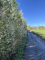
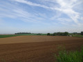
Starting from the 1815 site, this circular route takes you across fields to explore the sweeping landscapes of the Plancenoit and Braine-l’Alleud area, the site of Napoleon’s final battle. Largely along country lanes, you’ll be accompanied by the song of the lark and the call of the pheasant. If you’re lucky, in the early morning you might spot a roe deer coming out to feed. And, for history buffs, there are a few reminders of the battle at the start and end of the route.

Details

34089122
Creation:
Last update:
Last review:
  • Walking
    Activity: Walking
  • ↔
    Distance: 4.53 mi
  • ◔
    Average duration: 2h 10 
  • ▲
    Difficulty: Easy

  • ⚐
    Back to start: Yes
  • ↗
    Ascent: + 141 ft
  • ↘
    Descent: - 138 ft

  • ▲
    Highest point: 446 ft
  • ▼
    Lowest point: 325 ft

Photos

Description of the walk

The Site 1815 car park is accessible by car via the Brussels ring road (R0), exit 25, or by train: alight at Braine-l’Alleud station, then take the Braine-l’Alleud–Waterloo bus to the ‘Chaussée de Nivelles, Site 1815’ stop.

(S/E) Head towards the Visitor Centre and the Butte du Lion. Turn left in front of the hotel and continue to the Chaussée de Charleroi. On your right, on a hillock, is the Gordon Monument.

(1) Cross the road carefully. On the other side, you’ll see the Monument to the Belgians on your left and, about fifty metres away on your right, the Monument to the Hanoverians. Between the two, a road with uneven cobblestones leads into the fields. Follow it to the first Fork in the road.

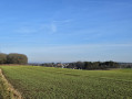
(2) Take the left-hand fork, which runs between a house and Fichermont Convent. Here is the first fine view of the battlefield. Continue to the junction with the Chemin des Catamouriaux.

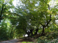
(3) Turn right and head down the sunken lane. It leads you to a quiet tarmac road, but be careful just before a bend that obscures the view. On your right is the Ferme de la Papilotte.
Follow the road to the right for about a hundred metres.

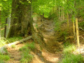
(4) Cross the road and head down another sunken track. At the Fork in the road, take the path going uphill to the right, which will quickly lead you onto the plateau. As you emerge from the sunken track, you’ll see the route you’ve already covered: the Butte du Lion, Fichermont Convent and the Ferme de la Papelotte. Continue along this dirt track until you reach the Charleroi road. Please be careful: traffic is heavy and there is only one pedestrian crossing.

(5) Cross the road and take the dirt track opposite, which will lead you to the Chemin des Vertes Bornes. Take a moment to admire the Hougoumont farm on your left, a key site of the 1815 battle.

(6) Turn right and head towards the Butte du Lion and the car park (S/E).

Waypoints

  1. S/E : mi 0 - alt. 443 ft - Mémorial de la bataille de Waterloo et butte du Lion
  2. 1 : mi 0.36 - alt. 430 ft - Chaussée de Charleroi
  3. 2 : mi 0.78 - alt. 417 ft - Fichermont Convent
  4. 3 : mi 1.29 - alt. 404 ft - Chemin des Catamouriaux junction
  5. 4 : mi 1.8 - alt. 331 ft - La Papilotte Farm
  6. 5 : mi 3.03 - alt. 443 ft - Chaussée de Charleroi – La Belle Alliance
  7. 6 : mi 3.91 - alt. 413 ft - Chemin des Vertes Bornes junction
  8. S/E : mi 4.53 - alt. 443 ft - Mémorial de la bataille de Waterloo et butte du Lion

Notes

Hotels and restaurants near the starting point. No water along the route.

Worth a visit

Well worth a visit, either at the start or finish, is the Visitor Centre. The tour includes the museum, the Butte du Lion and Hougoumont Farm, 2 km away.

Reviews and comments

4.3 / 5
Based on 3 reviews

Reliability of the description
4.7 / 5
Ease of following the route
4.7 / 5
Route interest
3.7 / 5
Patrick Vanbellinghen

Thank you for following up.

Machine-translated

catbalou
catbalou

Overall rating : 4.7 / 5

Date of your route : Jul 31, 2026
Reliability of the description : ★★★★★ Very good
Ease of following the route : ★★★★★ Very good
Route interest : ★★★★☆ Good
Very busy route : Yes

A lovely, easy walk. You’ll stroll through fields steeped in history. You can also visit the museum and see the key sites of the battle. There’s somewhere to eat near the museum (Le Bivouac).

Machine-translated

Patrick Vanbellinghen

Thank you for sharing this lovely post and for the springtime photo you added.

Patrick

Machine-translated

User 24849032

Overall rating : 4.7 / 5

Date of your route : Mar 29, 2026
Reliability of the description : ★★★★★ Very good
Ease of following the route : ★★★★★ Very good
Route interest : ★★★★☆ Good
Very busy route : Yes

A lovely post-winter walk to get back into the swing of things... Splendid weather that transformed the undulating terrain of the battlefield (which is by no means, absolutely not, a ‘dull plain’) into a landscape straight out of a 17th-century painting... A super-easy route to follow, not very muddy, and splendid views... Not a major hike but very enjoyable... Thanks for this walk.

Machine-translated

Patrick Vanbellinghen

Thank you, Michel, but that wasn’t the aim of this walk, which is to explore the landscape of the battlefield after – or before – visiting the museum and/or Hougoumont Farm.

Machine-translated

Michel Capette
Michel Capette

Overall rating : 3.7 / 5

Date of your route : Jul 24, 2024
Reliability of the description : ★★★★☆ Good
Ease of following the route : ★★★★☆ Good
Route interest : ★★★☆☆ Average
Very busy route : No

Not sufficiently representative of the context of the Battle of Waterloo

Machine-translated

Other walks in the area

For more walks, use our search engine .

The GPS track and description are the property of this route's author. Please do not copy them without permission.