


Refine your search for walks in Neuf-Berquin
Neuf-Berquin walks


 Circular route between Neuf-Berquin and Merville
 Visorando Member
 7.62 mi
 +10 ft
 -10 ft
 3h 30
3h 30
 Moderate
 Departure from Neuf-Berquin (Nord)
Route designed by the USEP Neuf-Berquin association for the ‘Septembre d’Or’ event. An easy walk that alternates between roads and paths through woodland and grassy areas. This route can be completed on foot, by running, with a pushchair or by bike, with a minor adjustment to avoid the walk’s only flight of stairs.
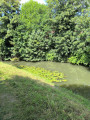
Merville, along the water
 2.75 mi
+13 ft
-13 ft
1h 15
2.75 mi
+13 ft
-13 ft
1h 15
 Easy
Departure from Merville (Nord) (Nord)
Easy
Departure from Merville (Nord) (Nord)
Here is a short walk that will take you along the River Lys and then through the flower-filled Les Prés de la Ville park.
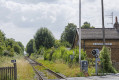
Along the Lys at La Gorgue
 2.61 mi
+13 ft
-13 ft
1h 15
Easy
Departure from La Gorgue (Nord)
2.61 mi
+13 ft
-13 ft
1h 15
Easy
Departure from La Gorgue (Nord)
Set off to explore the public gardens and the River Lys.
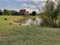
Magots Circular Loop
 3.79 mi
+13 ft
-13 ft
1h 45
Easy
Departure from La Gorgue (Nord)
3.79 mi
+13 ft
-13 ft
1h 45
Easy
Departure from La Gorgue (Nord)
Walk starting from the Jean-Paul II Parish, around Les Magots.
A circular route starting from Calonne-sur-la-Lys
11.97 mi
+16 ft
-16 ft
5h 30
Moderate
Departure from Calonne-sur-la-Lys (Pas-de-Calais)
This route will allow you to explore the countryside north of Béthune and enjoy the canals via the towpaths.
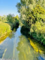
Boucle de Lestrem par le Pont Riqueult
 7.14 mi
+10 ft
-10 ft
3h 15
Easy
Departure from Lestrem (Pas-de-Calais)
7.14 mi
+10 ft
-10 ft
3h 15
Easy
Departure from Lestrem (Pas-de-Calais)
Discover the paths and small country roads starting from the hamlet of La Fosse. You will follow and cross the Lawe several times. You can admire magnificent willow trees, gigantic in the middle of their pastures. Several information panels on the history of the area line the route: Pont Riqueult, cemetery, park, village centre, along the Lawe, Pont de la Fosse. Take the time to read them.
Countryside path along the Lys
 6.06 mi
+10 ft
-10 ft
2h 50
Easy
Departure from Sailly-sur-la-Lys (Pas-de-Calais)
6.06 mi
+10 ft
-10 ft
2h 50
Easy
Departure from Sailly-sur-la-Lys (Pas-de-Calais)
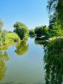
This walk will introduce you to the countryside around Sailly and the tranquility of the river Lys.
Path from the château to Morbecque
4.97 mi
+10 ft
-10 ft
2h 20
Easy
Departure from Morbecque (Nord)
Short walk in the Flamingue woods and along the Canal de la Nieppe.
Tannay path
 3.65 mi
+3 ft
-3 ft
1h 40
Easy
Departure from Haverskerque (Nord)
3.65 mi
+3 ft
-3 ft
1h 40
Easy
Departure from Haverskerque (Nord)
This tour will introduce you to three different settings: the Domaniale de Nieppe forest, the wooded countryside and the Lys river.
Tour of the 3 bell towers in the heart of Flanders
 6.76 mi
+7 ft
-7 ft
3h 05
Easy
Departure from Haverskerque (Nord)
6.76 mi
+7 ft
-7 ft
3h 05
Easy
Departure from Haverskerque (Nord)
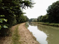
The forest edge, the canal banks and the agricultural plain give the trail its contrasting moods. Keep your eyes peeled for birds in the undergrowth, insects on leaves and trees, and the mushrooms that grow here in late spring.
A Franco-Belgian circular loop around Bailleul
13.35 mi
+607 ft
-577 ft
6h 40
 Difficult
Departure from Bailleul (Nord)
Difficult
Departure from Bailleul (Nord)
A long route around Bailleul, the only real challenge of which (especially in dry weather) is its length.After reaching Saint-Jans-Cappel via a farm track, you tackle Mont Noir (and it puts up a good fight!). You then set off along a route running along the border to reach the vicinity of Dranouter.A lovely descent through the fields, followed by a succession of paths and small roads, brings you to the Botanical Conservatory. All that remains is to make your way back to Bailleul, alternating between very narrow roads with badly damaged surfaces and footpaths. A lovely green space (the Bellekindt) allows you to bypass the cemetery, and the walk ends in the centre of Bailleul with its monuments.
It’s best to choose a dry spell, otherwise you may encounter some muddy sections. This was the case this morning (5 March 2025: difficult sections at point (5), between (9) and (10), between (11) and (12), and after (23).
Avoid the first weekend in August: the festival takes up part of the trails.
The Gorges Bleues trail in Mont-Bernanchon
 5.42 mi
+16 ft
-16 ft
2h 30
Easy
Departure from Mont-Bernanchon (Pas-de-Calais)
5.42 mi
+16 ft
-16 ft
2h 30
Easy
Departure from Mont-Bernanchon (Pas-de-Calais)
A short, peaceful stroll along a grassy path beside the Canal d'Aire à la Bassée, taking you past the observation hut at the Mont-Bernanchon bird sanctuary. Stables and a short stretch through the forest.
This walk is marked in yellow from start to finish.
Les T'chiens starting from Robecq
 4.99 mi
+33 ft
-36 ft
2h 20
Easy
Departure from Robecq (Pas-de-Calais)
4.99 mi
+33 ft
-36 ft
2h 20
Easy
Departure from Robecq (Pas-de-Calais)
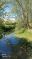
A walk that allows you to enjoy the village’s green surroundings. Walkers will discover a variety of paths during their stroll, including the Busnes stream and a wealth of diverse landscapes, rich in flora and fauna. This walk can be found on Randofiche 48, published by the FFRP and the CABBALR.
Take an unusual route up between Mont Noir and Mont Rouge
 7.95 mi
+758 ft
-761 ft
4h 20
Moderate
Departure from Saint-Jans-Cappel (Nord)
7.95 mi
+758 ft
-761 ft
4h 20
Moderate
Departure from Saint-Jans-Cappel (Nord)
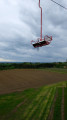
This hike crosses Flanders on both sides of the French-Belgian border via tiny paths. And, to gain a little more height, you can try out an unusual means of transport that has been connecting Mont Noir and Mont Rouge since 1958!This hike is accessible to everyone, young and old alike, with a slight incline to warm up your calves!
Mont Noir trail
 6.56 mi
+384 ft
-384 ft
3h 20
Moderate
Departure from Saint-Jans-Cappel (Nord)
6.56 mi
+384 ft
-384 ft
3h 20
Moderate
Departure from Saint-Jans-Cappel (Nord)
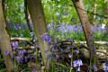
A bucolic tour through the wild hyacinths and wild garlic blooming in late April and early May.
Discover the Mont Noir and Flanders (Saint-Jans-Cappel, view of Mont des Cats and Bailleul) through undergrowth, forest paths and small roads.
Old lime tree and orchards in Aubers
 5.98 mi
+56 ft
-56 ft
2h 50
Easy
Departure from Aubers (Nord)
5.98 mi
+56 ft
-56 ft
2h 50
Easy
Departure from Aubers (Nord)
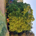
A short route with very little tarmac, allowing you to (re)discover the old lime tree of Joncquoy as well as the orchards of La Cliqueterie, which are particularly beautiful in autumn and spring.
Humani Twins Go in Nieppe
 Association / Club / Walk leader3.39 mi
+10 ft
-10 ft
1h 35
Easy
Departure from Nieppe (Nord)
Association / Club / Walk leader3.39 mi
+10 ft
-10 ft
1h 35
Easy
Departure from Nieppe (Nord)
Humani Twins Go hike in the town of Nieppe. Nieppe, in the heart of Flanders, where you can see the ponds and Michel Grasset Park. This hike is accessible to everyone and is not difficult.
Walking in Nieppe through town and countryside
7.36 mi
+13 ft
-13 ft
3h 25
Moderate
Departure from Nieppe (Nord)
Hiking in the city and the countryside. In Nieppe, you can stroll around the ponds or along the Lys river.
This route is accessible to everyone as there are no hills.
Mont des Cats - Around the Monastery
 6.90 mi
+705 ft
-676 ft
3h 45
Moderate
Departure from Berthen (Nord)
6.90 mi
+705 ft
-676 ft
3h 45
Moderate
Departure from Berthen (Nord)
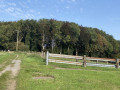
This walk will take you around the Mont des Cats along paths and back roads. It will reveal its viewpoints, its chapels, its heritage and its gentle slopes.
Les Chantiers in Beuvry
 5.02 mi
+10 ft
-10 ft
2h 20
Easy
Departure from Beuvry (Pas-de-Calais)
5.02 mi
+10 ft
-10 ft
2h 20
Easy
Departure from Beuvry (Pas-de-Calais)
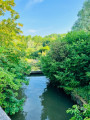
A beautiful walk along the banks of the Canal d'Aire in La Bassée. An invitation to stroll through remarkable landscapes such as the Marais de l'Avoué and the Prévôté de Gorre. The British military cemetery in Gorre is a reminder of the Great War.
The Lowlands between Vendin and Gonnehem
 7.21 mi
+30 ft
-33 ft
3h 20
Easy
Departure from Vendin-lès-Béthune (Pas-de-Calais)
7.21 mi
+30 ft
-33 ft
3h 20
Easy
Departure from Vendin-lès-Béthune (Pas-de-Calais)
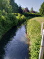
A short, unpretentious route with no significant elevation gain in the Béthune countryside. A mix of footpaths, farm tracks and small roads to keep you going for a good half-day.
The Three Mountains of Flanders
 12.77 mi
+1,152 ft
-1,161 ft
6h 55
Difficult
Departure from Berthen (Nord)
12.77 mi
+1,152 ft
-1,161 ft
6h 55
Difficult
Departure from Berthen (Nord)
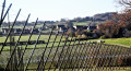
These three mountains watch over Bailleul, the capital of Flanders between Lille and Dunkirk: Mont des Cats, Mont de Boeschepe and Mont Noir, plus Mont Kokereel. From the top of these small hills (180m), you can enjoy views over the surrounding area.
The route offers several points of interest, including Marguerite Yourcenar's house on Mont Noir, the Boschepe mill in the village of the same name, and Mont des Cats and its abbey of Cistercian monks, founded in 1826.
Around Mont des Cats (Katts Walk)
 3.03 mi
+322 ft
-322 ft
1h 40
Easy
Departure from Godewaersvelde (Nord)
3.03 mi
+322 ft
-322 ft
1h 40
Easy
Departure from Godewaersvelde (Nord)
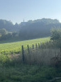
Walk around the Mont des Cats monastery. Peaceful, natural surroundings and panoramic views guaranteed.
La catorive à Béthune
 7.21 mi
+36 ft
-36 ft
3h 20
Moderate
Departure from Béthune (Pas-de-Calais)
7.21 mi
+36 ft
-36 ft
3h 20
Moderate
Departure from Béthune (Pas-de-Calais)
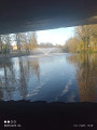
Venez découvrir Béthune avec ses anciens canaux, au départ, puis son port de plaisance, sans oublier le centre ville avec son beffroi.
The Ravensberg hill in the Bailleul countryside
6.22 mi
+200 ft
-200 ft
3h 00
Moderate
Departure from Heuvelland (Flandre-Occidentale)
Departure and arrival at the car park of the church in Dranouter via Ravensberg in the Bailleul countryside. Pass by the Wijngaard Koudekot vineyard, which produces white, rosé and red wines.
Dranouter via Monteberg, Lettenberg and Kemmelberg
9.31 mi
+774 ft
-804 ft
4h 55
Moderate
Departure from Heuvelland (Flandre-Occidentale)
Start and finish at the car park of the church in Dranouter via Monteberg, Lettenberg and Kemmelberg.
Pass along the Monteberg vineyard and through the woods of the Kemmelberg provincial estate.
Waiter, a 3 Monts, please!
 14.95 mi
+1,319 ft
-1,325 ft
8h 00
Difficult
Departure from Heuvelland (Flandre-Occidentale)
14.95 mi
+1,319 ft
-1,325 ft
8h 00
Difficult
Departure from Heuvelland (Flandre-Occidentale)
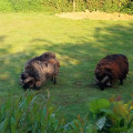
A patchwork of different routes in the area for a long hike that will delight your thighs.As for the mountains, like the Musketeers, there are four (or even five, I forgot the Baneberg near the mill), as you climb Mont Noir twice.In short, a nice climb in the Flat Country on numerous paths and a few small, quiet roads.
It's a demanding route, because even between the mountains, there are plenty of small hills. But, as is often the case in Belgium, the trails are well maintained and constantly being improved.
Walk to Kemmel
 8.11 mi
+712 ft
-712 ft
4h 20
Moderate
Departure from Heuvelland (Flandre-Occidentale)
8.11 mi
+712 ft
-712 ft
4h 20
Moderate
Departure from Heuvelland (Flandre-Occidentale)
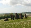
Short route on beautiful, well-maintained Belgian trails with good signage.Simple signposting: there are posts with numbers and an arrow indicating the number you want to go to (not easy to explain but obvious when you're there).
In wet weather, some areas may be soggy or even very muddy.
The Kemmel countryside from Dranouter
9.33 mi
+820 ft
-791 ft
5h 00
Moderate
Departure from Heuvelland (Flandre-Occidentale)
Departure and arrival at the car park of the church in Dranouter via Monteberg, the countryside of Kemmel and Loker. Passing by the vineyards of Monteberg, Kemmel and Loker. Passing by the French ossuary of the 1914-1918 war in Kemmel.
Neuve Eglise via the countryside of Bailleul
6.32 mi
+246 ft
-226 ft
3h 10
Moderate
Departure from Heuvelland (Flandre-Occidentale)
Start and finish at the car park on the main square in Neuve Église via the countryside around Dranouter. This route is mostly on paved paths and is therefore ideal for a mud-free walk in winter.
Neuve Église and Wulvergem via the Douve valley
6.27 mi
+138 ft
-148 ft
3h 00
Moderate
Departure from Heuvelland (Flandre-Occidentale)
Start and finish at the car park of Wulvergem Church or the main square in Neuve Église.
This walk mostly follows paved paths and is therefore ideal for winter.
Neuve-Eglise centre via the Ploegsteert countryside
8.13 mi
+154 ft
-154 ft
3h 50
Moderate
Departure from Heuvelland (Flandre-Occidentale)
Pass Notre Dame Church, follow Bassevillestraat, cross Zuidlindestraat and take Naaikorfstraat. Pass the Cense de l'Alouette vineyard. At the end, turn right onto Rue du Rossignol, then right onto Leeuwerkstraat and continue straight ahead onto the farm track, which can be quite muddy in winter.
The Ravensberg countryside in Bailleul
6.48 mi
+207 ft
-230 ft
3h 10
Easy
Departure from Heuvelland (Flandre-Occidentale)
Start and finish at the car park on the Grand-Place in Neuve Église, via the Ravensberg countryside in Bailleul. This route passes through muddy paths during winter, so it is advisable to do this hike in dry weather in summer.
Neuve Église via the Ploegsteert countryside
9.57 mi
+180 ft
-154 ft
4h 35
Moderate
Departure from Heuvelland (Flandre-Occidentale)
Start and finish at the car park on the main square in Neuve Église via the countryside around Ploegsteert
This route crosses a field and is therefore quite muddy in winter
Passes close to vineyards: there are two vineyard plots on this route
Neuve Eglise via the countryside of Ploegsteert and Walletjes
9.48 mi
+262 ft
-243 ft
4h 35
Moderate
Departure from Heuvelland (Flandre-Occidentale)
Departure and arrival at the car park on the main square in Neuve Église. This route takes you through the countryside around Ploegsteert.
The hike crosses a field and follows dirt paths through wet and muddy areas in winter.
You can admire the Heuvelland countryside with its vineyards at the foot of the Kemmel and Monteberg mountains.
Sentier des Gueux
 6.10 mi
+312 ft
-315 ft
3h 05
Easy
Departure from Heuvelland (Flandre-Occidentale)
6.10 mi
+312 ft
-315 ft
3h 05
Easy
Departure from Heuvelland (Flandre-Occidentale)
A pleasant route in Belgium.
This is the Sentier des Gueux (Geuzen walking route), the end of which I have modified.
It uses the same signposting as the Mont Kemmel and Mont Rouge routes.
It is an easy walk along small roads, wide farm tracks and some very pleasant paths (including a "paved slanting street"!).
Neuve Eglise via the countryside of Ploegsteert and Wulvergem
5.89 mi
+118 ft
-118 ft
2h 50
Easy
Departure from Heuvelland (Flandre-Occidentale)
Departure and arrival at the car park on the main square in Neuve Eglise via the countryside of Ploegsteert and Wulvergem
Passing close to the Cense de l'Alouette vineyard.
In the shadow of Mount Kemmel, the view overlooks the Douve to the north and the Lys valley to the south. The vineyard was planted in 2018
Passing close to the church of Wulvergem.
Neuve Eglise via the countryside of Wulvergem and Ploegsteert
9.48 mi
+194 ft
-207 ft
4h 30
Moderate
Departure from Heuvelland (Flandre-Occidentale)
Start and finish at the car park on the main square in Neuve Église. It is also possible to start from Wulvergem. Passing through Rosenberg, along dirt tracks and through fields that are wet and muddy in winter. The walk takes place near the Cense de l'Alouette vineyard. In the shadow of Mont Kemmel, it overlooks the Douve to the north and the Lys valley to the south.
Neuve Église via Ploegsteert and Nieppe
9.55 mi
+246 ft
-262 ft
4h 35
Moderate
Departure from Heuvelland (Flandre-Occidentale)
Start and finish at the car park on the main square in Neuve Église via the countryside of Ploegsteert and Nieppe
The hike crosses a field and follows dirt paths through wet and muddy areas in winter.
Pass through the Romarin district, which straddles France, Flanders and Belgium
Alternative route from Annezin
 5.07 mi
+33 ft
-33 ft
2h 20
Easy
Departure from Annezin (Pas-de-Calais)
5.07 mi
+33 ft
-33 ft
2h 20
Easy
Departure from Annezin (Pas-de-Calais)
This walk starting from Annezin will let you discover the charms of an urban walk, sometimes on good paths, sometimes on tarmac. You’ll follow in the footsteps of the old canal, which no longer exists today.
Let’s wander around the mountain
17.41 mi
+1,434 ft
-1,404 ft
7 hrs
 Very difficult
Departure from Godewaersvelde (Nord)
Very difficult
Departure from Godewaersvelde (Nord)
A very long route on and around Mont des Cats, allowing you to explore its southern section. I’ve tried to take as many paths as possible, resulting in a very winding route (hence the name of the walk). Take care on the small roads where visibility isn’t always very good.
The plain around Mont de Boeschepe
8.42 mi
+531 ft
-538 ft
4h 20
Moderate
Departure from Boeschepe (Nord)
Starting from the typical Auberge du Vermont, a route through the plains of Flanders at the foot of Mont des Cats and its monastery. Pass by the Moulin de l'Ingratitude and the Vierpot estaminet. Pass through the Boeschepe and Kokereel hills. View of Belgium, Bailleul.
Mont Rouge, route courte
4.37 mi
+525 ft
-551 ft
2h 30
Easy
Departure from Heuvelland (Flandre-Occidentale)
This is a more family-friendly version of my two other hikes on Mont Rouge. It's short but with a good elevation gain. Half of the route is in the countryside and half in the woods, with a minimum of tarmac. Enough to keep you busy for half a day while getting plenty of fresh air!
Loker, the Sulferberg, Westouter, Mont Noir and the Douve Valley
9.44 mi
+646 ft
-669 ft
4h 55
Moderate
Departure from Heuvelland (Flandre-Occidentale)
A circular walking route starting from Loker Church, passing through the Sulferberg, the Westouter vineyards, Marguerite Yourcenar Park, Mont Noir, the Douve Valley and the Behaegel Estate
Loker, Scherpenberg, Sulferberg, Westouter, Mont Noir and Mont Rouge
9.45 mi
+656 ft
-673 ft
4h 55
Moderate
Departure from Heuvelland (Flandre-Occidentale)
A circular walking route starting from Loker Church via Scherpenberg, Sulferberg, the Westouter countryside, Marguerite Yourcenar Park, Mont Noir, the Douve Valley and Mont Rouge.
Loker, Mont Rouge, the Monteberg vineyard and the Douve Valley
9.40 mi
+686 ft
-686 ft
4h 55
Moderate
Departure from Heuvelland (Flandre-Occidentale)
A circular walking route starting from Loker Church, passing through Mont Rouge, the Douve Valley, the Behaegel estate, the British Military Cemetery No. 10 at Locre, Dranouter Church and the Monteberg vineyard.
Loker, Mont Rouge, the Douve Valley and the Entre-deux-Monts vineyards
9.44 mi
+682 ft
-699 ft
4h 55
Moderate
Departure from Heuvelland (Flandre-Occidentale)
A circular walking route starting at Loker Church, via Mont Rouge, the Behaegel estate, the Douve Valley, the Entre-deux-Monts vineyards, the Hellegatbos, the Westouter countryside and the Scherpenberg.
Discovering the Lettenberg
 13.66 mi
+1,178 ft
-1,184 ft
7h 20
Difficult
Departure from Heuvelland (Flandre-Occidentale)
13.66 mi
+1,178 ft
-1,184 ft
7h 20
Difficult
Departure from Heuvelland (Flandre-Occidentale)
A long stretch along the slopes of Mont Kemmel to discover the Lettenberg, a small hill near Kemmel (perhaps the result of the union between Mont Rouge and Mont Kemmel?). The rest of the route is fairly standard, but passes through areas that are often very damp. And as always in this area, the elevation gain is quite significant. Avoid this walk in early August, during the Dranouter Festival.
The Mont Rouge and the Douve valley circular starting from Loker
9.42 mi
+673 ft
-673 ft
4h 55
Moderate
Departure from Heuvelland (Flandre-Occidentale)
Departure and arrival at the car park of Loker church via the Westouter countryside. Crossing the Hellegatbos woods with a passage through the Hell Hole of Mont Rouge. Passing near the Baneberg mill in Westouter. Crossing the Douve valley, which forms the border between France and Belgium. Passing into France through the Mont Noir countryside in Saint Jans Cappel and the vineyards of Dranouter.
Loker via Saint Jans Cappel, Mont Noir, Douve valley and Mont Rouge
9.37 mi
+712 ft
-702 ft
4h 55
Moderate
Departure from Heuvelland (Flandre-Occidentale)
Departure and arrival at the car park of Loker Church via the countryside of Saint Jans Cappel and the Marguerite Yourcenar Nature Reserve at Mont Noir. Pass through the Douve Valley, which forms the border with France, and along Mont Rouge.
Mont des Cats and the Helleketelbos Nature Reserve
 15.05 mi
+774 ft
-784 ft
7h 35
Difficult
Departure from Godewaersvelde (Nord)
15.05 mi
+774 ft
-784 ft
7h 35
Difficult
Departure from Godewaersvelde (Nord)
After passing through Mont des Cats, you head back down to Boeschepe before a short detour into Belgium near Poperinge. As a bonus, there’s a ‘short’ circular route through the Helleketelbos nature reserve – just for the fun of getting your boots muddy.
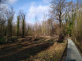
Tour of the marshes at Beuvry
 7.98 mi
+33 ft
-33 ft
3h 40
Moderate
Departure from Beuvry (Pas-de-Calais)
7.98 mi
+33 ft
-33 ft
3h 40
Moderate
Departure from Beuvry (Pas-de-Calais)
A walk through ponds, canals and marshes, where you'll be surrounded by water in the commune of Beuvry.
The Red and the Black
 10.86 mi
+1,276 ft
-1,270 ft
6h 05
Difficult
Departure from Heuvelland (Flandre-Occidentale)
10.86 mi
+1,276 ft
-1,270 ft
6h 05
Difficult
Departure from Heuvelland (Flandre-Occidentale)
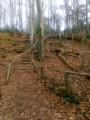
Return to Mont Rouge, passing through the Bois du Mont Noir. Enjoy a beautiful stroll through the woods, ending with a superb (and challenging) staircase.
Be careful, as soon as it gets a little wet, the paths become very difficult and you can sometimes find yourself with mud up to your mid-shoes. This was the case this morning (19 November 2021).
The Bellenville Marshes and the Préolan
 6.12 mi
+26 ft
-26 ft
2h 50
Easy
Departure from Beuvry (Pas-de-Calais)
6.12 mi
+26 ft
-26 ft
2h 50
Easy
Departure from Beuvry (Pas-de-Calais)
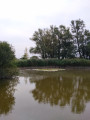
This walk, starting from Beuvry, will take you along the canals and then into the Bellenville Marshes. It passes through Petit Sailly before reaching Bas de Beuvry and Préolan. On the way back, you’ll walk alongside the canal, not forgetting to visit the observatory in the marshes where, with a bit of luck, you might spot some migratory birds.
Discovering Beuvry, via the back roads
 7.02 mi
+85 ft
-72 ft
3h 20
Moderate
Departure from Beuvry (Pas-de-Calais)
7.02 mi
+85 ft
-72 ft
3h 20
Moderate
Departure from Beuvry (Pas-de-Calais)
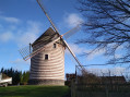
Discover Beuvry’s hidden gems, from canals to parks and green spaces.
Towpath at Beuvry
 3.19 mi
+20 ft
-20 ft
1h 30
Easy
Departure from Beuvry (Pas-de-Calais)
3.19 mi
+20 ft
-20 ft
1h 30
Easy
Departure from Beuvry (Pas-de-Calais)
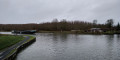
A walk along the banks of the Beuvry Canal.
Surrounded by towpaths on either side, the 3-km-long Beuvry Canal is a remnant of a former industrial waterway. Many people enjoy the peace and quiet and the scenery along its banks.
Scherpenberg and Rodeberg, mid-season route
 12.37 mi
+942 ft
-938 ft
6h 30
Difficult
Departure from Heuvelland (Flandre-Occidentale)
12.37 mi
+942 ft
-938 ft
6h 30
Difficult
Departure from Heuvelland (Flandre-Occidentale)
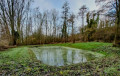
When the weather becomes a little wetter, you can still hike on Mont Rouge.
This route alternates between small roads (with little traffic), paths and forest trails, which makes it a little less strenuous.
It is a winding route, so the app is very useful.
There is quite a bit of elevation gain and, in wet weather, the trails are quite slippery. The walk is therefore quite tiring (equivalent to a 25 km route).
Roller coaster and maze on the Monts de Flandre
13.66 mi
+1,427 ft
-1,417 ft
7h 30
Difficult
Departure from Heuvelland (Flandre-Occidentale)
This is a route on which I had fun concentrating as many difficulties as possible (more than 400 m of elevation gain). This gives it a somewhat labyrinthine feel, but it allows you to avoid tarmac as much as possible. So you walk from peak to peak on well-marked, clean paths. The use ofthe Visorando app is highly recommended, even though the numbering system is very practical.
Around and on Mont Rouge
 10.03 mi
+787 ft
-814 ft
5h 20
Difficult
Departure from Heuvelland (Flandre-Occidentale)
10.03 mi
+787 ft
-814 ft
5h 20
Difficult
Departure from Heuvelland (Flandre-Occidentale)
A long, slightly winding route to enjoy the beautiful Belgian trails, which are well maintained and clearly marked.
Simple signposting: there are posts with numbers and an arrow indicating the number you want to go to (not easy to explain but obvious when you're there).
Difficult route, even very difficult in wet weather.
From Beuvry to Noyelles via Bellenville and Moulin Buret
 12.15 mi
+66 ft
-66 ft
5h 40
Moderate
Departure from Beuvry (Pas-de-Calais)
12.15 mi
+66 ft
-66 ft
5h 40
Moderate
Departure from Beuvry (Pas-de-Calais)
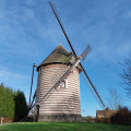
Route in an urban area, mainly on paths. It allows you to discover and cross the Domaine de Bellenville, the Terril and the Labourse ponds, as well as the impressive Moulin du Ballon (or Moulin Buret).
Mont Rouge from Loker
4.70 mi
+325 ft
-322 ft
2h 25
Easy
Departure from Heuvelland (Flandre-Occidentale)
A pleasant short hike near Loker and Le Mont Rouge, with easy-to-use numbered markings.
Return to Kemmel
 7.48 mi
+623 ft
-643 ft
4h 00
Moderate
Departure from Heuvelland (Flandre-Occidentale)
7.48 mi
+623 ft
-643 ft
4h 00
Moderate
Departure from Heuvelland (Flandre-Occidentale)
Another way to approach Kemmel, this time from the east. There are some sections in common with the first hike, but the paths are taken in the opposite direction, which allows you to enjoy them in a different way. And we can thank our Belgian neighbours for the quantity and quality of the trails they offer us.
Les marais depuis Cuinchy
 7.64 mi
+16 ft
-16 ft
3h 30
Moderate
Departure from Cuinchy (Pas-de-Calais)
7.64 mi
+16 ft
-16 ft
3h 30
Moderate
Departure from Cuinchy (Pas-de-Calais)
Entre canaux et marais de Cuinchy à Beuvry, on prend le temps de flâner sur le thème de la biodiversité.
The Two Rivers Trail in Fouquières-lès-Béthune
 5.18 mi
+135 ft
-135 ft
2h 30
Easy
Departure from Fouquières-lès-Béthune (Pas-de-Calais)
5.18 mi
+135 ft
-135 ft
2h 30
Easy
Departure from Fouquières-lès-Béthune (Pas-de-Calais)
The two rivers trail from Fouquières-lès-Béthune to Fouquereuil takes you along the Blanche to the Annezin marsh, then along the Lawe before walking above the water under a railway line!
This route will take you to the Fouquereuil storage slag heap (the Terril de la Cuisse Maraune) where you can enjoy a superb 360° panorama from the top. The return journey is through the fields.
The two Chartreuses in Fouquières-lès-Béthune
 7.69 mi
+174 ft
-151 ft
3h 40
Moderate
Departure from Fouquières-lès-Béthune (Pas-de-Calais)
7.69 mi
+174 ft
-151 ft
3h 40
Moderate
Departure from Fouquières-lès-Béthune (Pas-de-Calais)
Belle randonnée sans difficulté. Elle vous fait découvrir des chartreuses dans la campagne et les bois environnants.
Circular route between Fouquereuil and Bruay
 13.31 mi
+495 ft
-499 ft
6h 35
Difficult
Departure from Fouquereuil (Pas-de-Calais)
13.31 mi
+495 ft
-499 ft
6h 35
Difficult
Departure from Fouquereuil (Pas-de-Calais)
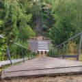
Long route through the urban area. Follow the Lawe and then the Brette to reach the Miner's Monument in Bruay. To return, head to Cité 4 in Bruay before reaching the Bois des Dames by following the PR® du Bois des Dames. Crossing the woods takes you to the slag heap before leading you to Emmaüs. From there, the return journey is via the Bois de la Sablière. There are many paths and "bus lanes" for a route that is passable even in wet weather.
Two woods, a slag heap and a charterhouse to digest it all
14.94 mi
+738 ft
-735 ft
7h 30
Difficult
Departure from Labeuvrière (Pas-de-Calais)
Up to the entrance to the Bois des Dames, the route is much the same as this walk (there aren’t many options in the Bois de Roquelaure), but for the section through the Bois des Dames, I took different paths. The final stretch passes behind Emmaüs before reaching the Chartreuse des Dames and joining the Bois des Sablières.It’s a long, winding route, with hardly any tarmac and a significant elevation gain; whilst there are no major hills, there’s a succession of ascents and descents, which makes it more tiring . Very difficult in wet weather.Use ofthe Visorando app is strongly recommended.
From one woodland to another, starting from Labeuvrière and passing by slag heap no. 12
 11.18 mi
+640 ft
-614 ft
5h 40
Moderate
Departure from Labeuvrière (Pas-de-Calais)
11.18 mi
+640 ft
-614 ft
5h 40
Moderate
Departure from Labeuvrière (Pas-de-Calais)
The route takes you through the two woods of Lapugnoy: Roquelaure, with its easy paths, followed by the Bois des Dames, where the trails can be very wet. I’ve tried to stick to the lesser-known paths, particularly in the Bois des Dames, which makes for a route that’s quite difficult to follow. I recommend using the Visorando app. Note: on OpenStreetMap, the paths are clearly marked.
The slag heap is very beautiful in spring when it’s covered in flax.
Around Mont Kemmel in Dries
5.61 mi
+486 ft
-469 ft
3h 00
Easy
Departure from Heuvelland (Flandre-Occidentale)
This is an easy hike despite a section on Mont Kemmel with steep slopes and steps. The rest is pleasant, with sections through vineyards and views of the surrounding countryside.
The source of the Peene at Sainte-Marie-Cappel
 6.32 mi
+75 ft
-75 ft
3h 00
Easy
Departure from Sainte-Marie-Cappel (Nord)
6.32 mi
+75 ft
-75 ft
3h 00
Easy
Departure from Sainte-Marie-Cappel (Nord)
A route through the fields following the course of the Peene’s sources, starting from Sainte-Marie-Cappel, with Mont Cassel and Mont des Récollets as a backdrop. Passing by one of the two documented sources of the Peene or Peene Becque.
Cassel and Oxelaëre from Sainte-Marie-Cappel
 7.62 mi
+604 ft
-594 ft
4h 00
Moderate
Departure from Sainte-Marie-Cappel (Nord)
7.62 mi
+604 ft
-594 ft
4h 00
Moderate
Departure from Sainte-Marie-Cappel (Nord)
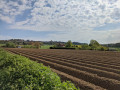
Circular starting from Sainte-Marie-Cappel, passing through Cassel and Oxelaëre.
Mont Cassel and Mont des Récollets starting from Terdeghem
 10.06 mi
+607 ft
-587 ft
5h 10
Moderate
Departure from Terdeghem (Nord)
10.06 mi
+607 ft
-587 ft
5h 10
Moderate
Departure from Terdeghem (Nord)
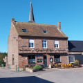
This route alternates between small roads and paths.
Explore Cassel via the Chemin des Remparts and enjoy a bite to eat as we’re two-thirds of the way through the walk.
After Cassel, we follow a series of paths to reach Terdeghem.
Mont Rouge circular starting from De Klijte
9.48 mi
+797 ft
-794 ft
5h 05
Moderate
Departure from Heuvelland (Flandre-Occidentale)
Departure and arrival at the car parks either at De Klijte church or Loker via Scherpenberg, Sulferberg and the Mont Rouge nature reserve (Hellegatbos, or 'hole in the hill') with its De Kosmos recreation park.
Loker, Scherpenberg, Mont Rouge and Sulferberg starting from De Klijte
9.73 mi
+768 ft
-794 ft
5h 10
Moderate
Departure from Heuvelland (Flandre-Occidentale)
Departure from the car park of De Klijte church via Loker, Scherpenberg, Mont Rouge and Sulferberg.
From De Klijte via Lettenberg, Kemmelberg, Monteberg and Scherpenberg
9.68 mi
+577 ft
-574 ft
4h 55
Moderate
Departure from Heuvelland (Flandre-Occidentale)
Departure and arrival in De Klijte via Lettenberg, Kemmelberg, Monteberg and Scherpenberg. Crossing Scherpenberg and the Hellebeek nature reserve. Passing close to the vineyards of Mont Kemmel, Mont Rouge and Mont Noir.
De Klijte via Scherpenberg and Mont Rouge
9.42 mi
+610 ft
-604 ft
4h 50
Moderate
Departure from Heuvelland (Flandre-Occidentale)
Departure from the car park at De Klijte church. Crossing Scherpenberg and the Hellebeek nature reserve. Passing close to the vineyards of Mont Kemmel, Mont Rouge and Mont Noir.
De Klijte and the countryside around Reningelst and Dikkebus
9.58 mi
+141 ft
-138 ft
4h 30
Moderate
Departure from Heuvelland (Flandre-Occidentale)
A circular walking route starting at the church in the hamlet of De Klijte in Reningelst, through the countryside around Reningelst and Dikkebus, and past the Klein-Vierstraat British Military Cemetery
Val de Clarence and Bois de Roquelaure
13.96 mi
+646 ft
-640 ft
7h 00
Difficult
Departure from Lapugnoy (Pas-de-Calais)
A patchwork of the various marked trails in the area for a long stroll, ending at the Bois de Roquelaure. It is a highly urbanised area, but you still feel as though you are in the countryside.
Woods, footpaths and mining heritage around Lapugnoy
 13.71 mi
+505 ft
-509 ft
6h 45
Difficult
Departure from Lapugnoy (Pas-de-Calais)
13.71 mi
+505 ft
-509 ft
6h 45
Difficult
Departure from Lapugnoy (Pas-de-Calais)
Long route through the Bois de Roquelaure, the Poulouches d'Allouagne and the Vallée Carreau d'Auchel. Return via Lozinghem and Mont Éventé before finishing at the Terril de Lapugnoy and a beautiful path on the edge of the Bois des Dames.Relatively little tarmac (but we are still in an urban area), but in wet weather, some paths can become difficult.
Bernard’s walk from Lapugnoy
 6.86 mi
+407 ft
-427 ft
3h 30
Moderate
Departure from Lapugnoy (Pas-de-Calais)
6.86 mi
+407 ft
-427 ft
3h 30
Moderate
Departure from Lapugnoy (Pas-de-Calais)
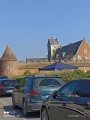
A lovely walk that takes you through the Bois des Dames State Forest, with its rich biodiversity and a good climb, returning via Labeuvrière and passing over the slag heap. A bit of mining history: in 1920, many Polish workers arrived in Lapugnoy, where they were forced to build the barracks to house themselves.
Le Chemin des Voyettes Poulouches
 3.02 mi
+20 ft
-20 ft
1h 25
Easy
Departure from Allouagne (Pas-de-Calais)
3.02 mi
+20 ft
-20 ft
1h 25
Easy
Departure from Allouagne (Pas-de-Calais)
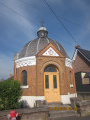
The Chemin des Voyettes Poulouches, which you will take, will lead you from one voyette (small lane) to another and allow you to discover or rediscover our village.
Standaert Straete - Mont des Récollets from Cassel
 4.60 mi
+433 ft
-430 ft
2h 30
Moderate
Departure from Cassel (Nord)
4.60 mi
+433 ft
-430 ft
2h 30
Moderate
Departure from Cassel (Nord)
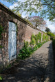
A walk that will allow you to enjoy the beautiful landscapes of Flanders as you descend north of Mont-Cassel.Admittedly, there are long stretches of tarmac, but these are not busy roads.