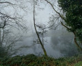
The Douve Valley and Mont Noir, starting from Loker

A circular walking route starting from the car park at Loker Church, via the Vidaigneberg, the Douve Valley, Mont Noir, the Westouter countryside, the De Broekelzen nature reserve and Mont Rouge.

Details

n°108732701
Creation:
Last update:
–
Last review:
–
  • Walking
    Activity: Walking
  • ↔
    Distance: 9.47 mi
  • ◔
    Average duration: 5h 20 
  • ▲
    Difficulty: Average

  • ⚐
    Back to start: Yes
  • ↗
    Ascent: + 1,083 ft
  • ↘
    Descent: - 1,073 ft

  • ▲
    Highest point: 453 ft
  • ▼
    Lowest point: 131 ft

Description of the walk

75 per cent of the walk takes place on unpaved paths, with the first section following the slopes of the Red and Black Mountains on the Flemish side. Halfway through the walk, at the summit of the Black Mountain, there are places to stop for food and drink. The second section, along the slopes on the French side, is almost entirely unpaved. Passing through countless wooden footpaths and forest tracks, you will eventually return to the Baneberg car park.

Route description

You start at hiking point 37 (right next to the car park at Lijstermolendreef 5–7, Heuvelland – from there, head towards hiking points 36, 35, 33, 25, 24, 23, 65, 64, 21, 14, 8, 9, 10, 95, 73, 99, 50, 1, 12, 2, 3, 4, 94, 93, 63, 62, 61, 60, 41, 40 and 37.

Waypoints

  1. S/E : mi 0 - alt. 285 ft - Sint-Petruskerk (Loker)
  2. 1 : mi 0.12 - alt. 295 ft - Junction of the short circular loop
  3. 2 : mi 0.26 - alt. 279 ft - Junction of the Grand Circular
  4. 3 : mi 0.87 - alt. 446 ft - Hellegatbos
  5. 4 : mi 1.52 - alt. 220 ft - Schomminkelstraat
  6. 5 : mi 1.68 - alt. 276 ft - Intersection – Hurdles
  7. 6 : mi 1.98 - alt. 331 ft - Kleine Bergstraat
  8. 7 : mi 2.14 - alt. 312 ft - Crossing the N398
  9. 8 : mi 2.9 - alt. 220 ft - Cross-reference
  10. 9 : mi 3.48 - alt. 220 ft - Boescheperstraat
  11. 10 : mi 4.05 - alt. 210 ft - Cross-reference
  12. 11 : mi 4.36 - alt. 220 ft - T-junction
  13. 12 : mi 4.54 - alt. 223 ft - Three-way junction
  14. 13 : mi 4.81 - alt. 318 ft - Belgium–France border
  15. 14 : mi 5.33 - alt. 440 ft - Crossing the D318
  16. 15 : mi 5.99 - alt. 184 ft - T-junction - Étang des Trois Fontaines
  17. 16 : mi 6.18 - alt. 144 ft - T-junction
  18. 17 : mi 6.33 - alt. 131 ft - Three-way junction
  19. 18 : mi 7.18 - alt. 364 ft - Mont Noir - Cimetière Britannique (Saint-Jans-Cappel)
  20. 19 : mi 7.26 - alt. 351 ft - Crossing the D223
  21. 20 : mi 7.69 - alt. 348 ft - France–Belgium border
  22. 21 : mi 8.58 - alt. 384 ft - Intersection
  23. 22 : mi 8.93 - alt. 295 ft - Cross-reference
  24. S/E : mi 9.47 - alt. 285 ft - Sint-Petruskerk (Loker)

Other walks in the area

For more walks, use our search engine .

The GPS track and description are the property of this route's author. Please do not copy them without permission.