Country:
 City:
City:


Park in the car park at the École Yves Montand in Neuf-Berquin.
(S/E) Head towards the church and continue along Rue Charles Capelle. Take the green path that runs alongside the cemetery. You’ll then come to a crossroads on the path.
(1) Turn left at a right angle and enjoy the tree-lined path. Pass the Hemerie Chapel, then continue straight on until you reach the junction with Rue Barra.
(2) Turn right onto Rue Barra and carry on until you reach the junction by the water tower.
(3) Carry on straight ahead; you’ll soon reach the bridge over the Bourre.
(4) Cross the bridge, walk past the police station and continue along Rue des Capucins until you reach the traffic lights. Turn left onto Rue du Général de Gaulle, then take the first left onto Quai des Anglais. You will then reach the Prés de la Ville, a large green space in the town of Merville.
(5) Walk through the park along the path on the left. Follow a circular path to the right to rejoin Rue du Général de Gaulle at a roundabout.
(6) Go round this roundabout on the right and stay on Rue du Général de Gaulle. Cross the bridge over the Vieille Lys Aval, then head for the junction with Rue de la Gare.
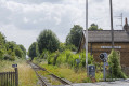
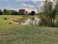
(7) Turn onto the path opposite Rue de la Gare and follow it alongside an old railway line. Go round the pond via a path through the woods and then across a footbridge. Continue to the end of the path.
(8) Turn right onto Rue Régniez Leclercq and continue to the Artois embankment.
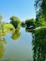
(9) Take the iron footbridge with steps on the left, walk alongside the River Lys, then head towards the water sports centre.
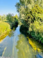
(10) Turn slightly left to walk alongside the Hazebrouck Canal for a long stretch, until you reach the junction with Rue Faidherbe.
(11) Turn right onto it, pass the first junction and carry on to the next one, near the cemetery.
(12) Turn left onto Rue Victorine Deroïde and follow it until you reach Rue Oscar Delache.
(13) Turn right onto this street, then left onto Rue Maurice Filleur. Continue to the junction with Rue Cochette.
(14) Turn left onto it, then right onto Rue du Fin Cornet, and you will reach the Courant de la Redoute.
(15) Turn left onto Rue du Moulin, follow the stream for a few metres, then cross the bridge. Continue along the path, which bends to the right and passes a wayside shrine before coming out onto Rue de la Vierhouck.
(16) Turn right onto it, then turn right onto Rue de Cassel. Continue along Rue d’Estaire, turn right onto Rue de l’Église, then turn right again onto Rue des Coquelicots to reach the area behind the École Yves Montand. Then take the gravel path (marked with red posts) to return to the starting car park (S/E).
 Visorando Member
 Easy
Easy