


The Ravensberg hill in the Bailleul countryside


Departure and arrival at the car park of the church in Dranouter via Ravensberg in the Bailleul countryside. Pass by the Wijngaard Koudekot vineyard, which produces white, rosé and red wines.
Details
Creation:
Last update:
Last review:
–
–
-
 Activity: Walking
 -
 Distance: 6.22 mi
 -
 Average duration: 3h 00
 -
 Difficulty: Moderate
 -
-
 Back to start: Yes
 -
 Ascent: + 200 ft
 -
 Descent: - 200 ft
 -
-
 Highest point: 256 ft
 -
 Lowest point: 112 ft
-
 Country:
Belgium
Country:
Belgium
-
 City:
Heuvelland
City:
Heuvelland -
 Start/End: N 50.765909° / E 2.783408°
 -
 IGN map(s): Ref. 2403O, 2404E
 -


 Hour-by-hour weather


Waypoints
- S/E : mi 0 - alt. 187 ft - Car park at Dranouter church
- 1 : mi 0.93 - alt. 144 ft - Wijngaard Koudekot
- 2 : mi 1.69 - alt. 223 ft - Border
- 3 : mi 2.75 - alt. 180 ft - Entry into France
- 4 : mi 3.92 - alt. 184 ft - Exit France
- S/E : mi 6.22 - alt. 187 ft - Car park at Dranouter church
Other walks in the area
Dranouter via Monteberg, Lettenberg and Kemmelberg
 Visorando Member9.31 mi
+774 ft
-804 ft
4h 55
Moderate
Visorando Member9.31 mi
+774 ft
-804 ft
4h 55
Moderate
 Departure from Heuvelland (Flandre-Occidentale)
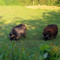
Start and finish at the car park of the church in Dranouter via Monteberg, Lettenberg and Kemmelberg.
Pass along the Monteberg vineyard and through the woods of the Kemmelberg provincial estate.
Waiter, a 3 Monts, please!
 14.95 mi
+1,319 ft
-1,325 ft
8h 00
14.95 mi
+1,319 ft
-1,325 ft
8h 00
 Difficult
Departure from Heuvelland (Flandre-Occidentale)
Difficult
Departure from Heuvelland (Flandre-Occidentale)
A patchwork of different routes in the area for a long hike that will delight your thighs.As for the mountains, like the Musketeers, there are four (or even five, I forgot the Baneberg near the mill), as you climb Mont Noir twice.In short, a nice climb in the Flat Country on numerous paths and a few small, quiet roads.
It's a demanding route, because even between the mountains, there are plenty of small hills. But, as is often the case in Belgium, the trails are well maintained and constantly being improved.
Walk to Kemmel
 8.11 mi
+712 ft
-712 ft
4h 20
Moderate
Departure from Heuvelland (Flandre-Occidentale)
8.11 mi
+712 ft
-712 ft
4h 20
Moderate
Departure from Heuvelland (Flandre-Occidentale)
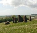
Short route on beautiful, well-maintained Belgian trails with good signage.Simple signposting: there are posts with numbers and an arrow indicating the number you want to go to (not easy to explain but obvious when you're there).
In wet weather, some areas may be soggy or even very muddy.
The Kemmel countryside from Dranouter
9.33 mi
+820 ft
-791 ft
5h 00
Moderate
Departure from Heuvelland (Flandre-Occidentale)
Departure and arrival at the car park of the church in Dranouter via Monteberg, the countryside of Kemmel and Loker. Passing by the vineyards of Monteberg, Kemmel and Loker. Passing by the French ossuary of the 1914-1918 war in Kemmel.
The Mont Rouge and the Douve valley circular starting from Loker
9.42 mi
+673 ft
-673 ft
4h 55
Moderate
Departure from Heuvelland (Flandre-Occidentale)
Departure and arrival at the car park of Loker church via the Westouter countryside. Crossing the Hellegatbos woods with a passage through the Hell Hole of Mont Rouge. Passing near the Baneberg mill in Westouter. Crossing the Douve valley, which forms the border between France and Belgium. Passing into France through the Mont Noir countryside in Saint Jans Cappel and the vineyards of Dranouter.
Discovering the Lettenberg
 13.66 mi
+1,178 ft
-1,184 ft
7h 20
Difficult
Departure from Heuvelland (Flandre-Occidentale)
13.66 mi
+1,178 ft
-1,184 ft
7h 20
Difficult
Departure from Heuvelland (Flandre-Occidentale)
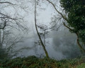
A long stretch along the slopes of Mont Kemmel to discover the Lettenberg, a small hill near Kemmel (perhaps the result of the union between Mont Rouge and Mont Kemmel?). The rest of the route is fairly standard, but passes through areas that are often very damp. And as always in this area, the elevation gain is quite significant. Avoid this walk in early August, during the Dranouter Festival.
Loker, the Sulferberg, Westouter, Mont Noir and the Douve Valley
9.44 mi
+646 ft
-669 ft
4h 55
Moderate
Departure from Heuvelland (Flandre-Occidentale)
A circular walking route starting from Loker Church, passing through the Sulferberg, the Westouter vineyards, Marguerite Yourcenar Park, Mont Noir, the Douve Valley and the Behaegel Estate
Loker, Mont Rouge, the Monteberg vineyard and the Douve Valley
9.40 mi
+686 ft
-686 ft
4h 55
Moderate
Departure from Heuvelland (Flandre-Occidentale)
A circular walking route starting from Loker Church, passing through Mont Rouge, the Douve Valley, the Behaegel estate, the British Military Cemetery No. 10 at Locre, Dranouter Church and the Monteberg vineyard.
For more walks, use our search engine .
The GPS track and description are the property of this route's author. Please do not copy them without permission.

