


 Country:

 City:
City:




Park in the car park opposite the school, on Rue Jules Guesde, in Labeuvrière.
(S/E) Cross the grassy plain diagonally to reach the left-hand end of the Prévôté wall. Then turn right towards the church to find a pretty arched passageway leading to a square. Cross the square to the right, then turn left onto a sloping path, the Sentier de l’Église. At the bottom, turn left and cross the railway line. Just past the railway line, turn left and follow the footbridge. When you see two blocks of flats (on the right), look out for a flight of steps on the right.
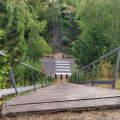
(1) Go down the steps and continue along the footbridge until you reach a gate.
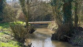
Then turn right to cross the lawn and reach the Clarence. Cross it and turn right into the small
park. Leave it very quickly (via the steps) to reach the main street in Lapugnoy. Follow it to the right for about a hundred metres. Just past an electricity pole, marked with a yellow hiking arrow, take the small path on the left(PR®: Sentierd’Ecques). You will then need to go through two gates (ignore the ‘private property’ sign and make sure to close them properly). Walk uphill until you reach a T-junction.
(2) Head off to the left and, about 200 metres further on, turn right to enter the Bois de Roquelaure, passing through the gate. Walk uphill a little until you come to a signpost: from here, broadly follow the red route to cross this first woodland. At the signpost, turn right. Take a hairpin bend to the left and reach a fork in the road. Turn right and arrive at asecond fork. Turn right again. Shortly after the junction with a path coming from the left, turn sharply right at a right angle; there is a hiking marker here: follow the Red route. Cross the valleys along this rather wild path. Reach a T-junction with a wide path.
(3) Follow it to the left – be careful to leave the red markings, which head off to the right, for a moment. After about 200 m uphill, you’ll reach a Fork in the road. Continue straight ahead and rejoin the markings here. You’ll then reach the northern edge of the Bois de Roquelaure, with heathland to your left. Take a hairpin bend to the left and, after about 300 m, you’ll reach a Fork in the road. Head right, still following the red markings, onto a descending path featuring steps and a footbridge (December 2024: the wet section before the footbridge has just been superbly improved). After crossing the footbridge, turn left.
A little further on, turn left again to head uphill and reach a junction.
(4) Head straight ahead and reach a Fork in the road.
(5) Turn right downhill (blue markings) and reach a T-junction.
(6) Turn right uphill to join a wide path.
(7) Turn left and leave the woods (gate). Follow the path leading to the Calvary at La Motte. Just past the Calvary, take the path on the right to descend via a rustic staircase and reach the first houses of Lapugnoy.
(8) Turn right and you’ll immediately come to a Fork in the road. Leave the tarmac road and take the path on the right which runs alongside the woods. Join a small road and follow it to the right, still on the edge of the woods. At the very end, take the path on the right which leads to Rue Barbusse.
Head straight ahead to reach the military cemetery.
(9) At the cemetery, turn left onto the grassy path that leads down towards Lapugnoy.
(10) Just before reaching the D70, take the path on the left which leads to a housing estate. Continue straight on, first along Rue des Bleuets and then, against the one-way flow, along Rue des Violettes. Turn left then right to reach Rue Barbusse, which you follow to the right as far as the wayside cross, where you rejoin the D70. Follow it for about fifty metres to the left, then turn right onto the Sentier de la Clarence. Cross the Clarence and reach a junction. Head straight on towards the pond and walk as close as possible to it along the grass.
Cross a footbridge, walk alongside the pond, cross asecond footbridge and turn right to pass to the left of the children’s playground, then head for the park entrance. Reach Rue Bouchart and turn right. Cross the railway line and, at the junction, continue straight on uphill towards the Bois des Dames.
(11) At the edge of the woods, with the car park and houses on your right, take the path on the left before the barrier. Walk up to the top of the hill to reach a Fork in the road with a post on the right.
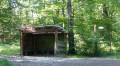
(12) Turn left and continue along this wide path. Turn right to reach the Carrefour Saint-Joseph, where you’ll find a shelter and a large signpost.
(13) Just past the shelter, at the Fork in the road, turn right – there’s a Red Cross on a tree – onto the slightly narrower path. Continue to a junction and head straight on to reach another junction, from where you can see a forest warden’s cottage slightly to the left. Turn right and, after about a hundred metres, you’ll reach a fork in the road. Turn left onto a narrow track and follow it until you reach a T-junction with a wide path.
(14) Follow this path to the left. At the T-junction, turn left and continue for about fifty metres.
(15) Take the first path on the left (Yellow Cross and the number 21 marked on the trees).
You’ll soon reach the bottom of the valley: a crossroads.
(16) Turn right towards the low wall and a small bridge. Two successive short climbs lead to a T-junction.
(17) Turn left and follow the path to the edge of the woodland. A lovely path follows a valley (on the left) through which a stream flows.
Then turn left at the edge of the woods to reach the forest ranger’s house. Take the steps and head for the car park entrance.
(18) Do not enter the car park but turn left onto the path to enter the woods.
Keep following it, ignoring the paths on the left, until you reach a rustic staircase. Climb the stairs and turn right – you’ll see some tall trees – to reach a wide path near a forest ranger’s house. Follow this path to the right. Ignore the first turn-off to the left.
(19) A little further on, turn left onto a narrow track. You’ll reach a junction. Continue straight ahead to reach the slag heap. Head onto the spoil heap and follow the faintly marked path to the left, past a gate. The easiest way is then to go round the spoil heap, keeping well onto the black earth overlooking the woodland; be careful: there are craters on the right. You’ll reach the end of the spoil heap.
(20) Ignore the barrier and carry on straight ahead along a wide path for about a hundred metres, until you come to a track branching off to the left.
(21) Follow this fairly distinct path until you reach a T-junction.
(22) Turn left and walk past a pond (you can leave the path for a moment to get a closer look: it’s quite pleasant, despite the rubbish). You’ll reach a Fork in the road.
(23) Take the narrow path on the right and you’ll soon reach a wider track. Follow it to the right.
It curves to the left and reaches a junction. Carry on straight ahead for about 300 metres to find a path that winds sharply to the right.
(24) Follow this path until you reach a T-junction. Turn left and, immediately, leave the woodland to the left to cross a pasture along a well-marked path. You’ll come to a small road at the entrance to Labeuvrière. Follow the small road to the right as far as the cemetery.
(25) Turn right onto the path that runs alongside the cemetery. At the end, turn left. Then take thefirst small lane on the left (’enlivened’ by two or three barking dogs); there’s asecond onea little further on (quieter) – take whichever you prefer – to arrive opposite the school. Go round it on the left to reach the Labeuvrière car park (S/E).


 Visorando Member
 Difficult

 Association / Club / Walk leader
 Easy
Easy 
