Bernard’s walk from Lapugnoy

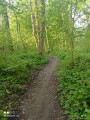
A lovely walk that takes you through the Bois des Dames State Forest, with its rich biodiversity and a good climb, returning via Labeuvrière and passing over the slag heap. A bit of mining history: in 1920, many Polish workers arrived in Lapugnoy, where they were forced to build the barracks to house themselves.

Details

73720721
Creation:
Last update:
Last review:
  • Walking
    Activity: Walking
  • ↔
    Distance: 6.86 mi
  • ◔
    Average duration: 3h 30 
  • ▲
    Difficulty: Moderate

  • ⚐
    Back to start: Yes
  • ↗
    Ascent: + 440 ft
  • ↘
    Descent: - 459 ft

  • ▲
    Highest point: 325 ft
  • ▼
    Lowest point: 85 ft

Photos

Description of the walk

Start from the leisure centre on Rue Cyr Bouchart

(S/E) Leave the leisure centre. At the end, turn right, cross the road, head straight across to the opposite side and continue along Rue Haute. Enter the forest until you reach a Fork in the road.

(1) Turn onto the path on the right, then further up, turn right until you reach another junction.

(2) Keep to the right, then take the second right and carry on straight ahead until you reach a four-way junction.

(3) Carry on straight ahead until you reach the next junction.

(4) Turn left, then take the first right until you reach the junction.

(5) First turn right then left. At the end, turn right and carry on straight ahead until you reach a Fork in the road.

(6) Turn right; at the end, take the first turn right then left, then take the first left until you reach a four-way junction. 

(7) Carry on straight ahead to reach a T-junction.

(8) Turn right, then take the second path on the left. At the top, turn right and carry on straight ahead to the end.

(9) First turn right then left; at the end, take the second left to climb up the slag heap and go round it before heading back down.

(10) Turn left, take the second path on the right and carry on straight ahead until you reach the junction.

(11) Turn right, leave the woods and carry on straight ahead along Rue de l’Égalité until you reach the cemetery.

(12) Turn right onto the path running alongside the cemetery. Turn left. At the end, first turn right then left and carry on straight ahead to the school.

(13) Turn right, go under the archway and carry on straight ahead until you reach Rue Paul Vaillant Couturier.

(14) First turn left then right, cross the railway line and turn left. Carry on straight ahead to return to the starting point (S/E). 
Waypoints

  1. S/E : mi 0 - alt. 112 ft - Leisure park car park. Near the - Clarence (rivière)
  2. 1 : mi 0.51 - alt. 190 ft - Fork
  3. 2 : mi 0.78 - alt. 259 ft - Crossroads
  4. 3 : mi 1.31 - alt. 315 ft - Four-way junction
  5. 4 : mi 1.56 - alt. 253 ft - Crossroads
  6. 5 : mi 1.98 - alt. 292 ft - Junction
  7. 6 : mi 2.34 - alt. 253 ft - Fork
  8. 7 : mi 2.93 - alt. 240 ft - Crossroads of four paths
  9. 8 : mi 3.11 - alt. 249 ft - T-junction
  10. 9 : mi 3.65 - alt. 253 ft - End of the path
  11. 10 : mi 4.16 - alt. 256 ft - End of the descent down the slag heap
  12. 11 : mi 4.57 - alt. 246 ft - Fork
  13. 12 : mi 5.18 - alt. 121 ft - Cemetery
  14. 13 : mi 5.51 - alt. 115 ft - School
  15. 14 : mi 5.68 - alt. 89 ft - Rue Paul Vaillant Couturier
  16. S/E : mi 6.86 - alt. 112 ft - Leisure park car park

Notes

No water supply

Worth a visit

Leisure park

The park is open from 1 March to 30 September from 8.00 am to 8.00 pm and from 1 October to 28 or 29 February from 8.00 am to 5.30 pm

Reviews and comments

5 / 5
Based on 2 reviews

Reliability of the description
5 / 5
Ease of following the route
5 / 5
Route interest
5 / 5
Marc defontaine
Marc defontaine

Rough rose, marsh iris, flax-blue flowers.
Beautiful flowers on the slag heap.

Machine-translated

souchez rando
souchez rando

Hello, thank you for your feedback

Machine-translated

joorange
joorange

Overall rating : 5 / 5

Date of your route : May 12, 2025
Reliability of the description : Not used / Not applicable
Ease of following the route : ★★★★★ Very good
Route interest : ★★★★★ Very good
Very busy route : No

I went for a walk this morning, setting off from Labeuvrière.
I added the loop around the Bois de Roquelaure and, after point 10, I headed down towards Emmaüs to reach Gosnay via the GRP du Bassin Minier trail (unusually, the section behind Emmaüs was in excellent condition. Long live the drought!)
I really enjoyed the southern paths between points 2 and 6: I’d probably never walked them before.
As for the slag heap, covered in blue flowers, it’s magnificent, especially in the sunshine.
A lovely route. “Thanks, Bernard!”

Machine-translated

souchez rando
souchez rando

Hello, thank you for your feedback

Machine-translated

Marc defontaine
Marc defontaine

Overall rating : 5 / 5

Date of your route : May 12, 2025
Reliability of the description : ★★★★★ Very good
Ease of following the route : ★★★★★ Very good
Route interest : ★★★★★ Very good
Very busy route : No

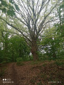
A lovely walk through the woodland, with magnificent common beech trees several hundred years old, as well as chestnut, oak and wild cherry trees.
It ends at a little restaurant (Le Far West)

Machine-translated

Other walks in the area

For more walks, use our search engine .

The GPS track and description are the property of this route's author. Please do not copy them without permission.