


Refine your search for walks in Crépy (Pas-de-Calais)
Crépy (Pas-de-Calais) walks


 Around Crépy
 Visorando Member
 6.10 mi
 +102 ft
 -105 ft
 2h 55
 Easy
 Departure from Crépy (Pas-de-Calais) (Pas-de-Calais)
A lovely walk around Crépy and its plain towards the wind farm between Verchin, with its crooked bell tower, and Ambricourt. An easy walk with very little change in altitude.
The humpback bridge at the start of Équirre
6.95 mi
+256 ft
-256 ft
3h 25
 Moderate
Departure from Équirre (Pas-de-Calais)
Starting from Équirre Castle, which was reduced by half following a fire, this walk takes you to the small village of Prédefin and back via the Lisbourg plain. The paths taken by the GRP® Tour du Ternois Nord are partly cultivated between points (8) and (9), but don't hesitate to cross them as they are often used by farmers.
The hedgerows
10.90 mi
+374 ft
-354 ft
5h 20
Moderate
Departure from Teneur (Pas-de-Calais)
The old marked trail around Ambricourt is unfortunately poorly maintained or not maintained at all. We have been walking it for 25 years and have encountered difficulties every time (poor signage, paths buried under nettles or difficult to walk on).The start at Teneur allows you to pass (twice) in front of the superb limestone hillside of Teneur. Deer are often visible in or around the Bois de Crépy
The path is in very poor condition between points (2) and (6).
If possible, avoid the period between mid-June and mid-August. The passage after point (3) will be easier if the field is not too far into the growing season or has already been harvested.
The upper Lys valley
 13.55 mi
+673 ft
-666 ft
6h 50
 Difficult
Departure from Lisbourg (Pas-de-Calais)
The source of the Lys, the Lugy Mill and a lovely route across the plateau (beautiful views).This walk can be more difficult in wet weather as some paths are regularly churned up.Some tarmac, but on minor roads.
Please note: the path leading up through the Lugy woods after the (5) can be very difficult in wet weather.
Circular North loop of Bergueneuse
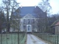 10.64 mi
+584 ft
-571 ft
5h 25
Moderate
Departure from Bergueneuse (Pas-de-Calais)
A beautiful circular route north of Bergueneuse with pretty paths and good climbs. Get your calves ready and let's go!
Please note that in wet weather, some paths become difficult (between (1) and (2), between (5) and (6) in particular), which significantly increases the journey time.
The southern circular route from Bergueneuse
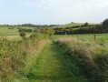 8.80 mi
+554 ft
-571 ft
4h 30
Moderate
Departure from Bergueneuse (Pas-de-Calais)
A trail exploring the Ternois region, with paths that are generally in good condition and offering lovely views.
Route amended in April 2023, as the newGRP® route is really rather dull!
From Bergueneuse to La Fosse aux Loups
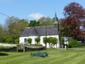 7.33 mi
+364 ft
-371 ft
3h 40
Moderate
Departure from Bergueneuse (Pas-de-Calais)
Another short walk to explore the Ternois region: plenty of paths, woods and, if you’re lucky, a few roe deer.
Three-quarters of the route follows theGRP® du Ternois, which is well signposted.
Henry V Trail in Azincourt
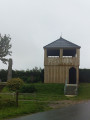 7.48 mi
+167 ft
-177 ft
3h 35
Moderate
Departure from Azincourt (Pas-de-Calais)
A beautiful hike along the Henry V trail around the plain where the Battle of Agincourt took place in 1415.
The Bliot Trail in Anvin
5.66 mi
+338 ft
-338 ft
2h 55
Easy
Departure from Anvin (Pas-de-Calais)
A short walk in the Ternois region, starting from Anvin. A short climb will take you up to Mont d’Heuchin.Descend to Bergueneuse and return through the countryside to the starting point.Stunning views throughout the walk and plenty of opportunities for some lovely photos.
Mont de Fleury
7.88 mi
+361 ft
-338 ft
3h 55
Moderate
Departure from Anvin (Pas-de-Calais)
A pleasant short hike on good paths. Beautiful views of the Ternois.
Hike modified in April 2023 because theGRP® route has changed.
The Riez Chaud from Heuchin
 8.99 mi
+577 ft
-600 ft
4h 40
Moderate
Departure from Heuchin (Pas-de-Calais)
A lovely, undulating walk through lush vegetation with some lovely views. Some paths may be muddy in wet weather. The numerous dirt and stony tracks will make you forget the few tarmac roads.
On the ridges around Bergueneuse
 15.06 mi
+801 ft
-784 ft
7h 35
Difficult
Departure from Fontaine-lès-Boulans (Pas-de-Calais)
More than 22 km of trails for a nature trail with some nice climbs and descents. Sharpen your calves!Beautiful views, woods and, if you're lucky, a few wild animals. At least, the ones that the hunters don't slaughter, as we recently freed two roe deer caught in snares (fox traps, but any animal can get caught there, and it's legal!).
The Heuchin blockhouses
4.75 mi
+184 ft
-184 ft
2h 20
Easy
Departure from Fontaine-lès-Boulans (Pas-de-Calais)
A short walk, mostly along paths on the Prédefin plateau. You’ll pass by old buildings and blockhouses dating from the Second World War.
Route designed and signposted by the Pas-de-Calais departmental committee of the FFR.
The Wolf Pit
6.40 mi
+203 ft
-180 ft
3h 05
Moderate
Departure from Fontaine-lès-Boulans (Pas-de-Calais)
A short walk starting from the church in Fontaine-lès-Boulans, heading towards the plateau in the commune of Prédefin.
The route mainly follows a path which can be muddy when it rains. In fine weather, you’ll be treated to some truly beautiful views and panoramic scenery. On the way back, you’ll pass an old German army barracks.
The Ternoise hills, from Blangy-sur-Ternoise to Rollancourt
7.64 mi
+548 ft
-551 ft
4h 00
Moderate
Departure from Blangy-sur-Ternoise (Pas-de-Calais)
A circular loop on the good paths surrounding Blangy-sur-Ternoise.
From Fruges to the Bois de Radinghem
 9.01 mi
+518 ft
-499 ft
4h 35
Moderate
Departure from Fruges (Pas-de-Calais)
This varied, not overly difficult route is largely based on the ‘7 Bell Towers’ trail. You’ll therefore come across a few sections marked in yellow.
The End of the World in Fleury
7.93 mi
+446 ft
-449 ft
4h 00
Moderate
Departure from Monchy-Cayeux (Pas-de-Calais)
A walk starting from Monchy-Cayeux, with its marshland and castle. You’ll be able to explore both sides of the valley along some lovely paths. This walk has an elevation gain of 123 m, which is nothing insurmountable for walkers.
The Ravin de l’Étoile
12.22 mi
+735 ft
-741 ft
6h 15
Difficult
Departure from Monchy-Cayeux (Pas-de-Calais)
We continue our exploration of the Ternois region, culminating in the superb Ravin de l’Étoile.
Where Justice can lead to Hell
 11.27 mi
+686 ft
-692 ft
5h 45
Moderate
Departure from Eps (Pas-de-Calais)
Another lovely route in the Ternois hills. Few roads and, in good weather, beautiful panoramic views.If you're lucky, you may also spot some deer (a herd of six at the end of February 2019).
Eps and Herbeval mountains
 6.36 mi
+548 ft
-545 ft
3h 25
Moderate
Departure from Eps (Pas-de-Calais)
A short but very hilly route (carto-explorer even gives 230m elevation gain) around the village of Eps, unjustly excluded by the marked trails. Beautiful views.Best done on a sunny day - it's magical!
The Bois Capelle
8.23 mi
+299 ft
-299 ft
4h 05
Moderate
Departure from Coupelle-Vieille (Pas-de-Calais)
A route amongst the wind turbines with very little tarmac.
I’ve tried to stick to the ‘wildest’ paths, which may make the walk a little trickier in wet weather.
It’s easy to combine this walk with the one from Fruges to the Bois de Radinghem to make a 28 km route.
The slopes of the Ternoise near Auchy
 10.43 mi
+669 ft
-650 ft
5h 25
Moderate
Departure from Rollancourt (Pas-de-Calais)
A fairly long but not overly difficult hike offering beautiful views over the Ternoise valley.
May 2025: The Montigny trail (3) has been thoroughly cleared, something that hasn’t happened for ages! It is currently perfectly passable.
From Saint-Martin to Fleury via the Ravin de l’Étoile
7.08 mi
+341 ft
-325 ft
3h 35
Moderate
Departure from Hernicourt (Pas-de-Calais)
A lovely walk through the Ternois region and its small villages and hamlets.
The Ravin de l’Étoile is closed during the hunting season.
The Maronnes Hills
7.35 mi
+361 ft
-348 ft
3h 40
Moderate
Departure from Humières (Pas-de-Calais)
A lovely hike in the Ternois region starting from the charming village of Humières with its castle and cave.
You’ll be walking mainly on paths and trails that can get muddy in wet weather, but the scenery quickly makes you forget that.
The Mont Galant trail starting from Auchy-lès-Hesdin
 6.97 mi
+436 ft
-440 ft
3h 35
Moderate
Departure from Auchy-lès-Hesdin (Pas-de-Calais)
A lovely walk starting from the church in Auchy-lès-Hesdin, taking you across the Mont Galant plateau with its beautiful panoramic views. You’ll walk along the edge of the Hesdin State Forest, with a view of the Ferme du Bois-Saint-Jean, a former commandery of the Order of Hospitallers. The only challenging bit is a hill as you leave the village of Auchy.
Le Puits sans Fond depuis Febvin-Palfart
 Local authority6.42 mi
+423 ft
-407 ft
3h 20
Moderate
Departure from Febvin-Palfart (Pas-de-Calais)
C’est un parcours en pleine nature. Sur les hauteurs, le randonneur apercevra l’Audomarois, les Monts des Flandres et le bassin minier. C'est un sentier balisé de la Communauté d'Agglomération du Pays de Saint-Omer.
Notre-Dame du Bon Voyage
 8.94 mi
+499 ft
-492 ft
4h 35
Moderate
Departure from Reclinghem (Pas-de-Calais)
A short, very sunny route to explore the Artesian Plateau and enjoy beautiful views over Vincly and the Lys Valley.
Moderate elevation gain, but a good climb all the same.
And at the end of the route, a panoramic descent towards Reclinghem.
From Reclinghem to Mont d'Erny
11.08 mi
+814 ft
-797 ft
5h 50
Difficult
Departure from Reclinghem (Pas-de-Calais)
Three lovely climbs and a long stroll across the plateau make for a walk surrounded by nature. A very hilly first section, followed by a long stretch along the heights before descending to Reclinghem with magnificent views. The icing on the cake is an optional circular loop I suggest, which brings the total elevation gain to over 300 m.
The Romans Route in Reclinghem
4.94 mi
+322 ft
-312 ft
2h 35
Moderate
Departure from Reclinghem (Pas-de-Calais)
This route will take you from the Lys valley up to the heights of Artois. It is a signposted trail managed by the Pays de Saint-Omer Urban Community.
On the plateau between the Lys and the Aa
 15.76 mi
+912 ft
-922 ft
8h 00
Difficult
Departure from Dennebrœucq (Pas-de-Calais)
A long route with a significant elevation gain on paths that are generally in very good condition.
Le Puits sans Fond stream
 7.28 mi
+361 ft
-354 ft
3h 40
Moderate
Departure from Fléchin (Pas-de-Calais)
A short walk that takes you up to the ridge before descending and going along the Puits sans Fond stream. More pleasant in dry weather, as some paths can be very wet.
The Artois Hills to Assonval
 8.11 mi
+335 ft
-318 ft
4h 00
Moderate
Departure from Renty (Pas-de-Calais)
Return to Assonval for a relatively easy walk (apart from the climb at the start) through the Artois hills.
Three-quarters of the walk takes place at an altitude of over 150 m (dizzying!) and follows good paths.
From Turkey to Fond Breton (in less than 10 km!)
5.80 mi
+358 ft
-354 ft
3h 00
Moderate
Departure from Renty (Pas-de-Calais)
A short but fairly strenuous route with a steep hill and some very grassy paths.
On 12/08/2025: the start of the trail is once again very overgrown (brambles and nettles). It's passable but it's best to wear trousers or good gaiters and, of course, bring a walking stick or even a pair of secateurs.