


 Country:
 City:
City:


Start at Place du Général De Gaulle, near the Fruges post office.
(S/E) At the post office, turn left onto Rue des Fontaines. At the end, near the church, turn right onto the D130 (Rue du Paradis). Cross the Traxenne and turn right to pass in front of the care home.
(1) Immediately afterwards, turn left into Rue Blanche (yellow arrow). You’ll soon come to a good path leading uphill. After about 800 metres, turn right (yellow arrow). Continue for a further 800 metres and turn left (yellow arrow) to head down towards Senlis.
(2) Follow Rue Lapette to the right to reach the D104 near Senlis church. Follow it to the left, then turn right to immediately find a grassy path on the right just before thefirst house. You’ll come to a small road.
(3) Follow it to the left and keep heading in this direction (almost due north) for about 2 km. Ignore a path on the left and another on the right, and you’ll reach a junction.
(4) Go straight ahead. Ignore a path on the right and you’ll reach a T-junction near a wayside shrine.
(5). Turn left, ignore a path on the left and you’ll reach a small road; follow this to the left until you reach a pumping station.
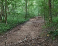
(6) Take the small road on the left. After a 600-metre climb, turn right (the road continues to climb). Pass a large white reservoir and keep going in the same direction to cross the Bois de Radinghem: the path quickly becomes quite difficult due to heavy machinery use.
(7) Near the edge of the woods, ignore the path on the right which leads down to Radinghem and carry on straight ahead to join the D928 at the water tower (clearly visible).
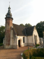
(8) Cross the road (be careful – traffic is heavy and travelling fast!!) to take the path opposite and join the D155 near a reservoir. Follow it for a few metres to the right and take the hairpin bend onto the path on the left. This will take you to the church at Coupelle-Vieille and back onto the D155.
(9) Cross it to take the path opposite. Ignore the two paths on the left and you’ll arrive near Basleau.
(10) At the first house on the left, don’t miss the path branching off to the right (it would be a shame, especially as it’s signposted!!). Cross the Traxenne and join the D343. Follow it for a few metres to the left, then turn right and head slightly uphill for 250 m.
(11) Just before the campsite, take the path on the left which climbs up the embankment (easy, but don’t miss it). You’ll then come to a path that runs alongside the campsite (you’ll admire the superb fences!!! To live happily, let’s live hidden away, even behind these eyesores!). Near a housing estate (on the left), cross a grassy plain along the hedge, before reaching some garages, then Rue Brebières.
(12) Follow it to the right until the next junction.
(13) Turn left for a few metres, then turn right. After a few metres, at the pedestrian crossing, take the path on the left (signposted). Ignore the road on the left and continue to a T-junction.
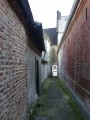
(14) Turn right, then immediately left (just after the garages) onto the footpath (still signposted). A pretty archway leads us to the centre of Fruges, Place du Général De Gaulle (S/E).

 Visorando Member

 Difficult
 Local authority
