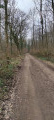
The Heuchin blockhouses

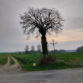
A short walk, mostly along paths on the Prédefin plateau. You’ll pass by old buildings and blockhouses dating from the Second World War.

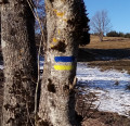
Route designed and signposted by the Pas-de-Calais departmental committee of the FFR.

Details

n°27281157
Creation:
Last update:
Last review:
  • Walking
    Activity: Walking
  • ↔
    Distance: 4.75 mi
  • ◔
    Average duration: 2h 20 
  • ▲
    Difficulty: Easy

  • ⚐
    Back to start: Yes
  • ↗
    Ascent: + 184 ft
  • ↘
    Descent: - 184 ft

  • ▲
    Highest point: 568 ft
  • ▼
    Lowest point: 374 ft

Description of the walk

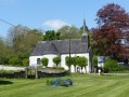
Park in the car park next to the church in Fontaines-lès-Boulans.

(S/E) Set off to the right heading south, then turn right at thefirst junction after the church onto Rue de Prédefin, heading west.

(1) 100 metres from the junction, take the narrow lane on the left heading south-southeast.

(2) At the end of the lane, take the sharp right-hand bend onto the track, heading north-west, and climb Mont Aubert.

(3) At the junction with the D93, turn left and follow it for about 50 metres. At the bend, take the path on the left heading south-south-east. After about 400 metres, turn right onto the path heading west and walk past the old barracks.

(4) At the crossroads with the wayside cross, cross over and take the path opposite. After 100 m, follow the path on the right heading north-west and, at the next crossroads, turn right towards the village of Prédefin. At the Y-junction with the D93, follow it to the left heading west-north-west.

(5) After about 200 m, take the path on the right heading north-west and, 200 m further on, turn right onto the path at the 162-metre mark heading north-east.

(6) At the junction with the road, turn right towards the south and, at the next crossroads, turn left.

(7) At the next crossroads, take the track on the right heading south-east and ignore the tracks on the right and left.

(8) At the junction with the D93 (pumping station), turn left onto the road heading east and enter the village. At the church, turn left and return to your starting point (S/E).

Waypoints

  1. S/E : mi 0 - alt. 384 ft - Car park at the - Église Sainte-Berthe (Fontaines-lès-Boulans)
  2. 1 : mi 0.14 - alt. 397 ft - Alleyway on the left
  3. 2 : mi 0.58 - alt. 374 ft - Hairpin bend
  4. 3 : mi 1.31 - alt. 541 ft - Junction with the D93
  5. 4 : mi 1.76 - alt. 538 ft - Crossroads and wayside cross
  6. 5 : mi 2.7 - alt. 535 ft - Path on the right
  7. 6 : mi 3.47 - alt. 554 ft - Road junction
  8. 7 : mi 3.76 - alt. 568 ft - Crossroads: take the path on the right
  9. 8 : mi 4.51 - alt. 430 ft - Junction with the D93 at the pumping station
  10. S/E : mi 4.75 - alt. 384 ft - Car park at the - Église Sainte-Berthe (Fontaines-lès-Boulans)

Notes

Good walking shoes are recommended, especially in wet weather.
Don’t forget your snack and a bottle of water

Worth a visit

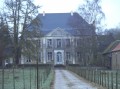
Between points (3) and (4), don’t miss the buildings of a former German barracks from the Second World War, as well as the ruins of a few blockhouses.

Reviews and comments

5 / 5
Based on 1 review

Reliability of the description
5 / 5
Ease of following the route
5 / 5
Route interest
5 / 5
Alain fontaine
Alain fontaine

Overall rating : 5 / 5

Date of your route : Aug 05, 2024
Reliability of the description : ★★★★★ Very good
Ease of following the route : ★★★★★ Very good
Route interest : ★★★★★ Very good
Very busy route : No

A lovely walk; didn’t see a soul; it was peaceful and very pleasant

Machine-translated

Netra
Netra ★

Hello Poulouche,

The aim is to increase the number of ways in which hikers can find out about the route. As long as the description is written by the author on Visorando and does not copy from the FFR guidebook, there’s no problem.

In the introduction to this walk, I’ve added a sentence acknowledging the FFR’s role in this route.

Machine-translated

Poulouche_62
Poulouche_62

This walk is actually called ‘Le Sentier des Avinettes’. It’s very well signposted… I don’t see the point in taking over these trails – which are maintained by the French Hiking Federation – and giving them a different name, even if you walk them in the opposite direction.

Machine-translated

Other walks in the area

For more walks, use our search engine .

The GPS track and description are the property of this route's author. Please do not copy them without permission.