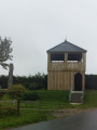
The Bois Capelle

A route amongst the wind turbines with very little tarmac.
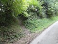
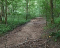
I’ve tried to stick to the ‘wildest’ paths, which may make the walk a little trickier in wet weather.

It’s easy to combine this walk with the one from Fruges to the Bois de Radinghem to make a 28 km route.

Details

3246318
Creation:
Last update:
Last review:
  • Walking
    Activity: Walking
  • ↔
    Distance: 8.23 mi
  • ◔
    Average duration: 4h 05 
  • ▲
    Difficulty: Moderate

  • ⚐
    Back to start: Yes
  • ↗
    Ascent: + 299 ft
  • ↘
    Descent: - 299 ft

  • ▲
    Highest point: 581 ft
  • ▼
    Lowest point: 344 ft

Description of the walk

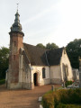
Start from the small square opposite the church in Coupelle-Vieille.

(S/E) Head downhill towards the south-west. Cross a stream and reach Rue de Monteville. Follow it straight on to reach the D343. Follow it to the right, passing the Town Hall.

(1) After 150 m, turn right onto Rue Marc Têtard and follow it to the end. At the T-junction, turn right and rejoin Rue de Monteville, which you follow to the left for about 150 m.

(2) Take the first wide track on the left (just before a farm), which quickly turns into a grassy path. Follow it, keeping in the same direction, until you reach a T-junction under the high-voltage power line. Turn left onto the D343 and follow it to the right for about a hundred metres until you reach the chapel.

(3) Take the path on the right. Follow it to a T-junction where you turn left towards a wind turbine.
Just before the wind turbine, turn left onto a lovely path (very grassy in mid-May 2020: see practical information). It turns right at a 90° angle and joins a small road at the entrance to a farm.

(4) Follow the small road to the left and you’ll immediately reach the D343. Follow it for 100 m to the right, then take the wide path on the left. At the T-junction, turn right. Ignore the path coming from the right and continue to a further T-junction near a wind turbine.

(5) Turn left. At the three-way junction, follow the path straight ahead. Ignore a path leading uphill to the left and cross the Fond Tiennet (a small wood with a nice little climb and bamboo on the right). As you emerge from the wood, the path turns sharply left and joins the D155.

(6) Follow it for a few dozen metres to the right, then take the path on the left to reach a T-junction, near a wind turbine. Turn left and you’ll reach a three-way junction.

(7) Continue straight ahead along the lovely descending path (it is difficult: rutted and full of large flints). At the bottom, join a wider track which you follow for about fifty metres to the right in a hairpin bend.

(8) Take the first path on the left, which is very grassy and flat. Pass under the high-voltage power line. Shortly afterwards, the path improves.

(9) Leave this path and take a hairpin bend to the right onto a lovely, ascending path that crosses the Bois Capelle. Pass under the high-voltage power line again and reach a T-junction near a wind turbine.

(10) Turn left onto the wide path and follow it for over 2 km to reach the D343.

(11) Follow it to the left, crossing the Traxenne (a tributary of the Lys, which it joins at Lugy). Just after this, on the right, you’ll notice the superb building (Domaine de la Traxène, where weddings are held).
After 150 m, turn right onto the D155 (Rue Cavée). Pass a pretty pond (on the right), cross a stream and take the second street on the left (Rue de l’Église) to return to the starting point (uphill) at the small square opposite the church (S/E).


Waypoints

  1. S/E : mi 0 - alt. 374 ft - Coupelle-Vieille, a small square opposite the church
  2. 1 : mi 0.26 - alt. 384 ft - Rue Marc Têtard on the right
  3. 2 : mi 0.74 - alt. 361 ft - Path on the left before a farm
  4. 3 : mi 1.73 - alt. 502 ft - Chapel by the D343
  5. 4 : mi 3.14 - alt. 581 ft - Junction with a small road at the entrance to a farm
  6. 5 : mi 4.01 - alt. 548 ft - T-junction (wind turbine on the right)
  7. 6 : mi 4.87 - alt. 509 ft - Junction with the D155
  8. 7 : mi 5.42 - alt. 528 ft - Three-Way Junction
  9. 8 : mi 5.9 - alt. 413 ft - Grassy path on the left
  10. 9 : mi 6.21 - alt. 394 ft - Turn right onto the uphill path
  11. 10 : mi 6.61 - alt. 502 ft - T-junction
  12. 11 : mi 7.8 - alt. 364 ft - Junction with the D343
  13. S/E : mi 8.23 - alt. 374 ft - Coupelle-Vieille, a small square opposite the church

Notes

There are many paths on this route. Good walking shoes and walking stick(s) are therefore strongly recommended.

Between (2) and (3), if the grassy path seems too difficult, you can carry on straight ahead past the wind turbine. You’ll reach a T-junction where you turn right for a few metres. Then take the first hairpin bend on the left to join the D343. Cross the road and take the path opposite, which leads you to (4).

Reviews and comments

4.3 / 5
Based on 2 reviews

Reliability of the description
4.5 / 5
Ease of following the route
4.5 / 5
Route interest
4 / 5
Ylcar
Ylcar

Overall rating : 3.7 / 5

Date of your route : Aug 10, 2025
Reliability of the description : ★★★★☆ Good
Ease of following the route : ★★★★☆ Good
Route interest : ★★★☆☆ Average
Very busy route : No

Hike in the countryside where you can play at counting wind turbines. We followed the route in the same direction but only partially because after point 2, at mark 117 (altitude), we went up to the right and then took the first left to reach point 4 via the sand pits and the Cagnards mill. At altitude 167, we turned left then right. At point 7, we continued straight ahead as the path downhill to the left did not look very passable (very tall grass). The route we took was just 13 km long. Best regards

Machine-translated

Cérénius
Cérénius

Overall rating : 5 / 5

Date of your route : Jan 30, 2022
Reliability of the description : ★★★★★ Very good
Ease of following the route : ★★★★★ Very good
Route interest : ★★★★★ Very good
Very busy route : No

A lovely walk; it’s best to bring walking poles and shoes with good grip after periods of rain, as many of the paths are used by farm machinery, which leaves deep, muddy ruts that can be slippery.
At point 7, the “lovely downhill path” requires careful attention to avoid falls or twists, but it isn’t difficult.
At point 9 on the route, it’s not easy to find the “lovely uphill path that crosses the Bois Capelle”; personally, I missed it, so I finished the walk via another path, which isn’t a big deal – I’ll just need to be a bit more careful next time.

Machine-translated

Other walks in the area

For more walks, use our search engine .

The GPS track and description are the property of this route's author. Please do not copy them without permission.