The Wolf Pit

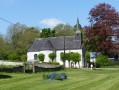
A short walk starting from the church in Fontaine-lès-Boulans, heading towards the plateau in the commune of Prédefin.
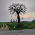
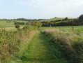
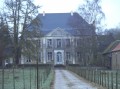
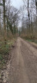
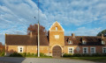
The route mainly follows a path which can be muddy when it rains. In fine weather, you’ll be treated to some truly beautiful views and panoramic scenery. On the way back, you’ll pass an old German army barracks.

Details

n°30892682
Creation:
Last update:
Last review:
  • Walking
    Activity: Walking
  • ↔
    Distance: 6.40 mi
  • ◔
    Average duration: 3h 05 
  • ▲
    Difficulty: Moderate

  • ⚐
    Back to start: Yes
  • ↗
    Ascent: + 203 ft
  • ↘
    Descent: - 180 ft

  • ▲
    Highest point: 561 ft
  • ▼
    Lowest point: 377 ft

Description of the walk

(S/E) From the church car park, head south and take the first road on the right, ignoring the path on the left, which will be the route back.

(1) At the pumping station, take the path on the right and follow the GRP®. At the first crossroads, by the wayside cross, leave theGRP® and turn left.

(2) At the junction with the D93, continue along the path to the right, pass the water tower, turn right onto the road and take the small footpath just after a house on the left. After 150 m, at the footpath junction, take the one on the left.

(3) At the junction with the D93, walk past the church and follow the road heading west-south-west. Leave the road on your right and follow theGRP®; then leave the path on your left and continue following the GRP®.

(4) At the junction with a road, by the wayside cross, turn left towards the south-east and continue for approximately 2 km.

(5) At the Y-junction, take the path on the left heading north and, at the junction with the road, follow it to the left heading north, noting the former German barracks.

(6) At the crossroads by the wayside cross, turn onto the path on the right heading east and, at the next crossroads, turn left. At the junction with the D93, turn right.

(7) Leave the D93, take the path on the right heading south-east and follow the path downhill.

(8) Before the junction with the D94, turn onto the small path on the left, heading north. At the junction with the road, turn right towards the village; at the next crossroads, turn left and rejoin the (S/E).

Waypoints

  1. S/E : mi 0 - alt. 381 ft - Church of Fontaine-lès-Boulans
  2. 1 : mi 0.25 - alt. 446 ft - Pumping station, track on the right, GRP
  3. 2 : mi 0.91 - alt. 535 ft - Junction with the D93
  4. 3 : mi 1.4 - alt. 554 ft - Junction with the D93, Prédefin church
  5. 4 : mi 2.53 - alt. 482 ft - Junction of road and tracks, wayside cross
  6. 5 : mi 3.88 - alt. 463 ft - Y-junction where the road meets the track
  7. 6 : mi 4.67 - alt. 538 ft - Crossroads, wayside cross, former barracks
  8. 7 : mi 5.14 - alt. 541 ft - Fork in the path to the right
  9. 8 : mi 5.86 - alt. 381 ft - Path on the left before the junction with the D94
  10. S/E : mi 6.4 - alt. 381 ft - Church of Fontaine-lès-Boulans

Reviews and comments

5 / 5
Based on 1 review

Reliability of the description
5 / 5
Ease of following the route
5 / 5
Route interest
5 / 5
Poulouche_62
Poulouche_62

Overall rating : 5 / 5

Date of your route : Feb 28, 2023
Reliability of the description : ★★★★★ Very good
Ease of following the route : ★★★★★ Very good
Route interest : ★★★★★ Very good
Very busy route : No

It’s not something we usually do, but this time we really enjoyed it. The Bouli 62 route – even the tarmac section, which, thankfully, wasn’t very busy. We’re going to do the next one: ‘Le Bois d’Épenin from Bajus’. I can’t wait to see what happens next...

Machine-translated

Other walks in the area

For more walks, use our search engine .

The GPS track and description are the property of this route's author. Please do not copy them without permission.