


 Country:
 City:


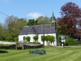
Park in the car park by the church and school
(S/E) Set off north-north-east along the path between the church and the school; at the end of the path, turn right.
At the first junction, take the road on the left heading north-east. Ignore the two roads on the left and follow Rue de l’Abreuvoir.
(1) At the junction with a wayside cross, follow the same road north-east.
You’ll see the old drinking trough on the left.
(2) At the junction with the D343, cross over and head straight ahead – take care as this is a very busy road. At the next Fork in the road, turn left.
(3) At the junction on the 132 hill, turn left and leave the path on your right. You’ll reach the D343 at the traffic lights.
(4) Follow it to the right for about 700 m, passing close to the water tower. Use the pavements where available, or walk well to the right in single file.
(5) At the fork in the road where a path branches off to the right, take this path heading north-north-west. Ignore the paths to the right and left, cross the D71E2 and continue straight ahead.
(6) At the junction at elevation 127, turn left, walk past a wind turbine and cross the D343 again with care. Continue along the path straight ahead.
(7) At the crossroads at the foot of a wind turbine, turn left and, at the junction with the D71E2, cross the road and follow it to the left for about ten metres, then take the path on the right. Ignore the path on the left and continue to the D71.
(8) At the junction with the D71, turn left and follow it back to your starting point (S/E).


 Visorando Member
 Moderate

 Difficult

