The Artois Hills to Assonval

Return to Assonval for a relatively easy walk (apart from the climb at the start) through the Artois hills.

Three-quarters of the walk takes place at an altitude of over 150 m (dizzying!) and follows good paths.

Details

n°16923967
Creation:
Last update:
Last review:
  • Walking
    Activity: Walking
  • ↔
    Distance: 8.11 mi
  • ◔
    Average duration: 4h 00 
  • ▲
    Difficulty: Moderate

  • ⚐
    Back to start: Yes
  • ↗
    Ascent: + 335 ft
  • ↘
    Descent: - 318 ft

  • ▲
    Highest point: 607 ft
  • ▼
    Lowest point: 390 ft
  • ⚐ Country: France
  • ⚐ City: Renty (62560)
  • ⚑
    Start/End: N 50.564409° / E 2.079498°
  • ❏
    IGN map(s): Ref. 2205E
  • Hour-by-hour weather

Photos

Description of the walk

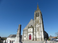
Park near the church in Assonval

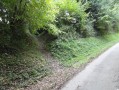
(S/E) Set off northwards on theGR®127A. Very soon, leave the tarmac and take a path on the right. This path, which is largely made of limestone, can be tricky. However, it has been well cleared and, in early November 2021, I found it to be in excellent condition. Do take care, though, as it can be treacherous. After a good climb, you’ll reach the ridge. Continue along the path between the fields until you reach a T-junction.

(1) Turn left. After 300 m, you’ll reach a crossroads.

(2) Take the path furthest to the right – a grassy track in fairly poor condition where you often have to ‘navigate’ around the puddles. You’ll reach a T-junction near a wind turbine.

(3) Turn right to walk past the wind turbine and reach the D928. Cross it carefully, continue along the path opposite and reach another wind turbine. Just before it, turn right and reach a junction.

(4) Turn right, leaving theGR®, and join the D928. Cross it carefully to take the path opposite. Continue along this path (south-westbound) to reach the hamlet of Rimeux and the D129E3. Cross it to take the path opposite. Good at the start, this path becomes very grassy and joins the D126.

(5) Follow it to the right for 400 m (there’s a lot of traffic, especially at weekends, so be careful), then turn left onto a wide track. Stay on this track, ignoring the turn-offs to the left, until you reach a junction.

(6) Follow the D148 to the right. Leave it after 200 m to take a wide track on the left, though this is made difficult by vehicle tracks. You’ll reach a T-junction. Turn right here to reach the hamlet of Rollez.

(7) Turn right (Rue des Vaudons) and head towards the D126. Follow it to the right (pavement on the right) until you reach a junction.

(8) Turn left onto the D148 (towards the stadium). After 400 m, the road bends to the left.

(9) Leave this road and take the lovely grassy path on the right, which winds its way to the hamlet of Gournay. Cross the small road and take the path opposite, which turns left and leads to a T-junction.

(10) Turn right (you’ll rejoin theGR®) and head towards the D129E3. Follow it for a few metres to the right before taking the path on the left. This lovely path eventually joins a small road.

(11) Follow it to the left to rejoin the departmental road. Then turn right to reach the church at Assonval (S/E).
Waypoints

  1. S/E : mi 0 - alt. 407 ft - Église Saint-Bertulphe (Assonval)
  2. 1 : mi 0.52 - alt. 584 ft - T-junction
  3. 2 : mi 0.71 - alt. 564 ft - Crossroads
  4. 3 : mi 1 - alt. 571 ft - T-junction near a wind turbine
  5. 4 : mi 1.56 - alt. 600 ft - Crossroads near a wind turbine
  6. 5 : mi 3.29 - alt. 528 ft - Junction with the D126
  7. 6 : mi 4.18 - alt. 436 ft - Crossroads
  8. 7 : mi 5.32 - alt. 499 ft - T-junction
  9. 8 : mi 5.71 - alt. 515 ft - Crossroads
  10. 9 : mi 5.95 - alt. 449 ft - Turn left
  11. 10 : mi 6.82 - alt. 538 ft - T-junction
  12. 11 : mi 7.75 - alt. 453 ft - T-junction
  13. S/E : mi 8.11 - alt. 407 ft - Église Saint-Bertulphe (Assonval)

Notes

Sturdy footwear and walking stick(s) are recommended.

The small square at the start is well equipped with benches and tables: a picnic on arrival can be a pleasant way to finish.

There are plenty of wind turbines along this route, but the country roads are much noisier!

Always be cautious and plan ahead when you're outdoors. Visorando and the author of this route cannot be held responsible for any accidents occurring on this route.

The GR® and PR® markings are the intellectual property of the Fédération Française de Randonnée Pédestre.

Reviews and comments

5 / 5
Based on 1 review

Reliability of the description
5 / 5
Ease of following the route
5 / 5
Route interest
5 / 5
benoitrando
benoitrando

Overall rating : 5 / 5

Date of your route : Apr 04, 2025
Reliability of the description : ★★★★★ Very good
Ease of following the route : ★★★★★ Very good
Route interest : ★★★★★ Very good
Very busy route : No

A brilliant route, done in the morning, starting with a steep climb that really gets your lungs working. It takes you right into the heart of the countryside, through farmland with superb views of the rolling countryside. In the villages you pass through, you can see some beautiful religious buildings, most of which are closed as they are in need of repair.
Thanks, joorange, for this lovely route

Machine-translated

Other walks in the area

For more walks, use our search engine .

The GPS track and description are the property of this route's author. Please do not copy them without permission.