Country:
 City:


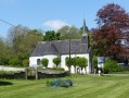
Park in the car park near the church.
(S/E) Leave the car park and turn left, then left again onto the D94.
(1) At the first junction, take Rue des Frênes on the right, heading west-north-west. Yellow signposting. After the right-hand bend, continue straight on for about 150 metres, passing a farm building on your left.
(2) Turn right onto the track heading north-north-east. At the junction with the D94, turn left heading north. Yellow signposting.
(3) After 150 m on the D94, take the track on the left heading north-west. Yellow signposts. You’ll reach a crossroads by the Second World War ruins.
(4) Continue straight on. At the junction with the D93, turn right heading east and, after 40 m, turn right again heading south-east, continuing straight on along the track until you reach the junction with the D94.
(5) Turn left towards the north, enter Fontaine-lès-Boulans; after 250 m, take the first road on the right towards the east, crossing a bridge. Ignore the track on the right, continue straight ahead and arrive at a crossroads after a wide left-hand bend.
(6) Take the tarmac track on the right heading south-east, follow theGRP® “Tour du Ternois Nord”, pass the first track on the left and take the next one heading north-east, which turns right to reach the Quévaussart farm.
(7) At the junction with the D92E, turn left past the farm heading north-east. Yellow and red markings.
(8) At the junction before the bridge, take the road on the right heading south-east. Yellow and red markings. The path continues along the edge of the woodland towards the north-east and, at the crossroads, leave theGRP® and turn right towards the south.
(9) At the junction with a wayside cross, take the road on the right heading south and, at thefirst crossroads, turn right heading south-west. Yellow markings
(10) At the junction by the wind turbine, continue along the path opposite heading south-west. Yellow markings
(11) At the junction with the D71, take the path opposite, heading south-west. At the next junction, turn right, heading north-west, take the first path on the left and turn right after 50 metres.
(12) At the junction with the D71, cross the road and take the path opposite heading north-east – the path that leads to Rue du Blanc Pays. Cross the River Le Faux and turn left heading west for about a hundred metres. Yellow markings.
(13) At the right-hand bend, turn left onto the path that runs alongside the Faux towards Rue du Curé and return to the starting point (S/E).


 Visorando Member

 Difficult