Notre-Dame du Bon Voyage

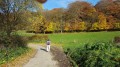
A short, very sunny route to explore the Artesian Plateau and enjoy beautiful views over Vincly and the Lys Valley.
Moderate elevation gain, but a good climb all the same.
And at the end of the route, a panoramic descent towards Reclinghem.

Details

n°754223
Creation:
Last update:
Last review:
  • Walking
    Activity: Walking
  • ↔
    Distance: 8.94 mi
  • ◔
    Average duration: 4h 35 
  • ▲
    Difficulty: Moderate

  • ⚐
    Back to start: Yes
  • ↗
    Ascent: + 499 ft
  • ↘
    Descent: - 492 ft

  • ▲
    Highest point: 604 ft
  • ▼
    Lowest point: 233 ft
  • ⚐ Country: France
  • ⚐ City: Reclinghem (62560)
  • ⚑
    Start/End: N 50.573102° / E 2.176871°
  • ❏
    IGN map(s): Ref. 2305O
  • Hour-by-hour weather

Photos

Description of the walk

In Reclinghem, you can park on Rue du Presbytère, near the cemetery.
(S/E) Walk alongside the cemetery to reach the D104. Follow it to the left. At the junction, take Rue Principale on the right and, 250 metres further on, turn left, staying on Rue Principale. When it curves to the left, continue straight ahead until you reach a T-junction.

(1) Turn left (a lovely, recently restored path). Join the D92 after the barrier. Follow it for a few metres to the left.

(2) Turn right ontothe GR®127along a wide track. Reach the D104, cross it and take the long, straight track opposite, which climbs gently (a bit tedious, but the view is lovely).

(3) Turn right, then left 400 metres further on.

(4) At the crossroads, turn right (the other two paths are dead ends). At the T-junction, turn right and, 300m further on, turn left.

(5) After 200m, turn right then immediately left onto a good track (yellow markings). You’ll reach a small road.

(6) First turn left then right to find a good track that joins the D133.

(7) Take the path furthest to the left and begin the ascent of Mont Grave, initially on a well-surfaced track, then on a footpath. A lovely climb of over a kilometre takes you to a crossroads at the foot of a wind turbine.

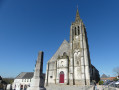
(8) Continue straight ahead across the plateau until you reach a T-junction. Turn left towards a farm. Pass between the sheds before reaching another T-junction (Chapelle Notre-Dame du Bon Voyage on the right, with its rather ‘kitsch’ external bell tower)

(9) Turn left ontothe GR®127, then 600m further on, just after a wind turbine, turn right. A short stretch along the ridge (with a lovely view of Vincly and the Lys Valley to the left) takes you to the D92 (theGR® itself has turned left after the second wind turbine).

(10) Follow it for 200m to the left, then turn right until you reach a junction. Turn right to pass at the foot of a wind turbine. You’ll then come to a lovely grassy path lined with a hedge, which leads to a T-junction

(11) Turn left onto a good path (hedge on the right). Ignore two paths on the right and continue to the junction (you’re now at the top of the Reclinghem hill, well known to cyclists!).

(12) Turn left twice to continue across the plateau. There’s a wind turbine on the left, another on the right, and you’ll come to a wide stony track on the right.

(13) Take this path to head back down to Reclinghem, keeping in the same direction, and reach the starting point (S/E).
Waypoints

  1. S/E : mi 0 - alt. 279 ft - Reclinghem, Rue du Presbytère
  2. 1 : mi 0.75 - alt. 233 ft - Turn left at the T-junction. Near the - Lys (rivière canalisée)
  3. 2 : mi 1.02 - alt. 253 ft - Junction with the GR127
  4. 3 : mi 2.2 - alt. 430 ft - Sharp right-hand bend
  5. 4 : mi 2.71 - alt. 351 ft - Turn right at the crossroads
  6. 5 : mi 3.17 - alt. 312 ft - Marked path on the right
  7. 6 : mi 3.71 - alt. 374 ft - Turn left/right at the road
  8. 7 : mi 4.02 - alt. 341 ft - Junction with the D133
  9. 8 : mi 4.64 - alt. 604 ft - Opposite the wind turbine
  10. 9 : mi 5.31 - alt. 587 ft - Écouflan, farm and chapel
  11. 10 : mi 6.36 - alt. 577 ft - Turn left onto the D92
  12. 11 : mi 7.02 - alt. 561 ft - Sign celebrating hunters’ achievements, on the right
  13. 12 : mi 7.68 - alt. 558 ft - Turn left twice
  14. 13 : mi 8.18 - alt. 561 ft - Gravel path on the right after the wind turbine
  15. S/E : mi 8.94 - alt. 279 ft - Reclinghem, Rue du Presbytère

Notes

The paths are generally in good condition, but sturdy footwear is essential.
There are no refreshment stops along the way, so make sure you bring enough to drink, especially in hot weather (there is little shade)

This walk can easily be shortened (the map is reliable).

Worth a visit

Always be cautious and plan ahead when you're outdoors. Visorando and the author of this route cannot be held responsible for any accidents occurring on this route.

The GR® and PR® markings are the intellectual property of the Fédération Française de Randonnée Pédestre.

Reviews and comments

5 / 5
Based on 1 review

Reliability of the description
5 / 5
Ease of following the route
5 / 5
Route interest
5 / 5
benoitrando
benoitrando

It’s a shame because it’s well worth the effort, and the slight climb to get to the chapel isn’t too bad either

Machine-translated

joorange
joorange

I’m glad that this walk, which I really like, has finally been completed! You’re the first person to do it, even though it’s been on offer since 2017.

Machine-translated

benoitrando
benoitrando

Overall rating : 5 / 5

Date of your route : Apr 02, 2025
Reliability of the description : ★★★★★ Very good
Ease of following the route : ★★★★★ Very good
Route interest : ★★★★★ Very good
Very busy route : No

A magnificent route, right in the heart of the countryside, winding through farmland and past wind turbines, with superb rolling landscapes. In the villages along the way, you can see some beautiful religious buildings, most of which are closed as they require renovation work. The highlight is the Chapel of Notre-Dame-du-Bon-Voyage in Écouflans, which you wouldn’t expect to find right in the middle of the countryside, perched on top of a hill. It appears to be a very popular spot, judging by the guest book inside the chapel.
Thank you, joorange, for this lovely route

Machine-translated

Papy-Rene
Papy-Rene
• Edited:

Not yet used

Machine-translated

Other walks in the area

For more walks, use our search engine .

The GPS track and description are the property of this route's author. Please do not copy them without permission.