


Refine your search for walks in Clénay
Clénay walks


 A long circular route through the Clénay Forest
 Visorando Member
 9.90 mi
 +164 ft
 -164 ft
 4h 40
4h 40
 Moderate
 Departure from Clénay (Côte-d'Or)
Do you enjoy wide open spaces, nature and peace and quiet, away from the beaten route?
Then come and take a walk in the Clénay state-owned forest; we’ll walk along the River La Flacière to the village of Flacey, where we can admire the wash house, the castle and its church. Then we’ll return to Clénay through the forest.
The Clénay State Forest, starting from Saint-Julien
9.95 mi
+184 ft
-171 ft
4h 45
Moderate
Departure from Saint-Julien (Côte-d'Or)
A walk that combines a stroll through the old village of Saint-Julien and a visit to the surrounding area, before crossing part of the Clénay National Forest, following an active railway line, and returning via the Fontaine aux Lions in Saint-Julien, skirting Clénay.
Please note: the route on the ground does not always correspond to the route on the IGN map due to forestry operations.
Norges observatory trail
 3.95 mi
+33 ft
-36 ft
1h 50
3.95 mi
+33 ft
-36 ft
1h 50
 Easy
Departure from Norges-la-Ville (Côte-d'Or)
Easy
Departure from Norges-la-Ville (Côte-d'Or)
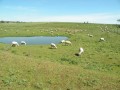
From Norges-la-Ville town hall, take the Norges observatory trail. Follow a boardwalk on stilts to Norges-le-Bas, then discover the old stone houses of the villages of Norges and Brétigny. Along the way you'll see 4 washhouses, 2 small waterfalls and plenty of wildlife.Ideal for families, preferably from April to October.
The Val de la Norges and the Edge of the Langres Plateau
6.90 mi
+46 ft
-46 ft
3h 15
Easy
Departure from Norges-la-Ville (Côte-d'Or)
This walk takes you along the Norges, through the villages of Norges (Haut and Bas), Bretigny and Clénay, and also across the start of the Langres Plateau as you head to the Fontaine aux Lions and return to Norges at the end. Along the way, you’ll encounter numerous natural, historical and legendary points of interest.
Circular route around Flacey
 5.81 mi
+236 ft
-230 ft
2h 55
Moderate
Departure from Flacey (Côte-d'Or)
5.81 mi
+236 ft
-230 ft
2h 55
Moderate
Departure from Flacey (Côte-d'Or)
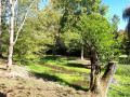
A pretty little village, with a stream and a mix of forest paths and open stretches. You can cover fewer kilometres by, for example, avoiding the loop around the grassy area.
This route is described for Nordic walking but is also suitable for hiking.
Circular Arceau
 5.51 mi
+69 ft
-66 ft
2h 35
Moderate
Departure from Arceau (Côte-d'Or)
5.51 mi
+69 ft
-66 ft
2h 35
Moderate
Departure from Arceau (Côte-d'Or)
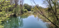
Arcelot, Arceau, Fouchanges; three villages that have always formed a single commune, crossed by the River Tille. Arceau is a rural commune situated 15 minutes from Dijon in a protected environment. Once situated on the Roman road linking Mirebeau to Dijon, the town was undoubtedly provided very early on with a single-arched bridge spanning the River Tille, which gave its name to the village. In the 17th century, General Gallas’s troops pillaged and burned the town.
Circular route via the Ogny farm, starting from Orgeux
11.51 mi
+217 ft
-207 ft
5h 30
Moderate
Departure from Orgeux (Côte-d'Or)
A circular route with no technical difficulties, starting from Orgeux, which takes us to the Ogny farm, then passes close to Brétigny, Ruffey-Lès-Echirey and Varois-et-Chaignot before returning to the starting point.
The Norges Valley between Orgeux and Saint-Julien
9.12 mi
+56 ft
-56 ft
4h 15
Moderate
Departure from Orgeux (Côte-d'Or)
A walk starting from Orgeux, with no technical difficulty, which follows the pleasant Norges valley and leads to Saint-Julien. The return route takes you through woods and fields, away from the road.
Plains and woods around Orgeux
 5.16 mi
+46 ft
-46 ft
2h 25
Easy
Departure from Orgeux (Côte-d'Or)
5.16 mi
+46 ft
-46 ft
2h 25
Easy
Departure from Orgeux (Côte-d'Or)
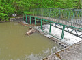
Does the village of Orgeux owe its name to ancient barley fields (Hordeu)? The Church of the Assumption dates back to the 13th century and features beautiful stained-glass windows in the choir. In the cemetery, there is a 17th-century calvary with a stone plaque. Adjacent to a small stone bridge, the wash house is built straddling a stream. A needle weir on the Norges slows the flow of the water just a stone’s throw away. A Roman road once crossed the area and, in 1967, a hoard of Gallo-Roman coins was unearthed in a sand pit.
Around Arcelot Castle
 5.17 mi
+46 ft
-49 ft
2h 25
Easy
Departure from Arceau (Côte-d'Or)
5.17 mi
+46 ft
-49 ft
2h 25
Easy
Departure from Arceau (Côte-d'Or)
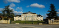
Arcelot Castle is situated in the commune of Arceau, in the Côte d’Or department, in the canton of Mirebeau-sur-Bèze. It has been listed as a Historic Monument since 22 September 1948, with the gardens listed on 30 April 1999. Behind the18th-century château lies one of Burgundy’s very first English-style parks.
Around Varois-et-Chaignot
5.40 mi
+82 ft
-82 ft
2h 35
Easy
Departure from Varois-et-Chaignot (Côte-d'Or)
An easy walk with no significant elevation gain in the Dijon plain
From Beire-le-Châtel to Spoy and back
 5.56 mi
+72 ft
-79 ft
2h 35
Easy
Departure from Beire-le-Châtel (Côte-d'Or)
5.56 mi
+72 ft
-79 ft
2h 35
Easy
Departure from Beire-le-Châtel (Côte-d'Or)
Beire-le-Châtel: canton of Saint-Apollinaire (formerly canton of Mirebeau).
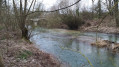
The village takes its name from the Gaulish word "Beire", meaning "plain". The discovery of a temple dedicated to Januaria recalls the position of Beire-le-Châtel in Gallo-Roman times, at the crossroads of ancient roads where the remains of two Roman roads can be found. In addition, six Gallo-Roman burials were found in 2019.
In the woods of Savigny-le-Sec
 6.35 mi
+554 ft
-522 ft
3h 25
Moderate
Departure from Savigny-le-Sec (Côte-d'Or)
6.35 mi
+554 ft
-522 ft
3h 25
Moderate
Departure from Savigny-le-Sec (Côte-d'Or)
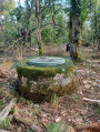
A pleasant walk through the woods of Savigny-le-Sec in search of the Puits de l’Ermitage.
The Puits de l’Ermitage is located at GPS coordinates 47.455 N 5.0064 E
Les Grandes Charrières via the valleys at Savigny-le-Sec
6.12 mi
+509 ft
-495 ft
3h 15
Moderate
Departure from Savigny-le-Sec (Côte-d'Or)
A walk through the woods, known as the Grandes Charrières, taking in several valleys, including notably the Combe Froidevau and the Combe Pensa.
The Tille Valley between Arcelot and Beire-Le-Châtel
12.19 mi
+131 ft
-135 ft
5h 45
Moderate
Departure from Arceau (Côte-d'Or)
A circular walk with no technical difficulties in the Tille valley, between Arcelot and Beire-le-Châtel, offering a lovely stroll through woods and fields, skirting the Tille on the return leg and passing buildings and monuments worth seeing or revisiting as you pass through the villages.
Source du Bué in Pichanges
 5.07 mi
+148 ft
-161 ft
2h 25
Easy
Departure from Pichanges (Côte-d'Or)
5.07 mi
+148 ft
-161 ft
2h 25
Easy
Departure from Pichanges (Côte-d'Or)
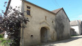
This circular route will take you to the Source du Bué with its curious legend. You can also explore the village, its chapel and its equally fascinating history, the Templars’ house, the manor house and the fortified church.In spring, you can see wild orchids in bloom.
Short circular loop around Messigny
4.19 mi
+427 ft
-407 ft
2h 20
Easy
Departure from Messigny-et-Vantoux (Côte-d'Or)
A circular walk in the Forest of Messigny, with its lily of the valley in May and its orchids and foxgloves in June.
Around the Fontaine aux Ânes fountain at the start of Messigny-et-Vantoux
 5.11 mi
+558 ft
-535 ft
2h 50
Easy
Departure from Messigny-et-Vantoux (Côte-d'Or)
5.11 mi
+558 ft
-535 ft
2h 50
Easy
Departure from Messigny-et-Vantoux (Côte-d'Or)
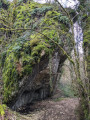
A beautiful, undulating walk through the woods. Please note that the route may be slippery in wet or humid conditions.
A circular through the Bois de Vantoux and the Bois Monsieur starting from Vantoux.
 8.05 mi
+571 ft
-561 ft
4h 10
Moderate
Departure from Messigny-et-Vantoux (Côte-d'Or)
8.05 mi
+571 ft
-561 ft
4h 10
Moderate
Departure from Messigny-et-Vantoux (Côte-d'Or)
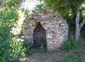
A very easy hike on the outskirts of Dijon, between Vantoux and Hauteville.
In the Bois de Vantoux in Messigny
5.54 mi
+489 ft
-492 ft
3h 00
Easy
Departure from Messigny-et-Vantoux (Côte-d'Or)
A short hike south-west of Messigny, towards the Château de Vantoux, the Combe Grivot and the farms on the plateau. This is an easy route for exploring the Suzon valley and a small combe, the Combe Grivot, which is characteristic of the valley with its stunted trees and stony slopes.
A circular starting from Gemeaux, a picturesque village.
 5.58 mi
+141 ft
-131 ft
2h 40
Easy
Departure from Gemeaux (Côte-d'Or)
5.58 mi
+141 ft
-131 ft
2h 40
Easy
Departure from Gemeaux (Côte-d'Or)
Circular route around and through Gemeaux to discover this picturesque little village in the Côte d'Or, rich in architectural heritage: its market halls, medieval house, church, castle, fountain and wash house.
From the Hauts du Suzon to the crocodiles of the Ouche
 10.45 mi
+413 ft
-554 ft
5h 10
Moderate
Departure from Dijon (Côte-d'Or)
10.45 mi
+413 ft
-554 ft
5h 10
Moderate
Departure from Dijon (Côte-d'Or)
The Suzon and the Ouche, two rivers of great importance to Dijon. This route runs from one to the other through a patchwork of gardens, avenues and small paths. Historical and artistic points of interest and viewpoints.
Access by tram; access by car is also possible.
Through woods and valleys in Messigny-et-Vantoux
 6.19 mi
+568 ft
-568 ft
3h 20
Easy
Departure from Messigny-et-Vantoux (Côte-d'Or)
6.19 mi
+568 ft
-568 ft
3h 20
Easy
Departure from Messigny-et-Vantoux (Côte-d'Or)
A beautiful walk, mainly through woods, which is not difficult but is good for your heart thanks to the gentle slope. A beautiful valley to finish.
Messigny Forest via Sainte-Anne
5.10 mi
+387 ft
-381 ft
2h 40
Easy
Departure from Messigny-et-Vantoux (Côte-d'Or)
Explore the Messigny Forest to Sainte-Anne. Return via the BMX site to the village. A route with very little elevation gain. This hike through the forest is very pleasant in the summer, with lily of the valley in May and orchids and foxgloves in June.
Around Couternon
 5.84 mi
+39 ft
-39 ft
2h 45
Easy
Departure from Couternon (Côte-d'Or)
5.84 mi
+39 ft
-39 ft
2h 45
Easy
Departure from Couternon (Côte-d'Or)
A leisurely walk around Courternon. This route will take you round the village and allow you to discover it in a different light.
The route is in open countryside with little shade. Make sure you bring suitable gear if the sun is strong.
Circular route in the Bois de Vantoux starting from Ahuy
5.61 mi
+564 ft
-577 ft
3h 05
Easy
Departure from Ahuy (Côte-d'Or)
Forest walk starting from Ahuy and heading towards Vantoux.
Between Tille and Gourmerault
9.92 mi
+33 ft
-33 ft
4h 35
Moderate
Departure from Arc-sur-Tille (Côte-d'Or)
This circular walk, between the two rivers that flow through our villages, takes you along these waterways and allows you to explore the church and the old mill at Arc-sur-Tille, Bressey-sur-Tille Castle, and the ponds at Remilly-sur-Tille.Did you know that the bell tower of the church at Arc-sur-Tille owes its flat roof to the Chape telegraph (1841)?
Around the lake and green spaces of Arc-sur-Tille
6.30 mi
+16 ft
-16 ft
2h 55
Easy
Departure from Arc-sur-Tille (Côte-d'Or)
This hike will take you through the town's green spaces, around the lake and along the Tille river.
From one mill to another in Arc-sur-Tille
6.65 mi
+66 ft
-79 ft
3h 05
Moderate
Departure from Arc-sur-Tille (Côte-d'Or)
Country walk between Arc-sur-Tille and Remilly-sur-Tille, taking in their mills.
The mill at Arc-sur-Tille
 Association / Club / Walk leader1.69 mi
+10 ft
-10 ft
0h 45
Easy
Departure from Arc-sur-Tille (Côte-d'Or)
Association / Club / Walk leader1.69 mi
+10 ft
-10 ft
0h 45
Easy
Departure from Arc-sur-Tille (Côte-d'Or)
A superb walk along the River Tille, during which you’ll discover the watermill and the church at Arc-sur-Tille.
Les Balcons du Suzon, part 1
 4.01 mi
+653 ft
-584 ft
2h 25
Easy
Departure from Messigny-et-Vantoux (Côte-d'Or)
4.01 mi
+653 ft
-584 ft
2h 25
Easy
Departure from Messigny-et-Vantoux (Côte-d'Or)
A route well-known to local hikers, signposted by the CAF.
The route given here (1h45/2h) from Messigny-et-Vantoux to Sainte-Foy was completed by a man in his sixties, walking on the uphill sections and trail running on the flat and downhill sections...
This route forms part of a longer hike (Tour du Val Suzon).
Circular walk starting from Viévigne via Bèze
12.34 mi
+433 ft
-453 ft
6h 05
 Difficult
Departure from Viévigne (Côte-d'Or)
Difficult
Departure from Viévigne (Côte-d'Or)
A circular walk starting from Viévigne that leads to Bèze through fields and woods. Enjoyable scenery throughout the walk and a close-up view of the beautiful Dame Alix ponds.
The Chaugey Well in Chaignay
8.94 mi
+558 ft
-581 ft
4h 35
Moderate
Departure from Chaignay (Côte-d'Or)
A circular route around the village of Chaignay, taking in the magnificent ‘Puits de Chaugey’ washhouse (19th century). Also on this route is the Médepain Fountain with its copse, which serves as a bird sanctuary (Bird Protection League). The paths through the woods and the Laverottes forest are also very pleasant.
The Creux Bleu Spring, starting from Chaignay
 9.70 mi
+925 ft
-896 ft
5h 15
Moderate
Departure from Chaignay (Côte-d'Or)
9.70 mi
+925 ft
-896 ft
5h 15
Moderate
Departure from Chaignay (Côte-d'Or)
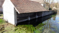
This circular walk allows you to discover or revisit this magnificent resurgence with its bluish hue. This spring flows into the Ignon at the site, which has been developed into a small park with picnic tables, a children’s playground and a wash house.
Villecomte is also steeped in history, notably with the Surcouf group’s maquis. A commemorative plaque on the town hall, next to the resurgence, marks these historical events.
The Suzon ridges - Full tour
 12.28 mi
+1,660 ft
-1,650 ft
7h 05
Moderate
Departure from Messigny-et-Vantoux (Côte-d'Or)
12.28 mi
+1,660 ft
-1,650 ft
7h 05
Moderate
Departure from Messigny-et-Vantoux (Côte-d'Or)
Well-marked, fairly easy route (it is indicated on the hiking map (Dijon Ouest - Val Suzon - Sainte-Seine l'Abbaye - 3022ET).
Beautiful views over the valley on a clear day.
Itinerary initially structured in four parts (Les Balcons du Suzon, parts 1 to 4), with an outward and return section off the itinerary.
⚠️The complete trail is described here in its entirety, with no escape route.
Through woods and fields west of Belleneuve
5.82 mi
+148 ft
-148 ft
2h 50
Easy
Departure from Arceau (Côte-d'Or)
An easy hike through woods and fields as you approach Belleneuve (Côte-d'Or).
Circular route through the plains on the outskirts of Dijon
11.73 mi
+79 ft
-79 ft
5h 30
Moderate
Departure from Quetigny (Côte-d'Or)
A circular route with no technical difficulty starting from Quétigny, taking you to the outskirts of the residential areas of Saint-Apollinaire, Varois and Chaignot, Couternon, and Chevigny-Saint-Sauveur. A very pleasant route in fine weather when the path runs alongside the Vieille Tille and then the Norges between Couternon and Chevigny.
Fountain in Hauteville
5.81 mi
+472 ft
-446 ft
3h 05
Easy
Departure from Fontaine-lès-Dijon (Côte-d'Or)
From the Basilica of Saint Bernard to the Hauteville-lès-Dijon viewpoint.
Fontaine-lès-Dijon Circular
 5.18 mi
+456 ft
-436 ft
2h 45
Easy
Departure from Fontaine-lès-Dijon (Côte-d'Or)
5.18 mi
+456 ft
-436 ft
2h 45
Easy
Departure from Fontaine-lès-Dijon (Côte-d'Or)
A short walk on the outskirts of Dijon. Lovely views of the villages along the route.
In search of greenery in Dijon
 4.53 mi
+262 ft
-240 ft
2h 20
Easy
Departure from Dijon (Côte-d'Or)
4.53 mi
+262 ft
-240 ft
2h 20
Easy
Departure from Dijon (Côte-d'Or)
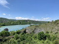
I suggest a short walk that will take you through some of Dijon's parks, passing by a beautiful viewpoint overlooking Lac Kir.
The banks of the Tille and the Perte de la Venelle in Lux
 5.35 mi
+62 ft
-62 ft
2h 30
Easy
Departure from Lux (Côte-d'Or)
5.35 mi
+62 ft
-62 ft
2h 30
Easy
Departure from Lux (Côte-d'Or)
This circular walk will take you around the charming village of Lux, its dam, the banks of the Tille, its fountains, its church, its park along the Tille, and the peaceful spot known as the Perte de la Venelle.
Why not combine a walk with a picnic by the water (the Tille) in Lux, perhaps in the landscaped park?
Circular walk between Tille, the Romanesque church and the Templars’ site, starting from Lux
9.24 mi
+262 ft
-243 ft
4h 30
Easy
Departure from Lux (Côte-d'Or)
Starting from Lux-sur-la-Tille, a nearly entirely flat circular route along dirt tracks to explore the Tille valley, the River Ignon and the leats of Tilchâtel. The walk takes you past the Ferme de Fontenotte, a former Templar commandery, and the beautiful Church of Saint-Florent in Tilchâtel, a Romanesque church adorned with fine capitals and bearing an inscription on its portal.
Dijon, from the Valois to Art Nouveau
 4.92 mi
+30 ft
-20 ft
2h 15
Easy
Departure from Dijon (Côte-d'Or)
4.92 mi
+30 ft
-20 ft
2h 15
Easy
Departure from Dijon (Côte-d'Or)
Dijon is a remarkable city, shaped by its history. Since its Gallo-Roman origins (3rd century), three major periods have shaped this city: the Middle Ages, with its churches; then the Valois, Grand Dukes of Burgundy; and the Renaissance, reflected in the splendour of the parliamentarians’ mansions; and Art Nouveau, with its inventive decorations. The aim of this discovery walk is to take you through these different periods.