Country:
 City:
City:


In Savigny-le-Sec, head towards “Val Suzon”, then take Rue de la Mare, following the signs for the Salle des Fêtes. Park at the end of this street, in the Salle des Fêtes car park, near the football pitches.
(S/E) Return to the access road to the car park and follow it down to the right for about 150 m. Take a first turn right then left to join the Chemin des Cailles and leave the village, crossing the fields in an almost straight line. Continue to the Rochotte crossroads.
(1) Turn right onto the Chemin de la Combe Froidevau. Stay on this track for about 2 km, ignoring the side tracks on either side, until you reach a Y-junction.
(2) Continue to the right, heading uphill to the next junction – another Y-junction – with a clump of trees (elevation 369).
(3) Turn right again and head up the Combe Pensa for over 1 km. You’ll reach a star-shaped junction.
(4) Take the path on the right and head downhill for approximately 1.3 km. On this descent, the routes marked by signs on the trees on the left have names. Continue until you reach the route named ‘Josette’.
(5) Turn left and follow this path to the junction with the Chemin de la Motte.
(6) Turn right at the fork and follow the path straight on until you reach the 337-metre mark.
(7) Take the track on the right and head towards La Sommière des Corroys.
(8) Turn left to follow forest track no. 19-21, and stay on it. At the next junction, turn right, then turn left towards the edge of the woods.
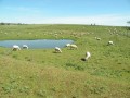
Follow the path alongside the pastures: be careful, there are several dogs running free on the farm before the stadium, but they are not aggressive.
Walk past the football pitch and head back to the car park (S/E).


 Visorando Member

 Easy
Easy