Circular walk starting from Viévigne via Bèze

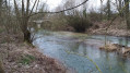
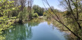
A circular walk starting from Viévigne that leads to Bèze through fields and woods. Enjoyable scenery throughout the walk and a close-up view of the beautiful Dame Alix ponds.

Details

5453614
Creation:
Last update:
Last review:
  • Walking
    Activity: Walking
  • ↔
    Distance: 12.34 mi
  • ◔
    Average duration: 6h 05 
  • ▲
    Difficulty: Difficult

  • ⚐
    Back to start: Yes
  • ↗
    Ascent: + 433 ft
  • ↘
    Descent: - 453 ft

  • ▲
    Highest point: 909 ft
  • ▼
    Lowest point: 686 ft
  • ⚐ Country: France
  • ⚐ City: Viévigne (21310)
  • ⚑
    Start/End: N 47.434304° / E 5.229998°
  • ❏
    IGN map(s): Ref. 3122SB
  • Hour-by-hour weather

Description of the walk

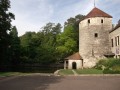
Head to Viévigne and park in the town hall car park on Rue de l’Église.

(S/E) Set off to the left, with your back to the town hall, to reach the junction where the Chemin de Fontaine Tresie (or Trésille) begins. Turn left and follow this tarmac road, which becomes a stony track as you leave the village, heading towards the fields. It veers to the right towards the gas station in the distance, crossing a dry ditch. When you reach the T-junction at elevation 249, turn left.

(1) Follow this field track continuously until it joins a transverse dirt track. Then turn left and follow this stony track to its end at elevation 254. Turn left.

(2) This path heads towards a copse of trees in the distance on the right. Well before reaching it, turn right at the first junction of tracks. The field path climbs the hillock then drops down the other side, revealing a new landscape. At the bottom, it meets a cross-path. Turn left and head straight on until you reach the D112. Turn right onto this road.

(3) Walk _carefully_ for about sixty metres before turning left onto a stony track that continues across the fields. It comes to an end following land consolidation, despite its continuation being marked on the IGN map. You must go up on the right to go round the field.

(4) Follow the grassy path to its end for a few dozen metres, then head along the edge of the fields, veering to the left (in a curved semicircle). Look out for the old Épenouses farm and the left-hand side of its wooden fence. Head back down along the field to join a grassy path running along the left-hand side of the property.

(5) In front of the main entrance to the old farm, join the tarmac road, pass the entrance to the Petit Hector farm, then go under the viaduct of the old railway line (VF) before reaching the D960 straight ahead at the entrance to the town of Bèze. Turn right.

(6) Follow this road _carefully_ as it descends, first on the hard shoulder and then on the left-hand pavement, towards the village. When you reach a sign indicating a ‘Stop’ 150 metres ahead, turn left into Impasse des Lilas.

(7) At the edge of the built-up area, the tarmac road becomes a stony track and then a completely grassy path. It ends at the old railway line. Turn right to follow a dirt track to the next junction, where you can cross the tracks. Turn left.

(8) Just after crossing the railway line, keep to the right to head towards the woodland. At the next Fork in the road, just before the woodland, keep to the right again. Continue along this fairly wide path through the woodland. It emerges to cross between fields in a hollow, then enters the woodland again. Follow it straight ahead for a long stretch until it reaches a fork in the road. Turn right here.

(9) Immediately afterwards, it veers to the left whilst climbing slightly, before descending again alongside a row of fir trees; follow the path to the right. When you reach a T-junction, turn left. The path heads straight on before veering left and climbing. Once you reach level ground, take the first path on the right (line 15) to join a wide, stony white track at the other end. Turn left.

(10) Follow this track in a straight line until it veers to the right. You can take the path on the left at this bend to get closer to the first Dame Alix pond (private property).
Continue along the original track, go through a gate before veering left to walk along the edge of the fields, keeping to the right. The track is now straight.

(11) Just after a slight bend to the left, turn onto a path on the left which leads to the second Dame Alix pond, with houses in sight (private property). Retrace your steps.

(11) Continue along the original path as you leave the woodland (with fields on your right) until you reach the 242-metre mark, where the path veers sharply to the right. Then turn left.

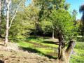
(12) This path enters the undergrowth. Shortly afterwards, at the Fork in the road, keep to the left. It heads straight into the Bois du Four until you reach the first T-junction (lines 22/23). Turn left, then immediately right (there is a Yellow Cross painted on a tree).

(13) The path continues deeper into the woods until it reaches another junction with a stone marker 7/9. Move about 3 metres to the left to take the path on the right (slightly indistinct yellow markings). This route does not correspond to the route shown on the IGN map. This path winds its way past stone marker 8, then under a hedge of fir trees before emerging at the edge of the woodland, into a field.

(14) Follow the grassy path which branches off to the left at the edge of the woodland and, a little further on across the fields, joins a wide, white, stony track at elevation 266. Turn right to enter Viévigne via the Chemin des Essarts, then the Rue de Montrivaut, until you reach the wide, open junction with the D960.

(15) Cross this road _carefully_ and take the D112 opposite, heading towards Tanay and Mirebeau. Follow the Grande Rue to the next junction (marked by a wayside cross) and keep right onto the Chemin de la Fontaine Tresie, which leads back towards the Town Hall, turning left onto the Rue de l’Église. You will arrive at the car park (S/E).

Waypoints

  1. S/E : mi 0 - alt. 883 ft - Town hall car park - Église de la Nativite de la Vierge (Viévigne)
  2. 1 : mi 0.8 - alt. 817 ft - Crossroads of footpaths
  3. 2 : mi 2.39 - alt. 833 ft - Crossroads of trails
  4. 3 : mi 3.44 - alt. 827 ft - Junction with the D112
  5. 4 : mi 4.4 - alt. 758 ft - Clear break in the path
  6. 5 : mi 4.9 - alt. 748 ft - Entrance to the former Épenouses farm
  7. 6 : mi 6.61 - alt. 764 ft - Junction with the D960
  8. 7 : mi 6.9 - alt. 722 ft - Impasse des Lilas junction. Near the - Bèze (rivière)
  9. 8 : mi 7.48 - alt. 784 ft - Cross the railway line on the left
  10. 9 : mi 8.86 - alt. 892 ft - Turn right at the fork in the road
  11. 10 : mi 9.4 - alt. 876 ft - Junction with the Bois Butteau trail
  12. 11 : mi 10.43 - alt. 810 ft - Access to the - Étang de la Dame Alix
  13. 12 : mi 10.94 - alt. 794 ft - Entry into the woodland
  14. 13 : mi 11.27 - alt. 833 ft - Junction of trails 22 and 23
  15. 14 : mi 11.63 - alt. 869 ft - Exit at the edge of the woodland, at the boundary of the field
  16. 15 : mi 12.21 - alt. 883 ft - Junction of the D960 and D112 in the centre of Viévigne
  17. S/E : mi 12.34 - alt. 883 ft - Town hall car park - Église de la Nativite de la Vierge (Viévigne)

Notes

You may wish to bring walking poles in wet weather and/or when crossing wooded areas.
It is not advisable to follow the route of the old railway line that served the silos, as it is dangerous and overgrown with dense vegetation (trees and brambles).

Worth a visit

- The Petit de Viévigne family, known by their titles since the 14th century. Jacques Petit de Viévigne, alias Taupin, was an honorary councillor at the Superior Council of Martinique in 1786.

- Disused railway line between Marcilly-sur-Tille and Mirebeau, which once served the numerous silos along its route.

- Bèze: a tourist attraction featuring its caves, the Bèze resurgence and its medieval buildings.

- The Dame Alix ponds: both are on private property but can be approached quite closely.

Reviews and comments

3.6 / 5
Based on 4 reviews

Reliability of the description
4 / 5
Ease of following the route
4 / 5
Route interest
2.8 / 5
User 778372

Overall rating : 4 / 5

Date of your route : Aug 25, 2025
Reliability of the description : ★★★★☆ Good
Ease of following the route : ★★★★☆ Good
Route interest : ★★★★☆ Good
Very busy route : No

A good long hike, but not tiring with no elevation gain. The return trip is through the forest, which is very pleasant in summer. Please note that this is private property, but we didn't have any problems. We went to the village of Bèze, of course, as that was also the destination of the hike. However, we missed point 12, which was not very obvious, and ended up on the road. Thanks to the author for this country walk.

Machine-translated

Chabanis
Chabanis

Overall rating : 3.7 / 5

Date of your route : Sep 15, 2023
Reliability of the description : ★★★★☆ Good
Ease of following the route : ★★★★☆ Good
Route interest : ★★★☆☆ Average
Very busy route : No

From the start to the farm (point 5), the route is rather uninspiring: straight, monotonous paths through fields, uninteresting, grassy and muddy. After that, the walk is quite pleasant and easy, following good paths through the forest. Best avoided after a spell of rain, as the paths at the start are likely to be very muddy…

Machine-translated

cuzcodom
cuzcodom

Overall rating : 3 / 5

Date of your route : Aug 24, 2021
Reliability of the description : ★★★★☆ Good
Ease of following the route : ★★★★☆ Good
Route interest : ★☆☆☆☆ Very disappointing
Very busy route : No

The ‘walk for the sake of walking’ route…
A quick detour via Bèze would indeed have been welcome, as it would have easily shortened the first section, which is of no interest whatsoever (an old farm that’s no longer there: the path has been turned into a cultivated field), but to skip the Viévigne washhouse – well, I really don’t understand that...

Machine-translated

GAGNAUX
GAGNAUX

Overall rating : 3.7 / 5

Date of your route : Mar 14, 2021
Reliability of the description : ★★★★☆ Good
Ease of following the route : ★★★★☆ Good
Route interest : ★★★☆☆ Average
Very busy route : No

A walk that’s only difficult if you reckon 19km is a long way!
It’s a shame not to carry on to the centre of Bèze, which has some great spots for a midday picnic if you set off from Viévigne at around 9 am.
Please note, the town hall car park isn’t very big if you’re coming as a group; on Sundays there’s no one there.

Machine-translated

Other walks in the area

For more walks, use our search engine .

The GPS track and description are the property of this route's author. Please do not copy them without permission.