Short circular loop around Messigny

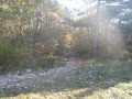
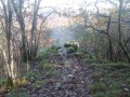
A circular walk in the Forest of Messigny, with its lily of the valley in May and its orchids and foxgloves in June.

Details

54660523
Creation:
Last update:
Last review:
  • Walking
    Activity: Walking
  • ↔
    Distance: 4.19 mi
  • ◔
    Average duration: 2h 20 
  • ▲
    Difficulty: Easy

  • ⚐
    Back to start: Yes
  • ↗
    Ascent: + 427 ft
  • ↘
    Descent: - 407 ft

  • ▲
    Highest point: 1,411 ft
  • ▼
    Lowest point: 1,060 ft

Description of the walk

Park at Messigny cemetery, Route de Savigny.

(S/E) Turn your back on the cemetery and head back to the crossroads. Turn right twice and you’ll immediately come to a three-way junction.

(1) Keep to the right to follow the road towards Combe Belle Fille.

(2) Note the path on the left which you will take later, and carry on straight ahead until you reach the next three-way junction.

(3) Take the path that climbs up to the right.

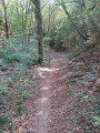
(4) Take the first path on the left which climbs through the communal woodland and follow it to the top of the Combe Prielle.

(5) At the junction, ignore the path on the right and turn left onto the track under the trees, which descends Combe Prielle and rejoins the outbound route.

(3) Continue straight on in the opposite direction to the outward journey and you’ll come to a fork at the foot of the climb.

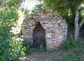
(2) Take a small path on the right which leads back to Messigny: on this path, on the right, note an old hut in the woods. Emerge onto Rue de la Combe Belle Fille and continue to the end. Carry on along the path and join Rue de la Mare.

(6) Turn left and follow this street until you reach the first three-way junction you passed on the way out.

(1) Turn right, then left at the crossroads to return to the cemetery (S/E).

Waypoints

  1. S/E : mi 0 - alt. 1,060 ft - Messigny Cemetery
  2. 1 : mi 0.08 - alt. 1,073 ft - Common three-way junction (out and back)
  3. 2 : mi 0.47 - alt. 1,079 ft - Common three-way junction (out and back)
  4. 3 : mi 0.61 - alt. 1,066 ft - Junction at the bottom of the valley. Return
  5. 4 : mi 0.84 - alt. 1,158 ft - Junction for the Combe Prielle circular loop
  6. 5 : mi 1.89 - alt. 1,411 ft - Top of Combe Prielle
  7. 6 : mi 3.74 - alt. 1,168 ft - Arrival in the village of Messigny
  8. S/E : mi 4.19 - alt. 1,060 ft - Messigny Cemetery

Worth a visit

In June: all kinds of orchids.
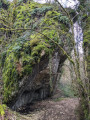
La Combe Prielle: foxgloves in June, lily of the valley in May.
Cabotte (an old hut or winegrower’s store) in the woods.

Reviews and comments

4.3 / 5
Based on 3 reviews

Reliability of the description
4.3 / 5
Ease of following the route
4.3 / 5
Route interest
4.3 / 5
guicheton
guicheton

Overall rating : 4.3 / 5

Date of your route : Jan 01, 2025
Reliability of the description : ★★★★☆ Good
Ease of following the route : ★★★★☆ Good
Route interest : ★★★★★ Very good
Very busy route : No

Apart from taking a wrong turn at point 4, the route was really lovely, especially on the way back through the valley.

Machine-translated

Magou21
Magou21

Overall rating : 5 / 5

Date of your route : Aug 12, 2024
Reliability of the description : ★★★★★ Very good
Ease of following the route : ★★★★★ Very good
Route interest : ★★★★★ Very good
Very busy route : No

A brilliant hike!

Machine-translated

juliuskronos
juliuskronos

Overall rating : 3.7 / 5

Date of your route : Jul 01, 2024
Reliability of the description : ★★★★☆ Good
Ease of following the route : ★★★★☆ Good
Route interest : ★★★☆☆ Average
Very busy route : No

Easy walk

Machine-translated

Other walks in the area

For more walks, use our search engine .

The GPS track and description are the property of this route's author. Please do not copy them without permission.