Circular walk between Tille, the Romanesque church and the Templars’ site, starting from Lux

Starting from Lux-sur-la-Tille, a nearly entirely flat circular route along dirt tracks to explore the Tille valley, the River Ignon and the leats of Tilchâtel. The walk takes you past the Ferme de Fontenotte, a former Templar commandery, and the beautiful Church of Saint-Florent in Tilchâtel, a Romanesque church adorned with fine capitals and bearing an inscription on its portal. 

Details

67168229
Creation:
Last update:
Last review:
  • Walking
    Activity: Walking
  • ↔
    Distance: 9.24 mi
  • ◔
    Average duration: 4h 30 
  • ▲
    Difficulty: Easy

  • ⚐
    Back to start: Yes
  • ↗
    Ascent: + 262 ft
  • ↘
    Descent: - 243 ft

  • ▲
    Highest point: 1,073 ft
  • ▼
    Lowest point: 827 ft
  • ⚐ Country: France
  • ⚐ City: Lux (21120)
  • ⚑
    Start/End: N 47.490478° / E 5.209186°
  • ❏
    IGN map(s): Ref. 3121SB, 3122SB
  • Hour-by-hour weather

Description of the walk

Start from Lux; there are plenty of designated parking spaces along the banks of the River Tille.

(S/E) Take Rue de la Gare (D28) southwards and, at thefirst junction, turn right (D28M). Continue along this road towards Gemeaux until you reach the railway line; immediately after, follow it to the right. Look for a gravel track on the left and follow it.

(1) Cross a bridge over the motorway and carry on to the Ferme de Fontenotte. Cross the farm along the correct path and follow it straight on to join the D974.

(2) Cross the road with care (it is a very busy route). Take the dirt track running parallel to the road, heading to the right. At the next junction, towards the Petite Forêt farm, carry on straight ahead, then turn left at the next track you come to and follow it straight on. You’ll reach the large clearing at Petite Forêt

(3) Take it on the right. Continue along the track past the barrier and head down a small valley to reach the old railway line. Walk alongside it on the right and cross it onto the correct path a little further on. Carry on along this path and, at the next junction, turn right towards a silo to reach Til-Châtel. Cross the D959 with care and head straight on towards the church.

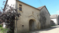
(4)The Romanesque-era Church of Saint-Florent is well worth a visit, and you can have a picnic on the esplanade. Note the small carved gate to the south of the church; it bears the engraver’s signature. Carry on a little way past the church and take a tiny path on the left leading towards a leat. At the small road below, follow the leat to the right along Rue du Pont Rion. At the square, cross the old main road and turn slightly right onto Rue des Moulins. Continue until you reach the D974; cross it withcare. Take the path opposite and follow it until you reach an underpass beneath the A31 motorway. Go through it and take the first path on the left.

(5) Cross the River Tille over a small bridge. At the next junction, take the correct path on the right. Continue in this direction until you reach a Fork in the road, at an altitude of 268 metres, at La Chalandrue, and then turn right. Continue straight on until you reach the River Tille again.

(6) Follow the river on your right along a small path that leads back to Lux. In the village, take the main road on the right, passing in front of the castle, and head towards the village centre. Then turn right (D959) to reach the bridge over the Tille and the car park (S/E).

Waypoints

  1. S/E : mi 0 - alt. 830 ft - Parking along the banks of the Tille
  2. 1 : mi 1.17 - alt. 869 ft - Bridge over the A31 motorway
  3. 2 : mi 2.65 - alt. 971 ft - Crossing the D974
  4. 3 : mi 3.82 - alt. 1,073 ft - Grande Sommière in the Petite Forêt
  5. 4 : mi 5.3 - alt. 932 ft - Saint-Florent Church in Til-Châtel
  6. 5 : mi 6.73 - alt. 850 ft - Bridge over the Tille
  7. 6 : mi 7.92 - alt. 840 ft - Path along the banks of - Tille (rivière)
  8. S/E : mi 9.24 - alt. 830 ft - Parking along the banks of the Tille

Notes

Easy parking in Lux; there is a restaurant in the village.
(2) D974: take care when crossing this busy road.
Refreshments available in Til Châtel.

Worth a visit

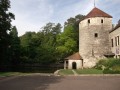
The Commandery of Fontenotte is a former Templar site: one tower remains, but the chapel was moved to Dijon in the early 1960s!
A beautiful Romanesque church in Til-Châtel: the south portal is notable for bearing the signature ‘Pierre de Dijon’.
A lovely walk along the leat at Til-Châtel.
Return via the banks of the River Tille.

All shops and amenities are available in Is-sur-Tille.

Reviews and comments

4.7 / 5
Based on 2 reviews

Reliability of the description
5 / 5
Ease of following the route
5 / 5
Route interest
4 / 5
MTS21
MTS21

Overall rating : 4.7 / 5

Date of your route : Aug 31, 2026
Reliability of the description : ★★★★★ Very good
Ease of following the route : ★★★★★ Very good
Route interest : ★★★★☆ Good
Very busy route : No

A walk suitable for everyone on good paths, best done outside the summer months as there is little shade. We altered the route slightly. At point 266, instead of heading towards the village centre, we turned off towards La Prée and continued along Rue de l’Ignon as far as the Rion Bridge, where we enjoyed our picnic at the tables in the playground. We then walked alongside the Ignon along the fitness route and rejoined the main route at Rue de la Cote.

Machine-translated

Chabanis
Chabanis

Overall rating : 4.7 / 5

Date of your route : May 26, 2025
Reliability of the description : ★★★★★ Very good
Ease of following the route : ★★★★★ Very good
Route interest : ★★★★☆ Good
Very busy route : No

A very pleasant, idyllic walk through the fields, along good paths. A route that is best avoided in hot weather

Machine-translated

Other walks in the area

For more walks, use our search engine .

The GPS track and description are the property of this route's author. Please do not copy them without permission.