Country:
 City:
City:


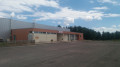
Head to Clénay, to the hamlet known as Les Louvières. Take Rue de la Fontaine Melot. Park in the Espace Loisirs car park.
(S/E) Our walk begins on the dirt track at the end of Rue de la Fontaine Melot, which is to the left of the Espace Loisirs, continuing along the road we took to reach the car park.
Follow this path to the first junction and turn right. This path runs alongside the railway line (SNCF) and leads to a junction at a bridge over the SNCF line.
(1) Turn right, go under the bridge and carry on straight ahead until you reach the first path on the right (Section No. 3)
(2) Turn right onto Section No. 3, continue until you reach the edge of the woodland and turn left onto the white track with a grassy strip down the middle. You’ll reach a junction in the bend.
(3) Turn left. On this path, keep an eye out so as not to miss the small path branching off to the left, which becomes grassy after about thirty metres. Then, after about 100 metres, the path widens again. Follow it and you’ll return to the crossroads you passed earlier.
(2) Turn right onto the section marked 7, where a yellow arrow is also visible on the left-hand side of the path you are to take. On the right-hand side of this path, the number 43 is also visible. Continue for about 200 metres.
(4) Turn left and take the small path just past the tree marked 17.
At the next junction, turn right onto the section marked 6 and 8 in blue. Walk for about 40 metres and take the path on the right. Ignore the first junction and stay on the well-maintained path until the next junction.
(5) Veer to the right, stay on this path until you reach the edge of the woods, then continue along the grassy path that runs alongside the forest.
(6) When the path enters the woods, do not go in but turn left and continue along the edge. Carry on walking alongside the woods until you reach the river ‘La Flacière’
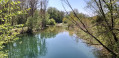
(7) Then turn left and walk upstream along the river, still on a grassy path. After a long straight stretch, you’ll reach a crossroads.
(8) Do not turn either right or left.
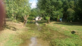
Ahead of you, you’ll see a stone crossing over the ditch. Once on the other side of the ditch, continue to the right to pass between the river and the horse paddock. When you reach Flacey, ignore the first bridge and head for a wooden footbridge.
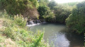
(9) Cross it, then turn left towards the wash house. Continue walking upstream along the river until you reach the bridge.
(10) Cross the bridge and take Ruelle du Potot opposite. As you go uphill, note a wayside cross on your right. At the first junction, carry on straight ahead until you reach the next junction.
(11) Ignore the path on the left and enter the woods. Follow the path to the railway line. Turn right and walk alongside the SNCF line to the level crossing.
(12) Cross it with care; only cross when the barrier is open.
Then take the path on the left after the level crossing. This runs alongside the railway line. At the end of the path, take the path furthest to the right, which leads into the woods.
At the next junction, ignore the path on the left and carry on straight ahead to reach another junction.
(13) Turn left onto the path that cuts across your route; here, turn right and stay on this path until you reach section number 15.
At this junction, ignore section No. 15, take the path on the right at the edge of the woods and follow it until you reach a stony track, then turn right towards the gate. Continue straight on until you reach the CD3b.
(14) Cross the road and follow the path opposite. Go through a gate, continue straight on and turn into the first path on the left.
At the next junction, turn left again onto a white track with a grassy strip down the middle. (Billaut Forest Road). When you reach the CD3b, cross the road, turn right and then take the first track on the left.
(15) Follow the first track on the right before the barrier. At the next junction, turn right again to skirt the woodland and follow this track to the junction with the white track.
(16) Turn right towards the SNCF bridge visible at the end of the track and return to the first junction you passed on the way out.
(1) Before the SNCF bridge, turn right onto the path that runs alongside the railway line, and follow the route taken on the way there.
Return to the car park (S/E).



 Visorando Member
 Easy
Easy