Country:
 City:
City:


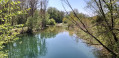
Head to Arcelot. Coming from the direction of Orgeux, park on the left-hand side below the D960 (or Rue du Faubourg Gallas) just before crossing the bridge over the River Tille, in a large white-marked car park next to the river. Coming from Beire or Arc, go round the roundabout and cross the bridge over the River Tille towards Orgeux–Dijon, then turn right onto the first tarmac track leading downhill.
(S/E) From the car park, walk up the track to join the D960. Turn left. Walk along the pavement towards Arcelot Castle and cross the bridge over the River Tille. When you reach the roundabout, turn right onto Rue du Colombier (on the D34) towards Arc-sur-Tille. Walk along the wall of the castle grounds, keeping to the left. At the end of the wall, turn left twice.
(1) Take the stony track that runs alongside the castle’s boundary wall, heading left. Follow it continuously north-eastwards. At one point, it turns left and then, shortly afterwards, right. On the left, it runs alongside a fir forest before veering off at a pond. At the next junction of tracks, turn left so as to head uphill towards a fir forest.
(2) At the three-way crossroads, marked by the edge of the woodland and, further to the right, a quarry, continue straight ahead. Shortly afterwards, at another junction, leave the white track that branches off to the left and head into the undergrowth. Continue in this way to cross the Bois Guyot from one end to the other.
(3) On emerging from the woods, turn right. Follow the curved edge of the woods, keeping to the right along a grassy path, for its entire length. Once you reach the tip, continue up the path across the fields, heading north.
(4) At the T-junction, turn right. Head towards the woodland directly ahead. At the edge of the woodland, turn left to follow the edge, keeping to the right. The path veers to the right then turns left again very close to a hunting lodge and joins the road leading to Magny-Saint-Médard. Turn left to reach the junction of the C1 and D112e roads shortly afterwards.
(5) Cross it carefully, keeping to the left to join a partially tarmacked field track on the right. At the first crossroads of tracks, turn left at a copse to head straight on towards the hamlet of Vesvrotte.
(6) In the centre of the hamlet, there is a spring, a fountain and a cross overlooking it. Continue along the road, keeping to the right to leave the hamlet, and turn right at the next junction, before the 50 km/h speed limit sign. Follow the white, stony track for some time.
(7) Turn into the first field track on the left. At the end of this track, it joins the D960, near a wayside cross dating from 1875.
(8) Head left towards the village of Beire-le-Châtel. To do this, take the Route de Fontaine-Française before turning into the first street on the right, Ruelle Viennet. It is a short street with a steep descent. At the end of it, turn right onto Chemin de Gemeaux before veering left to cross the bridge over the Tille via the Chemin du Pont Veillot. Further on, take the first gravel track on the left, which cuts through the fields between the two branches of the Tille, leading, at its end, to the 13th-century castle of Beire-le-Châtel.
(9) Keep to the left to cross the bridge over the Tille and arrive at Place de la Charme and its wayside cross. Turn immediately right into Ruelle des Amours, with a view of the castle, a round tower and outbuildings. Follow it up to where it joins the D960, near Saint-Laurent Church and the war memorial. Cross the main road carefully, keeping to the right, then immediately afterwards turn left onto Chemin de l’Etrée.
(10) Head towards the community hall, keeping to the right at the next Fork in the road. At the end of the street, it joins the D112e. Turn right and carefully cross Rue Jules Lenoir, then turn left immediately afterwards to continue along the gravel track of l’Etrée towards the fields.
(11) Much further on, across the fields, at the only four-way crossroads of tracks, turn right towards the houses at Fouchanges. When you reach a metal shed on the left and a stud farm on the right, turn right to go round the Vignotte equestrian centre on the right-hand side. This will take you onto the D960 via Rue de la Care.
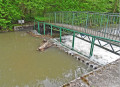
(12) Turn left onto Route de Fontaine-Française. On the left, admire an ornate wayside cross dating from 1800. Continue along the main road and, shortly afterwards, keep right onto Rue de Brognon, which descends towards the Tille. Follow the road, cross the bridge and take thesecond gravel track branching off to the left. Walk past the pumping station. At the end of the track, it joins the Arceau–Brognon road.
(13) Turn left. Walk carefully along this village road, situated behind the grounds of Arceau Castle, until it turns sharply left towards the village. At this sharp bend, once you reach the hamlet of La Charme, turn a quarter of the way to the left at the green space with benches to admire an old wooden mill on the neighbouring property, partly hidden by the trees.
(14) Without entering Arceau, head due south along the gravel track opposite the green space. At the entrance to the Arceau sandpit, the track becomes a road. Take care as there may be lorries on the road.
(15) Just before the very first house in Arcelot and a crossroads, turn left at a concrete medium-voltage electricity pylon. Take a path that winds between coppiced woodland on the right and a horse paddock on the left. At the far end of the paddock, the path veers to the right and then to the left at a greenhouse. Go through the wooden gate on the right and follow a track suitable for vehicles running alongside the River Tille (signposted to the left) to reach the starting car park (S/E).


 Visorando Member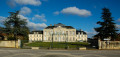
 Easy
Easy