


pgermaneau

 Visorando Member
 Premium user
Sign up:
Published route(s)
 The peaks of Antsestegiko, Antsestegi and the village of Aritzakun
 8.45 mi
 +2,484 ft
 -2,589 ft
 6h 05
 Moderate
 Departure from Baztan (Navarre)
A superb walk based on the PR®-NA 6 route proposed by the Comunidad Foral de Navarra, with the addition of the ascent to two peaks. You’ll be walking through fields or in the forest the whole time, surrounded by stunning mountains, and crossing or following streams. As this is a PR® route, it should be signposted in white and yellow. However, the almost complete absence of these markings, combined with numerous changes of direction, makes it essential to follow the route map. Finally, the length of the route, the elevation gain and, above all, the average gradient of between 20 per cent and 25 per cent – which occurs towards the end of the walk – mean that this route is only suitable for very experienced walkers. It should also be noted that the presence of numerous hunting posts means this walk is prohibited during the hunting season.
The Les Caletes Tower in Benidorm
 5.01 mi
+1,184 ft
-1,161 ft
3h 20
Moderate
Departure from Benidorm (Alacant / Alicante)
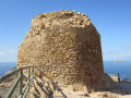
La Torre de Les Caletes, also known as Torre Punta de Cavall, is a classic and easy hike, as the route to reach it involves following tarmac roads – which, after a while, are closed to traffic – and thus takes you through unspoilt countryside along the coast, with the added bonus of discovering numerous stunning coves. As for the return journey, which can of course be done via the same route as the outward leg (which is what everyone does, in fact), the walk offers a lovely little path along the mountainside. This path runs along the cliffs overlooking the sea (which may be daunting for some) and includes a few rocky sections which, whilst not exactly rock climbing, do require you to use your hands to climb. So, before setting off on this return route, consider your abilities and do not take any unnecessary risks.
The Cabezo de la Sal in Pinoso
 3.61 mi
+935 ft
-919 ft
2h 30
 Easy
Departure from el Pinós / Pinoso (Alacant / Alicante)
The Cabezo de la Sal is a rather special peak, dome-shaped and approximately 4 kilometres in diameter, containing a vast salt deposit which is still being mined. The route suggested here takes you to the summit, but also past various salt works and pipelines that carry the salt away for processing. You’ll also come across a gigantic cave.
The Jaime el Barbudo trail in Hondón de los Frailes
 7.32 mi
+988 ft
-1,145 ft
4h 15
Moderate
Departure from Hondón de los Frailes (Alacant / Alicante)
This is a walk that combines both mountain scenery and local history. The mountain aspect comes from following a very pretty path with stunning views of the surrounding mountains, organised by the town council of Hondon de los Frailes, a small village in the province of Alicante. History, because you’ll be following in the footsteps of a famous local outlaw, regarded as a Robin Hood-like figure, and discovering his hideout deep in the mountains – a place that was never found at the time of the events. Ready for an adventure?
The Sierra de la Grana circular walk starting from Torre de les Maçanes
 6.60 mi
+1,217 ft
-1,217 ft
4h 05
Moderate
Departure from la Torre de les Maçanes / Torremanzanas (Alacant / Alicante)
The Sierra de la Grana is surrounded by much higher mountain ranges; as a result, it is somewhat overlooked and far less visited. But this makes it an excellent vantage point for all the region’s iconic peaks, such as Cabeço d’Or, Peña Migjorn, Menajador, Els Plans, Aitana, Puig Campana, etc. What’s more, the route is very pleasant and combines forest tracks, footpaths and lightly marked sections with no technical difficulties.
The shelters of the stone-breakers at the Novelda quarries
 2.70 mi
+469 ft
-466 ft
1h 40
Easy
Departure from Novelda (Alacant / Alicante)
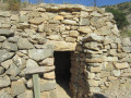
This is a themed route, linked to the numerous quarries in the region. More specifically, it involves visiting some of the stonemasons’ huts by making a return trip to these huts whilst following the circular route of this walk.
The peaks of the Sierra del Flare and Alt Redo towards Biar
 6.88 mi
+3,337 ft
-3,278 ft
6h 05
 Difficult
Departure from Biar (Alacant / Alicante)
A superb hike to explore several peaks over 1,000 metres high near the village of Biar in the province of Alicante. The spectacle of the surrounding mountains is fantastic, with their vertical cliffs. What’s more, the route follows part of a botanical trail, allowing you to learn more about the plants.
The summit of Don Pedro in Salinas
 6.24 mi
+1,647 ft
-1,493 ft
4h 20
Moderate
Departure from Salinas (Alacant / Alicante)
The summit of Don Pedro (Alto de Don Pedro) is a modest peak at an altitude of 817 metres, but it offers beautiful views of the neighbouring peaks such as the Sierra de Salinas and the Maigmo. You can walk along lovely, relatively easy paths and discover traces of an Iberian tribe. In short, it’s a spot well worth exploring.
The Pic de la Blasca in Baneyres de Mariola, in the province of Alicante
 7.39 mi
+2,513 ft
-2,500 ft
4h 30
Moderate
Departure from Banyeres de Mariola (Alacant / Alicante)
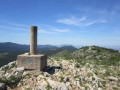
A hike to the highest peak in the Baneyres de Mariola area, a village in the Province of Alicante. Most of the route follows wide paths surrounded by meadows or trees. However, the majority of the elevation gain occurs over a short distance.
The route suggested here is known locally as the PR®-CV 313 (short for Pequeno Recorrido de la Comunidad Valenciana) and is signposted in white and yellow. It is easy to follow if you pay a little attention, as there are numerous signposts in addition to the coloured markings.
Around Sardinola from the Elurretxe Pass
 3.58 mi
+820 ft
-787 ft
2h 20
Moderate
Departure from Irun (Gipuzkoa)
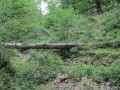
Sardinola is a small peak in the region, just over 500 metres high. The route suggested here goes all the way round it. It is a pleasant walk, generally along wide paths through woodland or meadows. You can enjoy beautiful views of the ‘Three Crowns’ peaks as well as Hendaye Bay, and you’ll usually come across numerous herds of livestock (please do not disturb them). You’ll also discover snow pits that were once used to make ice.
The Exkax and Putrarrita peaks from Eskas
 2.25 mi
+397 ft
-400 ft
1h 25
Easy
Departure from Goizueta (Navarre)
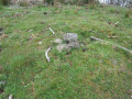
A short and pleasant hike in the Aiako Harria Natural Park, right in the heart of the forest. However, you’ll need to be prepared to go off-track (easy) as the paths become a bit overgrown. Using the GPS track is therefore recommended. You’ll climb two peaks of just over 700 m. This is a family-friendly hike offering beautiful scenery.
Around Maigmó from El Aljibe near Agost
 7.11 mi
+2,904 ft
-2,730 ft
5h 50
Moderate
Departure from Tibi (Alacant / Alicante)
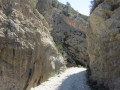
The Maigmó, at an altitude of 1,295 metres, is one of the region’s best-known peaks. However, this walk does not take you to the summit itself, but instead offers an extraordinary circuit around it. After a steep climb to the Balcon d’Alicante, where the view is fantastic, the walk takes you via the famous Col de la Xau, offering magnificent views of the peaks. You follow a barranco (a stream bed), passing through the superb spot known as ‘El Estret’. In short, everything is beautiful and practically in perfect solitude.
Llobera, Torreta and Pantano in Elda
 4.63 mi
+522 ft
-525 ft
2h 35
Easy
Departure from Elda (Alacant / Alicante)
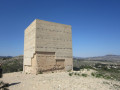
A walk around Elda to see some of its most characteristic spots. Firstly, the walk takes you up to a few peaks overlooking the town and past the remains of a15th-century defence tower at an altitude of 550 metres. You’ll then stroll along the River Vinalopó via a lovely, secluded path and discover the17th-century dam built across the river, enjoying the experience of walking across it.
The Mill Trail in Tibi
 3.29 mi
+607 ft
-449 ft
2h 05
Easy
Departure from Tibi (Alacant / Alicante)
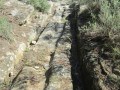
Here, we suggest exploring the old mills of Tibi, which once produced flour or paper. There were once as many as 11 mills in the area. You can see the main gate of the Groc mill at the crossroads at the entrance to Tibi. For your information, the rating established by the French Hiking Federation (FFR) gives an IBP of 22, which classifies this walk as ‘easy’.
It is an easy walk that generally follows the river known as the ‘Riu de Montnègre’ or ‘Rio Verde’.
The Cabeço Redondo and Cabec Redo peaks as seen from Tibi
 4.57 mi
+2,415 ft
-2,425 ft
4h 10
Moderate
Departure from Tibi (Alacant / Alicante)
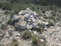
This walk takes you to two peaks over 1,000 metres in altitude amidst fantastic scenery near Penya Mitjorn. It is a fairly short walk but has an elevation gain of almost 600 metres, which means the climb is quite steep right from the start and continues steadily.
La Font de Partegat and La Font del Moli: a circular route from Benifato
 5.96 mi
+1,280 ft
-1,253 ft
3h 50
Moderate
Departure from Benifato (Alacant / Alicante)
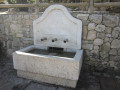
This is a very classic walk between two springs that were of great importance in people’s lives. The suggested route comprises two shared sections (there and back) near the two springs and a circular section. The walk follows wide paths with no particular difficulty, set in exceptional scenery at the foot of the Sierra d’Aitana, which includes the highest peak in the province of Alicante.
The Del Humo Cave in the Sierra de Fontcalent
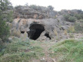 2.54 mi
+400 ft
-377 ft
1h 30
Easy
Departure from Alacant / Alicante
In the Sierra de Fontcalent, the mountain range closest to Alicante, there are numerous caves, but some are difficult to access. This walk takes you to explore a cave that is easily accessible. It is a short walk with little elevation gain that can be enjoyed by the whole family.
The Banyeres de Mariola Windmill Route
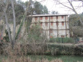 2.97 mi
+164 ft
-167 ft
1h 30
Easy
Departure from Banyeres de Mariola (Alacant / Alicante)
The Mill Trail offers an insight into part of the industrial history of the town of Banyeres de Mariola. This walk allows you to discover three flour and paper mills. There used to be many more. It follows the River Vinalopo through very pretty countryside. It is an easy walk suitable for the whole family.
A stroll through Irun
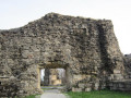 3.60 mi
+364 ft
-364 ft
2h 00
Easy
Departure from Irun (Gipuzkoa)
Here we suggest an urban walk through Irun – or rather a stroll – suitable for everyone. We’ll visit some of the town’s most iconic spots, whilst also discovering historical traces dating back to both the Middle Ages and more recent times.
A tour of Zarautz
 2.09 mi
+430 ft
-433 ft
1h 20
Easy
Departure from Zarautz (Gipuzkoa)
This short hike allows you to discover some of the sights of the town of Zarautz, including its famous beach and a few historical monuments. It is therefore a semi-urban hike. The first part takes place in the town. The second part takes you through Vista Alegre Park, where you climb to higher ground and quickly leave the town behind. The return journey is through the forest.
San Marco and the summit of Txoritokieta near Errenteria.
 3.55 mi
+761 ft
-761 ft
2h 20
Moderate
Departure from Errenteria (Gipuzkoa)
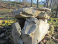
The Fort of San Marco is a military construction located at the top of Mount Bizarain at an altitude of 260 metres. It was built in 1880, near the village of Errenteria, to defend San Sebastián and the region from French attacks by land and sea. It is an excellent vantage point offering beautiful views of San Sebastián, Pasaia and Txingudi Bay.
The hike described here also offers the chance to discover some dolmens and take trails that are somewhat hidden in the forest. It may be useful to bring pruning shears to cut back any brambles or ferns that may have invaded the path.
Plaiaundi Ecological Park in Irun from Ficoba
 3.39 mi
+20 ft
-20 ft
1h 35
Easy
Departure from Irun (Gipuzkoa)
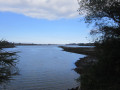
Plaiaundi Ecological Park is located in Irun, between the Bidassoa River, the Jaizubia Stream and Txingudi Bay. Inside the park, there is an interpretation centre providing information.
There are numerous observation points along the route where you can watch the birds without disturbing them. There are also many information panels and benches.
The park serves as a refuge for migratory birds due to its location at the foot of the Pyrenees. It has two saltwater lagoons and one freshwater lagoon.
With virtually no elevation gain, it is a great place for a family outing.
The Atxuria from the Col d'Urbia via the Col des Trois Bornes
 5.37 mi
+1,342 ft
-1,329 ft
3h 40
Moderate
Departure from Zugarramurdi (Navarre)
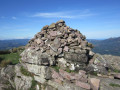
A climb up to Atxuria (or Peña Plata), which is not the classic route from the Caves of Sare. You’ll walk along some very beautiful paths, discover prehistoric remains, follow the borderline with a few boundary stones, and often find yourself in the middle of the forest.
For information: IBP = 51
The Argangoieta summit from Urdax
 3.42 mi
+820 ft
-820 ft
2h 15
Easy
Departure from Urdazubi/Urdax (Navarre)
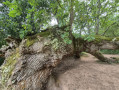
Two kilometres from Dantxaria, the village of Urdax is well worth a visit. Here you can explore a few places in the village. But above all, take a walk around the village in the middle of the woods. It is a fairly short hike that can be used as training, but nevertheless the route climbs and descends quite a bit. As for the proposed summit, it is easily recognisable with its large antennas.
A trip along the River Ibaia from Altzibar to Elizalde
 4.40 mi
+417 ft
-394 ft
2h 25
Easy
Departure from Oiartzun (Gipuzkoa)
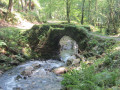
A lovely family walk along the River Ibaia with plenty of spots where you can take a dip if you fancy. But you’ll also learn a bit about the region’s history. As the route passes through a tunnel, you must carry a torch with you.
The quarry tour in Dantxarinea
 3.62 mi
+699 ft
-686 ft
2h 15
Easy
Departure from Urdazubi/Urdax (Navarre)
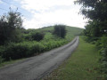
A short hike around Dantxarinea (Dantxaria) in the middle of the forest, ideal for families and to work up an appetite before heading to one of the many ventas in Dantxarinea.
The Arritxurieta summit from Altzibar to Oiartzun
 6.22 mi
+1,519 ft
-1,519 ft
4h 10
Moderate
Departure from Oiartzun (Gipuzkoa)
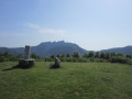
We set off to explore a lovely peak. Although you have to take a quiet tarmac road at the start, which is a bit tedious, the path is very scenic afterwards, either lined with trees or following rivers.
The Carrasca snow well near Castalla
 3.50 mi
+784 ft
-787 ft
2h 20
Easy
Departure from Castalla (Alacant / Alicante)
In the Alicante region, snow wells are called "pou" or "pou de neu" in the Valencian dialect. They are round wells dug into the ground with stone walls and a dome. There are usually two doors, one for putting snow in and the other for taking ice out. They are, of course, located at high altitude. The snow industry, which can be traced back to 1630, was very prosperous until the advent of refrigerators in the 1960s. Here we suggest a short, easy hike to discover one of the most beautiful snow wells in the region.
Alt del Bubo and Alt de la Casa Castalla starting from Castalla
 8.02 mi
+1,273 ft
-1,273 ft
4h 50
Moderate
Departure from Castalla (Alacant / Alicante)
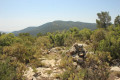
This hike takes you up two little-known peaks over 1,000 metres high near Castalla. Most of the time, you will be walking on wide paths lined mainly with almond trees in deserted areas.Prohibited during hunting season
Summit of La Replana and Font del LLop near Castalla
 6.26 mi
+1,660 ft
-1,647 ft
4h 20
Moderate
Departure from Castalla (Alacant / Alicante)
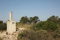
This is an easy hike, mostly on wide paths, to climb a peak at an altitude of 1,229 metres. The ascent is fairly gradual. You will pass by a superb snow well. Optionally, you can also visit a fountain.
Relleu footbridge
 5.73 mi
+801 ft
-761 ft
3h 20
Easy
Departure from Relleu (Alacant / Alicante)
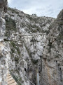
The footbridge is a wooden walkway attached to the wall of the canyon formed by the Amadoria River and known as Estret del Pantà (the strait of the dam). Below, there is a drop of between 20 m and 60 m, depending on the location. There are also two glass overhangs for the more daring. The walkway, which is a round trip, was installed in 2022. It is a vertiginous walkway above the ravine and is not recommended for those who suffer from vertigo.
El Penyo Mulero in the Serra d'Aitana
 6.88 mi
+2,651 ft
-2,638 ft
5h 30
Difficult
Departure from Benimantell (Alacant / Alicante)
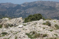
The Sierra de Aitana has the highest peaks in the province of Alicante. This route explores an extreme part of the sierra, on the Benimantell side, with a climb to a peak over 1,300 m. This hike is rated difficult due to the long climbs and constant exposure to the sun.
The road from Salt to Santa Pola
 6.09 mi
+305 ft
-279 ft
3h 05
Easy
Departure from Santa Pola (Alacant / Alicante)
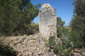
This is an almost entirely flat, easy hike that allows you to discover the wild surroundings of Santa Pola, but it is always in full sun. You will discover traces of human activity from the early 20th century, such as a mill and water management systems for agriculture, as well as the beautiful landscape of the Barranc de Salt.
La Moleta de Aitana from Font de l'Arbre near Confrides
 2.99 mi
+948 ft
-968 ft
2h 10
Moderate
Departure from Confrides (Alacant / Alicante)
In the Sierra de Aitana, the highest point is called Aitana and, at 1,559 metres above sea level, it is also the highest point in the entire province of Alicante. Just behind it, Moleta d'Aitana, at an altitude of 1,499 metres, is the second highest peak and easier to access by following this route. See Practical Information for details of the difficulties encountered.
Pou del Canonge in Ibi
 7.21 mi
+1,289 ft
-1,283 ft
4h 25
Difficult
Departure from Ibi (Alacant / Alicante)
The word "pou" is Valencian and means snow well. This was a very important trade involving the manufacture of ice from snow, which was more abundant at that time. This activity, which began in the 16th or 17th century, came to an end in the mid-20th century with the advent of the refrigerator.This trail offers a chance to see the remains of the snow well known as del Canonge, but most of the route is off-trail and requires some mountain experience and good navigation skills. This hike is therefore only suitable for experienced hikers.
Please note: Due to the difficulty of navigating this route, it is strongly recommended that you use the app (or a hiking GPS)
The summit of Escobella near Agost
 6.78 mi
+1,371 ft
-1,352 ft
4h 20
Moderate
Departure from Tibi (Alacant / Alicante)
A hike in an almost desert environment to climb two peaks: La Mosca and L'Escobella. Don't forget to bring plenty of water, as the entire route is on paths exposed to the sun.
Mas de Tetuan from Font Roja near Alcoi
 3.50 mi
+932 ft
-902 ft
2h 25
Easy
Departure from Alcoi / Alcoy (Alacant / Alicante)
In the Font Roja Natural Park, there is an easy hike to stretch your legs or enjoy with the family (but wear hiking boots), following wide trails through the forest.
The caves of Agua, Olm and the summit of El Xocolate in Petrer
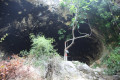 5.24 mi
+1,663 ft
-1,657 ft
3h 50
Difficult
Departure from Petrer (Alacant / Alicante)
This hike takes you up to one of the peaks in the province of Alicante, which is over 1,000 metres high. While the climb to the summit is not particularly difficult, the start of the hike involves exploring some well-hidden caves. This means passing through areas where there is virtually no path and having a good sense of direction. This hike is therefore not suitable for everyone.
The source of the Rio Salinetes and the Clot de la Sal near Novelda
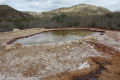 7.14 mi
+525 ft
-535 ft
3h 45
Moderate
Departure from Novelda (Alacant / Alicante)
This is a beautiful hike starting from the stunning Santuario de Santa Maria Magdanela (a must-see). You then set off in search of the source of a small river and finish with a dip in the thermal baths.
San Martial in a circular route near Irun
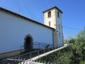 3.93 mi
+702 ft
-719 ft
2h 25
Easy
Departure from Irun (Gipuzkoa)
A pretty loop near the town of Irun to climb to the summit of San Martial, then on to the Ermita de San Martial with its exceptional view over the bay of Txingudi.Please note: due to the presence of numerous hunting posts, this hike should not be attempted during the pigeon hunting season.
Elatzeta circular starting from Irun
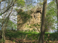 4.15 mi
+1,040 ft
-1,024 ft
2h 50
Moderate
Departure from Irun (Gipuzkoa)
Very close to the town of Irun, this route takes you into the heart of nature, where you can breathe in the fresh air far from the traffic. You will climb a small hill, but you will also learn a little history as you discover an ancient tower that was once used to defend the town of Irun.
The summit of Zubeltzu near Irun
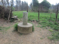 3.13 mi
+604 ft
-591 ft
2h 00
Easy
Departure from Irun (Gipuzkoa)
A lovely little hike very close to the town of Irun, but taking place entirely in the woods. In addition to breathing in the fresh air, you will visit a historical site where you can see one of the two towers that remain today, which were used to defend the town of Irun.
Circular tour of Lake Arritzulegi from Ituren
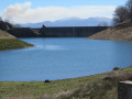 5.98 mi
+2,231 ft
-2,228 ft
4h 40
Difficult
Departure from Ituren (Navarre)
Lake Arritzulegi is better known as Lake Mendaur, as it lies at the foot of this peak. It is actually a dam lake. Located at an altitude of 700 m in a very pretty setting, it makes for a beautiful hiking destination. However, I would describe this hike as difficult, partly because of the elevation gain and partly because some of the paths that still appear on maps have disappeared. This means that part of the hike is off-trail and without many landmarks. You therefore need to have a good sense of direction and be used to walking off-trail. This hike is therefore only suitable for experienced walkers.The Visorando app is recommended.
The Artola in the Jaizkibel from Santa Barbara
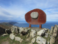 3.53 mi
+906 ft
-1,099 ft
2h 25
Easy
Departure from Hondarribia/Fontarrabie (Gipuzkoa)
A round trip hike in the Jaizkibel massif, allowing you to reach the summit of Artola, where there is a sculpture dedicated to the friendship of peoples, the work of sculptor Remigio Mendiburu. It is an easy hike, accessible to all.
A route to Zuhalmendi from Sare
 3.77 mi
+830 ft
-830 ft
2h 25
Moderate
Departure from Sare (Pyrénées-Atlantiques)
A route to the summit of Zuhalmendi, featuring traces of the past along the way, such as wayside shrines, a wash house and a redoubt, as well as the chance to learn about pig farming.
The Arraskuelarre peak and the Gainzabal dolmen in Elizalde
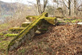 4.44 mi
+604 ft
-604 ft
2h 35
Easy
Departure from Oiartzun (Gipuzkoa)
This route around Elizalde, which takes you up to a small peak, follows part of a ‘Voie verte’ – a former railway line that ran from Artikutza to Renteria or Arditurri and was mainly used to transport ore. You’ll also be walking a lot on tarmac tracks, but there’s very little traffic.
El Mendibeltz (Belitz), Arburu, Sardinola, Gogortegiko near Ellurretxe
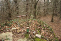 6.90 mi
+1,637 ft
-1,617 ft
4h 35
Moderate
Departure from Irun (Gipuzkoa)
A hike after passing the Elurretxe Pass through the forest with numerous streams and therefore sometimes muddy paths. During the hike, you will climb several peaks: Belitz, Arburu, Sardinola and Gogortegiko.
The Gartzin bunker in Ibardin
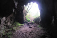 2.52 mi
+522 ft
-535 ft
1h 35
Easy
Departure from Urrugne (Pyrénées-Atlantiques)
This hike takes you to a large bunker that runs through the mountain and was part of the defensive structures built along the border during Franco's time to prevent a possible invasion from France. But the views of the surrounding landscape are very beautiful.
The summit of Urkabe and the Peñas de Arkale as seen from Gurutze
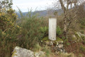 3.98 mi
+830 ft
-791 ft
2h 35
Moderate
Departure from Oiartzun (Gipuzkoa)
This walk takes you past the summit of Urkabe, one of the region’s most iconic peaks. You’ll then follow a superb, though more challenging, ridge path to reach the Peñas d’Arkale, but the effort is rewarded with stunning views and a magnificent finish at Beloaga Castle.
The Mos del Bou and Moleta peaks near Tibi
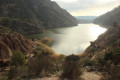 4.16 mi
+1,181 ft
-1,175 ft
2h 55
Difficult
Departure from Tibi (Alacant / Alicante)
A superb hike with exceptional views of Lake Tibi and impressive peaks to climb. However, it is a difficult hike with some very steep climbs and a path that is quite difficult to follow.
A GPS track is essential to avoid getting lost.