Country:

 City:


The starting point for this walk is in the car park at Klarene Plaza in Altzibar.
To get to this starting point by car, see the practical information section below.
(S/E) Return to the car park entrance and cross the bridge.
(1) Take the first street on the left. Then follow this tarmac road, which is fortunately fairly quiet once you’ve left the village, but which does climb quite steeply.
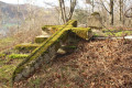
(2) At the gate on the right, leave the road to the left to enter the woods and see the Gainzabal Dolmen, marked by a small boundary stone. For a non-expert, it’s not very obvious. Then rejoin the road.
(3) At this large crossroads, take the road on the right and, by the house, note the various water fountains. This is also where the tarmac road ends. From here on, the rest of the route is magnificent.
(4) You’ll come out onto a very short stretch of road that forms part of a GR® route: this is the PR®-GI 1006 Aiako Harria. Follow the white and yellow markings. Turn left almost immediately, then straight away to the right.
(5) At the junction of the paths, carry on straight ahead, then turn immediately onto the path on the left.
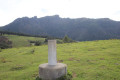
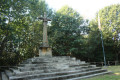
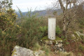
(6) Take the path that branches off slightly to the left, marked with white and yellow markings. Reach the summit of Arritxurieta at an altitude of 456 metres, marked by a geodetic marker – a cylinder on a cube – and a cromlech.
(7) Begin the descent until you reach a crossroads with a signpost indicating three directions.
(8) Continue to the right along the concrete path; after a hairpin bend, you’ll reach another crossroads.
(9) Turn sharply left to rejoin the path marked in white and yellow; this is the PR®-GI 1007 Artikutza.
(10) At the signpost, turn left towards Zorrola.
(11) Cross the River Ibaia via the bridge, following the signs for Sorondo. From here on, you’ll be following the river almost the whole way.
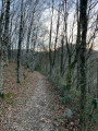
(12) Take the path that leads down to the river on the right (the one on the left leads onto private property). Go through a gate. Don’t forget to close it behind you. Follow a very pleasant path alongside the stream.
(13) Cross the river via a bridge and immediately take a track on the right reserved for cyclists and pedestrians.
(14) Carry on until you reach a junction you passed at the very start of the walk.
(1) Cross the bridge, keeping to the left, to return to the Klarene Plaza car park in Altzibar (S/E).
 Visorando Member
 Easy

 Association / Club / Walk leader