The summit of Don Pedro in Salinas

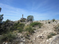
The summit of Don Pedro (Alto de Don Pedro) is a modest peak at an altitude of 817 metres, but it offers beautiful views of the neighbouring peaks such as the Sierra de Salinas and the Maigmo. You can walk along lovely, relatively easy paths and discover traces of an Iberian tribe. In short, it’s a spot well worth exploring.

Details

98346176
Creation:
Last update:
Last review:
  • Walking
    Activity: Walking
  • ↔
    Distance: 6.24 mi
  • ◔
    Average duration: 4h 20 
  • ▲
    Difficulty: Moderate

  • ⚐
    Back to start: Yes
  • ↗
    Ascent: + 1,647 ft
  • ↘
    Descent: - 1,493 ft

  • ▲
    Highest point: 2,795 ft
  • ▼
    Lowest point: 1,627 ft

Description of the walk

The starting point for this walk is at the Casa del Puntal, now home to the Bodega Rafa Cañizares, situated on the CV-830 after kilometre 7 between Salinas and Monovar.
To get to this starting point by car, see the ‘Practical Information’ section below.

(S/E) Take the path that runs past the information sign and heads uphill. The walk is known locally as the PR®-CV 165 and is therefore marked in white and yellow. It is very easy to follow, especially as there are signposts in addition to the coloured markings. Continue straight on at the two junctions you come to.

(1) You’ll see a watering trough on the left; join a very wide path and follow the signpost, turning left.

(2) There’s a lovely view of the summit from here. Take the small path slightly to the left.

(3) You’ll reach a large cairn; head left and back again to reach the summit. Follow the signposted direction ‘Cumbre Alto de Don Pedro’.

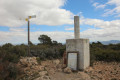
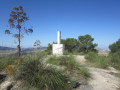
(4) This summit is marked by a triangulation point (a cylinder on a cube) and a cairn. Take in the 360° view. Retrace your steps.

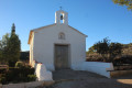
(3) You can return by retracing your steps, but for a circular route, follow the PR®-CV 165 signpost to Ermita de San Isidro, i.e. head left. Descend, always following the white and yellow markings.

(5) When you reach the bottom of the descent, do not follow the sign for Ermita de San Isidro any further; instead, take the wide path on the right. This also means you should no longer follow the white and yellow markings.

(6) Take the very narrow path on the right which leads into the forest.

(7) At the junction, take the path on the right.

(8) You’ll come out onto a wide track; follow it to the left.

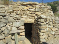
(9) You’ll come to some ruined houses. One of these houses still bears the number 136. Opposite this house, take the path leading off to the right.

(10) You’ll come out onto a wide track, with a wire fence in front of you. Turn right. You’ll find yourself back at the drinking trough you saw earlier.

(1) Retrace your steps along the path you came along, turning left towards “Pozzo casa del Puntal”. At the junction, take the path on the right.

(11) You’ll come to another path; take it, heading to the right.

(12) Continue along this path, staying on the ridges.

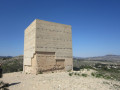
(13) You will reach the archaeological site marked by a round monument on a cube.
Research has confirmed the presence of a settlement between 375 and 350 BC. A necropolis and fifteen dwellings have been discovered at this site. The finds are on display in the museums of Villena, Elda and Salinas.
Continue down the slope, then retrace part of the route you have already taken, turning right to return to the car park (S/E).

Waypoints

  1. S/E : mi 0 - alt. 1,631 ft - Casa del Puntal
  2. 1 : mi 0.78 - alt. 2,060 ft - Signpost
  3. 2 : mi 1.88 - alt. 2,425 ft - View, post and cairn
  4. 3 : mi 2.56 - alt. 2,776 ft - Large cairn
  5. 4 : mi 2.61 - alt. 2,795 ft - Don Pedro Peak
  6. 5 : mi 3.43 - alt. 2,333 ft - At the bottom of the descent, signpost
  7. 6 : mi 4.01 - alt. 2,011 ft - A narrow lane
  8. 7 : mi 4.38 - alt. 2,021 ft - Turn-off
  9. 8 : mi 4.51 - alt. 2,067 ft - Junction
  10. 9 : mi 4.96 - alt. 1,854 ft - Ruins
  11. 10 : mi 5.35 - alt. 1,864 ft - Wire fencing
  12. 11 : mi 5.76 - alt. 1,991 ft - Junction with another path
  13. 12 : mi 5.93 - alt. 1,886 ft - Ridges
  14. 13 : mi 6.01 - alt. 1,768 ft - Poblado, archaeological site
  15. S/E : mi 6.24 - alt. 1,785 ft - Casa del Puntal

Notes

Driving directions to the start of the walk.

From Alicante city centre, take the A31 motorway (from Calle Mexico) towards Madrid and carry on straight ahead on the A31.
Take exit 196 for Sax (on the sign). Go over the motorway and, at the roundabout, turn right towards the CV-829 to Sax.
Cross the River Vinalopo and, at the roundabout, take the third exit onto the CV-830 towards Salinas.
Continue in this direction on the CV-830 to Salinas.
Pass the sign for the entrance to Salinas and continue on the CV-830, but this time towards Monóvar and Pinoso.
After the 7-kilometre marker (which you’ll see on the left-hand side of the road at the spot marked ‘Camino de la casa de Plaza’), just as you enter the bend to the right, look out for the sign on the left saying ‘Bodegas Rafa Cañizares’ and, 10 metres further on, turn onto the track on the right (you’ll see the usual yellow and white signposts indicating walking routes, and opposite there’s a sign for ‘Camino de la Laguna’). Drive on a little further and park near the information board.

The place is called Pozo de la Casa del Puntal. This is the old name, still used locally, for the building you can see, which has been restored and converted into the Bodega Rafa Cañizares. The ‘pozo’ in question is a well that has been restored and stands by the roadside: it dates from 1893.

For your information, the journey by car from Alicante is approximately 58 kilometres and takes around 45 minutes.

Worth a visit

Do visit the Bodega Rafa Cañizares, just a few metres from the car park – they produce some excellent wine.

Always be cautious and plan ahead when you're outdoors. Visorando and the author of this route cannot be held responsible for any accidents occurring on this route.

The GR® and PR® markings are the intellectual property of the Fédération Française de Randonnée Pédestre.

Other walks in the area

For more walks, use our search engine .

The GPS track and description are the property of this route's author. Please do not copy them without permission.