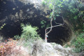
The shelters of the stone-breakers at the Novelda quarries

This is a themed route, linked to the numerous quarries in the region. More specifically, it involves visiting some of the stonemasons’ huts by making a return trip to these huts whilst following the circular route of this walk.

Details

98672921
Creation:
Last update:
Last review:
  • Walking
    Activity: Walking
  • ↔
    Distance: 2.70 mi
  • ◔
    Average duration: 1h 40 
  • ▲
    Difficulty: Easy

  • ⚐
    Back to start: Yes
  • ↗
    Ascent: + 469 ft
  • ↘
    Descent: - 466 ft

  • ▲
    Highest point: 1,342 ft
  • ▼
    Lowest point: 1,089 ft

Description of the walk

The starting point for this walk is the car park at the Santuario de Santa Maria Magdanela in the town of Novelda.
To get to this starting point by car, see the ‘Practical Information’ section below.

For information, the rating established by the French Hiking Federation (FFR) is as follows: IBP = 27, length = 4.14 kilometres and elevation gain = 148 metres. (These figures may sometimes differ from those given by Visorando; in this case, always use the higher figures to get an idea of the hike’s difficulty).

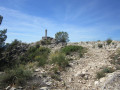
This “educational” route is known locally as SL-CV 174 and is signposted in white and green. It is therefore very easy to follow by keeping an eye on these colours.

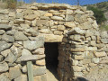
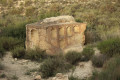
There are around a dozen listed huts. We will visit five of them, the ones closest to the main route we are following. Each time, we will make a return trip. For each one, you will find a sign by the side of the path indicating the direction to follow. They are all built of dry stone and served as temporary accommodation for workers between the 19th century and the early 20th century.

(S/E) From the car park, head back along the road you have just come along and, on the descent, look out for the post on the right with green and white markings and take this path uphill. Shortly afterwards, you’ll reach the Mola viewpoint, where you’ll have fantastic views of the sanctuary and the castle.

(1) Refuge number 1. Take the small path on the right and walk there and back to see the first refuge. This is undoubtedly the one that will require the most effort, as it is the furthest from the main path and involves a short climb. It is truly superb, built entirely of stone. Admire the way the stones in the ceiling are laid.

(2) Refuge number 2, very close to the path.

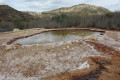
(3) Shelter number 3: much larger than the others and close to the quarry

(4) Shelter number 4: about 10 metres from the main path.

(5) Shelter number 5: head down a few metres.

(6) Walk down a little to see the Casa Cova del Tollo, which is a house in a cave.

(7) Make sure you spot this change of direction: turn right where there are wooden safety barriers and a small flight of steps.

Follow the path to return to the car park where you started. (S/E)

Waypoints

  1. S/E : mi 0 - alt. 1,102 ft - Car park at the Santuario de Santa Maria Magdanela
  2. 1 : mi 0.71 - alt. 1,335 ft - Refuge 1
  3. 2 : mi 0.88 - alt. 1,194 ft - Refuge 2
  4. 3 : mi 1.01 - alt. 1,286 ft - Refuge 3
  5. 4 : mi 1.36 - alt. 1,260 ft - Refuge 4
  6. 5 : mi 1.42 - alt. 1,266 ft - Refuge 5
  7. 6 : mi 1.85 - alt. 1,201 ft - Casa Cova
  8. 7 : mi 1.95 - alt. 1,138 ft - Junction
  9. S/E : mi 2.7 - alt. 1,093 ft - Car park at the Santuario de Santa María Magdanela

Notes

There are about a dozen listed huts. We’ll visit five of them – the ones closest to the main route we’ll be following. We’ll do a round trip to each one. For each hut, you’ll find a sign by the side of the path indicating the direction to follow. They’re all built from dry stone and served as temporary accommodation for workers between the 19th century and the early 20th century.

Driving directions to the start of the walk.
From Alicante city centre, take the A31 motorway (from Calle Mexico) towards Madrid and continue straight on along the A31.
Take exit 216 for Novelda (sur) / Agost.
At the roundabout, take the3rd exit towards Novelda.
Drive under the motorway bridge you have just left and, at the roundabout, take thefirst exit towards the CV-820 / Novelda (east).
At the next roundabout, take thesecond exit (i.e. straight on towards the Nero marble works) onto the CV-820.
At the next roundabout, take thesecond exit (which is actually straight on towards McDonald’s).
At the roundabout, take thesecond exit towards Novelda Norte. You’ll then be on the N-325 or Av. Vinalopó.
Further on, at the junction, head left towards the A31 Madrid / Centro Urba, but at the ‘give way’ sign, take the road directly opposite (C. Dos de Mayo), continue to the stop sign and turn right onto Calle P. de los Molinos or the CV-832.
Carry on for quite a while and, after a short while, you’ll come to a dead end ahead of you: turn left (in other words, just follow the road). Carry on until you reach the car park at the Santuario de Santa Maria Magdanela (where there are toilets).

As a guide, the journey by car from Alicante took about 30 km in around 30 minutes.

Worth a visit

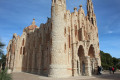
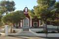
It’s practically a must to visit the Santuario de la Magdanela, a masterpiece of modern art in the style of Gaudí, just 100 metres from the car park.

- The Santuario de Santa Maria Magdanela
It is a project by the local architect José Sala Sala, who was heavily inspired by Gaudí.
It was built in three phases between 1918 and 1946.
Its main façade consists of two 25-metre-high side towers and a stone cross.
As for the interior, it is shaped like a vase, evoking the jar of ointment that Mary Magdalene brought to Jesus. This shape is unique in the world and, at the back, in the apse, is the niche dedicated to Saint Mary Magdalene.
It is included on the European Modernism Route.

- The castle
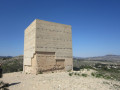
This castle is in the Islamic style of the late 12th century, but with Christian influences following the expulsion of the Muslims from the entire Mediterranean coast at the end of the 14th century.
Of particular note are its square tower and its triangular tower, which is quite rare.
It has been designated a Site of Cultural Interest since 1931.

Other walks in the area

For more walks, use our search engine .

The GPS track and description are the property of this route's author. Please do not copy them without permission.