Country:

 City:


The starting point for this walk is at the car park of Irun cemetery (Blaia cemetery).
To get to this starting point by car, please see the ‘Practical Information’ section below.
For information, the rating established by the French Hiking Federation (FFR) is as follows: IBP = 22, length = 5.7 km and elevation gain = 80 m. (These figures may sometimes differ from those given by Visorando; in this case, always use the higher figures to get an idea of the hike’s difficulty).
(S/E) From where you have parked, walk back a short way along the stretch of road you have just come along and turn right.
(1) You’ll reach the ruins of Gatzeluzar Castle; walk around them. This castle was built on a hill in 1512 and the following years to control the ford across the River Bidasoa. It was restored by the municipality of Irun in 2023.
Return to the path, cross the road and, taking the road on the right, head down towards Béhobie and its inns.
(2) After passing through the shops, you will come to a monument with columns. This is the former customs house. It was built in 1850 and subsequently remodelled in 1952. Having fallen into disuse, it was restored in 2016 and has since become a meeting place for older people. There are currently plans to carry out a further conversion to transform it into a new 1,000-square-metre centre for cutting-edge scientific and technological research in the field of biology.
Continue along the route and pass El Trinkete, at number 38, an18th-century building. Then, a little further on, turning to the right, head towards the banks of the River Bidassoa.
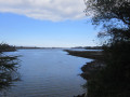
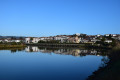
(3) Note the island in the middle of the river and a commemorative monument. This small island, known as Île des Faisans or Île de la Conférence, is the world’s smallest condominium, meaning it is administered jointly by France and Spain. To be precise, the island is French from 1 August to 31 January, and becomes Spanish from 1 February to 31 July. Furthermore, it has served as a venue for diplomatic meetings on numerous occasions. It was here that the Treaty of the Pyrenees, which brought the war between Spain and France to an end, was signed. It was also here that Louis XIV met Marie-Thérèse of Austria, his future wife: the wedding was celebrated in Saint-Jean-de-Luz.
A little further on, after crossing a stretch of water, enter Osinbiribil Park.
(4) You’ll reach the ruins of the former carabiniers’ barracks and continue along the banks of the Bidasoa.
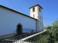
(5) Stop in front of the sculpture installed in 1984, “Laiak”, by Gabriel Narzabal Gonzalez. This sculpture is 4.5 m high, 2.5 m wide and weighs 9.5 t. “Laiak” were agricultural tools still in use in the 1950s for ploughing the land. Continue on to the Ermita de Santa Elena, which, in its present form, dates back to the14th century.
(6) Retrace your steps.
(7) Walk past the Santa Elena fountain, which dates from 1677, and turn right towards a roundabout.
(8) Go down the steps, take the second street on the right (Alzukaitz kalea) and continue to a junction.
(9) Carry on straight ahead, taking the road that goes uphill (Blaia Ibildidea). This will take you to the cemetery; then, turning right, you’ll reach the car park (S/E).
 Association / Club / Walk leader

 Moderate

 Visorando Member