The Banyeres de Mariola Windmill Route

The Mill Trail offers an insight into part of the industrial history of the town of Banyeres de Mariola. This walk allows you to discover three flour and paper mills. There used to be many more. It follows the River Vinalopo through very pretty countryside. It is an easy walk suitable for the whole family.

Details

92425092
Creation:
Last update:
Last review:
  • Walking
    Activity: Walking
  • ↔
    Distance: 2.97 mi
  • ◔
    Average duration: 1h 30 
  • ▲
    Difficulty: Easy

  • ⚐
    Back to start: Yes
  • ↗
    Ascent: + 164 ft
  • ↘
    Descent: - 167 ft

  • ▲
    Highest point: 2,530 ft
  • ▼
    Lowest point: 2,352 ft

Description of the walk

The starting point for this hike is located at the “Area Recreativa del Moli l’Ombria” in Banyeres de Mariola.
To get to this starting point by car, see the “Practical Information” section below.

For your information, the rating established by the French Hiking Federation (FFR) is as follows: IBP = 20, length = 4.78 kilometres and elevation gain = 68 metres. (These figures may differ from those given by Visorando; in this case, always use the higher figures to get an idea of the hike’s difficulty).

The Moli l’Ombria recreational area is closed from November until Easter. This means that during this period, picnicking or camping (in any form) is prohibited there. However, a passenger vehicle may park there for one day.

Historical information can be found in the "Places to See" section at the end of the document.

(S/E) Walk back to the car park entrance and turn left onto the path. Go down the steps.

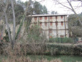
(1) You will find yourself facing a large building on the other side of the river: this is the Moli de l’Ombria. Continue along the path, cross the River Vinalopo via a small bridge and head left. Follow the signs for “Ruta dels Miradors” for a short while

(2) But immediately afterwards, take the path on the left between two low walls (like a small canal)

(3) Turn left, cross the river and turn left. A little further on, leave the road and take a path on the left.

(4) Then, at a lime kiln, turn right onto the path marked in yellow and white. This will take you almost back to the start of the walk at Moli de L'Ombria; follow the riverbank and continue straight ahead.

(5) Cross the river via a bridge and continue along the path to the right. A return section begins at this point.

(6) You’ll come to a large water reservoir, but go over it at the top. (On the way back, we suggest going around it at the bottom). Then pass Moli Sol (read the information boards).

(7) Continue on to reach Moli Pont.

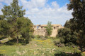
(8) And finally, finish at Moli de l'Espenta, which is somewhat overgrown but can be walked around.

Then retrace your steps, and at Moli de l'Ombria take the steps and climb back up to the car park. (S/E)

Waypoints

  1. S/E : mi 0 - alt. 2,461 ft - Moli l'Ombria Recreation Area
  2. 1 : mi 0.12 - alt. 2,457 ft - Moli de l'Ombria
  3. 2 : mi 0.33 - alt. 2,477 ft - Junction
  4. 3 : mi 0.58 - alt. 2,490 ft - Crossroads
  5. 4 : mi 0.91 - alt. 2,470 ft - Lime kiln
  6. 5 : mi 1.14 - alt. 2,474 ft - Cross the bridge
  7. 6 : mi 1.39 - alt. 2,428 ft - Water reservoir
  8. 7 : mi 1.75 - alt. 2,362 ft - El moli pont
  9. 8 : mi 2.01 - alt. 2,362 ft - The last
  10. S/E : mi 2.97 - alt. 2,457 ft - Moli l'Ombria Recreation Area

Notes

Driving directions to the start of the hike:
The starting point is accessible from the CV-795 road in Banyeres. Coming from the east, pass the sign for the entrance to Banyeres. You are now on Carrer del Conqueridor (or CV-795). When you reach a narrow section with a sign indicating both directions of traffic, turn left before passing this sign onto the small road leading downhill, called Carrer Sant Josep. Turn left in front of the company "Embalajes Alero". When you see the sign "Zona d'Acampada Moli l'Ombria", turn left and park in the car park.

For your information, the journey by car from Alicante is approximately 62 kilometres and takes around 50 minutes.

Worth a visit

Note: the word "moli" is Valencian and means mill.

The Moli de l’Ombria

This was the first paper mill, built in 1779 on the banks of the River Vinalopó. It produced paper for smoking, as well as for making stamps.

Towards the end of the 19th century, a mill for producing flour was added. It was also used for making liqueurs and, more recently, with the installation of turbines, it generated electricity.

The Moli Sol

It was built in 1856 to produce flour. Towards the end of the 19th century, it was converted into a factory producing fine paper for cigarettes. It finally closed its doors for good in 1964.

The Moli Pont

Originally built in 1758, it was converted in 1877 into a factory producing fine paper for cigarettes, like the Moli Sol. It too closed its doors for good in 1964.

A lime kiln

It transforms stone (calcium carbonate) into lime using a very intense heat, around 1000°C, for 4 to 5 days. The lime produced in this way was used in fields or on the facades of houses. This type of kiln fell into disuse around the 1950s.

Other walks in the area

For more walks, use our search engine .

The GPS track and description are the property of this route's author. Please do not copy them without permission.