The Jaime el Barbudo trail in Hondón de los Frailes

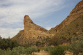
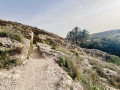
This is a walk that combines both mountain scenery and local history. The mountain aspect comes from following a very pretty path with stunning views of the surrounding mountains, organised by the town council of Hondon de los Frailes, a small village in the province of Alicante. History, because you’ll be following in the footsteps of a famous local outlaw, regarded as a Robin Hood-like figure, and discovering his hideout deep in the mountains – a place that was never found at the time of the events. Ready for an adventure?

Details

n°98903924
Creation:
Last update:
Last review:
–
  • Walking
    Activity: Walking
  • ↔
    Distance: 7.32 mi
  • ◔
    Average duration: 4h 15 
  • ▲
    Difficulty: Moderate

  • ⚐
    Back to start: Yes
  • ↗
    Ascent: + 988 ft
  • ↘
    Descent: - 1,145 ft

  • ▲
    Highest point: 2,211 ft
  • ▼
    Lowest point: 1,348 ft

Description of the walk

The starting point for this walk is on Avenida de Albareta in Hondon de los Frailes, next to the town hall (Ayuntamiento).
To get to this starting point by car, see the ‘Practical Information’ section below.

(S/E) From the car park, head back towards the road you just arrived on. Walk past the Ayuntamiento (town hall) and note the beautiful metal statue of a monk (a fraile). Turn into the first street on the right and follow it for a long way. It is a tarmac road with almost no traffic and is completely flat. Head towards the crossroads at the hamlet known as “Cases de l’Ombria”, at an altitude of 415 m.

(1) Turn right, following the sign for “Runar de Santera”. This is another tarmac road, but this time it climbs gradually. As you go, you’ll notice the crops: almonds, figs, grapes and olives. You’ll reach the hamlet known as “Runar de Santera”, also called “Rincon del Moreno”, at an altitude of 555 m. This is also where the tarmac road ends. This is where the most interesting part of the walk begins.

(2) Take the wide dirt track on the right and you’ll soon come out onto a broad path.

(3) Continue along this path to the right.

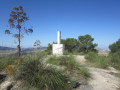
(4) Leave the path leading to the Pic de Sant Gaità on your left and carry on straight ahead towards Hondon de los Frailes. Reach the Mirador de los Frailes and , with the help of the pictures, identify the neighbouring peaks.

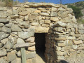
(5) Carry on to a junction near a small stone tower, where there is a signpost pointing in several directions. From here, you’ll take a round trip to visit the Sima de Jaume El Barbut (sima meaning ‘cave’). This is a more challenging section, as it involves very narrow paths where you’ll need to use your hands to get through in places. The white and yellow markings will serve as your guide.

(6) Take the path on the left.

(7) At the signpost, turn off onto the path on the right, heading towards the large electricity pylon. Pass right by the base of the pylon and continue, following the numerous white and yellow markings. You’ll reach the Jaime el Barbut cave, a large, narrow crevice in the rock. At the start, there are a few steps which you can carefully descend, but the rest of the cave requires special equipment. In any case, if you’re on your own, you must not go inside.

(8) Return along the same route to the signpost.

(6) Turn left, towards “Corral del Sastre”, and carry on until you reach an information board.

(9) Keep to the left and continue following the white and yellow markings. Do not head straight for the road, but take the small path on the left which runs alongside it and leads to the Puerto de Albatera at kilometre 11 of the CV-973 road. This spot is also known as the Collado de la Algüeda.

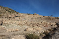
(10) Cross the road and take the path opposite, which goes straight ahead. You’ll soon reach the ruins of the Corral del Sastre (which you may wish to visit, taking care).

(11) Once you have passed all the buildings, follow the path on the right which leads downhill. You will come to a small tarmac road: there is a signpost.

(12) Turn left towards “Font Antiga”.

(13) Turn right towards the village.

(14) Turn right into Calle Castilla, then right again into Avenida Albatera to reach the Ayuntamiento and, a little further on, the car park (S/E).

Waypoints

  1. S/E : mi 0 - alt. 1,532 ft - Avenida de Albatera
  2. 1 : mi 1.7 - alt. 1,535 ft - Casas de l’Ombria
  3. 2 : mi 2.95 - alt. 1,995 ft - Runar de Santera
  4. 3 : mi 3.17 - alt. 2,103 ft - Wide path
  5. 4 : mi 3.81 - alt. 2,129 ft - Signpost, straight ahead
  6. 5 : mi 4.31 - alt. 2,034 ft - Viewpoint
  7. 6 : mi 4.4 - alt. 2,005 ft - Signpost
  8. 7 : mi 4.5 - alt. 1,969 ft - Common junction (outward and return)
  9. 8 : mi 4.66 - alt. 1,991 ft - Jaime el Barbut Cave
  10. 9 : mi 5.2 - alt. 1,811 ft - Information board
  11. 10 : mi 5.58 - alt. 1,621 ft - Puerto de Albatera
  12. 11 : mi 5.63 - alt. 1,781 ft - Corral del Sastre
  13. 12 : mi 5.85 - alt. 1,739 ft - Signpost
  14. 13 : mi 6.2 - alt. 1,654 ft - Crossroads
  15. 14 : mi 7.04 - alt. 1,529 ft - Calle Castilla
  16. S/E : mi 7.32 - alt. 1,348 ft - Avenida de Albatera

Notes

Access by car:
The starting point is in the village ofHondónde las Frailes, which can be reached via the CV-845, either from Brabarroja to the west or fromHondónde las Nieves to the east. In the village, take the CV-873 towards Albareta (turn right if coming from the west, left if coming from the east). You’ll find the car park straight away.
For your information, the journey from Alicante is approximately 48 km and takes 45 minutes.

For information, the rating established by the French Hiking Federation (FFR) is as follows: IBP = 40, length = 11.8 kilometres and elevation gain = 260 m. These figures may sometimes differ from those given by Visorando; in this case, always use the higher figures to get an idea of the difficulty of the walk.

Worth a visit

A bit of history about Jaime El Barbudo

His real name was Jaime José Cayetano Alfonso, and he was born in 1783. At around the age of 25, he was tending flocks and looking after a finca. But one day, a local bandit, the fearsome Zurdo, attacked the finca and Jaime killed him.

From then on, because of this murder, he had to flee not only from the law but also from the rest of Zurdo’s gang, who had sentenced him to death. He took refuge in the mountains, and to survive he had no choice but to steal. It is said that he mainly attacked nobles and merchants, redistributing part of his spoils to the poorest. He thus became the most famous bandit in the area, a sort of Robin Hood. Admittedly, he did distribute boots to the poorest, but we must not forget that he committed murders to obtain them.

During the Napoleonic invasion, he frequently attacked the troops. For this reason, he was pardoned for all his crimes and was thus able to return to a normal life.

However, after the Spanish War of Independence, he was deemed a collaborator and sentenced to death. His body was dismembered into five parts and displayed in various villages.

As for his hiding place – the cave to which this walk takes you – it is said that no one ever found it and that he hid all his stolen treasures there.

Other walks in the area

For more walks, use our search engine .

The GPS track and description are the property of this route's author. Please do not copy them without permission.