Country:

 City:
City:


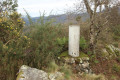
The starting point for this walk is at the Gurutze car park.
To get to this starting point by car, see the ‘Practical Information’ section below.
Please note: the presence of numerous pidgeon hunting huts means this walk is prohibited during the hunting season (check for exact dates).
As this route involves numerous changes of direction, it is almost essential to carry a map with you.
(S/E) From the car park, head left towards the wall and go down the tarmac path marked in white and yellow. A little further on, this path turns into a dirt track.
Walk through fields or through the forest, accompanied by the sound of a stream. You’ll join one of the routes to Santiago de Compostela, but leave it fairly quickly.
(1) Leave the road by taking the path on the right, where there is a large post. This is a Via Crucis, or Way of the Cross, which you join at Station 8, marked by a large cross. Continue along this route, following the other stations from 9 to 14.
For your information: the first of these crosses is in Elizalde, and the names marked on them are those of the donors who paid for their construction.
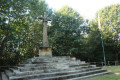
You will then arrive at a large area surrounded by a wooden fence, with a very large cross at the top of a flight of steps and the Basque flag fluttering in the wind at the summit of Urkabe, at an altitude of 233 metres.
(2) Enter this area, then exit on the other side and take a path to the left which leads straight into the woods. Pass an area with benches; then, when you see a road with a sheer drop ahead of you, do not follow this path any further, but head to the right to descend gently towards the road and turn left onto it; then, at the junction, go straight on.
(3) Leave the road and turn right onto the wide dirt track. A little further on, at the junction, keep left and then carry on straight ahead.
(4) Turn right onto a small path called ‘camino del canal’. It is a very pretty path through the forest overlooking the River Auztegi (Auztegi erreka) with some lovely views.
You’ll reach the end of the canal, where there’s a small concrete structure acting as a weir.
(5) Cross the river via the structure, then head uphill, more or less following the fence. This climb is quite strenuous and difficult as piles of leaves obscure the ground. Eventually, you’ll reach a path fairly quickly and continue straight on. Further on, cross a road and take the path opposite.
(6) Take the path on the right, then do the same a little further on to reach the Col de Arkaitz (Arkaitzlepo).
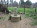
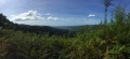
(7) Carry on straight ahead. From here, the path becomes more challenging as, on the one hand, you’ll be walking along the ridges and, on the other, you’ll be climbing and descending in places where you’ll need to use your hands. But the view is fantastic, taking in Jaizkibel, the Three Crowns, Hendaye and San Sebastián. Proceed with caution to reach the summit of Arkale with its triangulation point (marked by a cylinder on top of a cube). This peak is called Belekabita and stands at an altitude of approximately 275 metres.
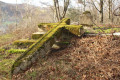
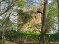
(8) Continue carefully along the path. You’ll reach the foot of the castle and go round it to the right. You’ll arrive at Beloaga Castle, which is thought to date from the 10th or 11th century. It has recently been restored and can be accessed via a flight of stairs. To visit it: after climbing a flight of stairs, you’ll reach the inner courtyard; then, by climbing another flight of stairs, you’ll reach the tower.
(9) Retrace your steps, then rejoin the path by turning left. You’ll reach a road next to a beautiful boundary stone depicting a horse (see details in the ‘Nearby’ section).
(10) Turn right and head back to the car park (S/E).


 Visorando Member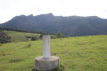

 Easy
Easy