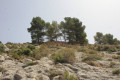
The Sierra de la Grana circular walk starting from Torre de les Maçanes

The Sierra de la Grana is surrounded by much higher mountain ranges; as a result, it is somewhat overlooked and far less visited. But this makes it an excellent vantage point for all the region’s iconic peaks, such as Cabeço d’Or, Peña Migjorn, Menajador, Els Plans, Aitana, Puig Campana, etc. What’s more, the route is very pleasant and combines forest tracks, footpaths and lightly marked sections with no technical difficulties.

Details

98779622
Creation:
Last update:
Last review:
  • Walking
    Activity: Walking
  • ↔
    Distance: 6.60 mi
  • ◔
    Average duration: 4h 05 
  • ▲
    Difficulty: Moderate

  • ⚐
    Back to start: Yes
  • ↗
    Ascent: + 1,217 ft
  • ↘
    Descent: - 1,217 ft

  • ▲
    Highest point: 3,573 ft
  • ▼
    Lowest point: 2,713 ft

Description of the walk

The starting point for this walk is situated near the Puerto de Collao pass, which lies on the road linking La Torre de les Maçanes (also known as Torremanzanas) to Relleu, past the 18-kilometre mark and, more precisely, on the street marked Partida Viola. To reach this starting point by car, please refer to the practical information section.

(S/E) Set off in an east-southeasterly direction and join a small tarmac road, heading uphill.

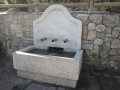
(1) Leave the tarmac road and take a dirt track on the right. Climb up through a series of hairpin bends. As you pass, note the Font de la Beura spring, which has now dried up. You may also notice signs marked‘Via Pecuaria’, indicating that you are on ancient cattle-drift routes.

(2) At a fork in the road, turn right.

(3) Shortly afterwards, just before a isolated house, turn right onto a wide, ascending dirt track.

(4) Walk past a pretty little artificial lake. The terrain then becomes almost flat.

(5) When the track takes a hairpin bend to the left, leave it and carry on straight ahead (west) off-track, following paths hidden by the vegetation. You’ll soon reach a wide track which narrows and may be overgrown: follow it at a leisurely pace.

(6) You’ll come out onto a clearer track; follow it to the right, due west. Climb and negotiate several bends. As you emerge from a gentle right-hand bend, look out for a cairn on the right and, further along, two more cairns.

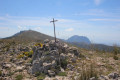
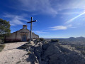
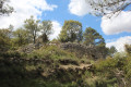
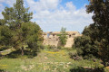
(7) Then turn right, pass between the two cairns and follow the path north-north-west. Pass a ruin on your right and climb up between abandoned agricultural terraces. You will then reach the summit of La Grana, easily recognisable by its triangulation point.

(8) Return along the same route to rejoin the path.

(7) Follow the path to the right.

(9) At a fork, take the path on the right.

(10) At a crossroads, turn sharply right and ignore a path branching off to the left. Head down north-north-east along a wide, easy path.

(11) At a three-way junction, veer left. Head slightly uphill, pass a building on the left and go between two hills (elevations 1064 and 1045). Head straight down again, then follow the winding path.

(12) At a fork in the road, turn left and continue the descent to the starting point (S/E).

Waypoints

  1. S/E : mi 0 - alt. 2,969 ft - El Collado
  2. 1 : mi 0.68 - alt. 2,972 ft - Start of the path
  3. 2 : mi 1.44 - alt. 2,769 ft - Fork
  4. 3 : mi 1.54 - alt. 2,762 ft - T-junction
  5. 4 : mi 2.14 - alt. 3,173 ft - Small artificial lake
  6. 5 : mi 2.41 - alt. 3,173 ft - Off-road start
  7. 6 : mi 2.57 - alt. 3,150 ft - Main path
  8. 7 : mi 3.5 - alt. 3,474 ft - T-junction – Cairns
  9. 8 : mi 3.6 - alt. 3,573 ft - Grana (1095 m)
  10. 9 : mi 3.98 - alt. 3,461 ft - Junction
  11. 10 : mi 4.7 - alt. 3,379 ft - Crossroads
  12. 11 : mi 5.54 - alt. 3,238 ft - Three-Way Junction
  13. 12 : mi 6.34 - alt. 3,156 ft - Fork
  14. S/E : mi 6.6 - alt. 2,969 ft - El Collado

Notes

Directions by car:
The starting point is near the 18 km mark on the CV-782, which links La Torre de les Maçanes and Relleu. Coming from La Torre de les Maçanes, after the 18 km mark on a bend, you’ll see a sign at the top bearing the words “Partida Teix de Beix”, then opposite you’ll see the sign indicating the name of the pass (Puerto de Collao at an altitude of 890 metres). Turn immediately onto the track on the right signposted “Partida Viola”. Continue for about 200 metres until you come to a wide dirt track on the right: park there on the right-hand side of the track, taking care not to obstruct the passage of a tractor, for example.
For your information, the journey by car from Alicante is approximately 58 km and takes just under an hour.

Note: there are very few parking spaces, so if you’re coming as a group, please keep the number of cars to a minimum.

Other walks in the area

For more walks, use our search engine .

The GPS track and description are the property of this route's author. Please do not copy them without permission.