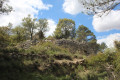
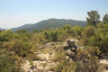
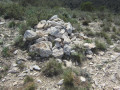
The Pic de la Blasca in Baneyres de Mariola, in the province of Alicante

A hike to the highest peak in the Baneyres de Mariola area, a village in the Province of Alicante. Most of the route follows wide paths surrounded by meadows or trees. However, the majority of the elevation gain occurs over a short distance.

The route suggested here is known locally as the PR®-CV 313 (short for Pequeno Recorrido de la Comunidad Valenciana) and is signposted in white and yellow. It is easy to follow if you pay a little attention, as there are numerous signposts in addition to the coloured markings.

Details

97772631
Creation:
Last update:
Last review:
  • Walking
    Activity: Walking
  • ↔
    Distance: 7.39 mi
  • ◔
    Average duration: 5h 35 
  • ▲
    Difficulty: Moderate

  • ⚐
    Back to start: Yes
  • ↗
    Ascent: + 2,513 ft
  • ↘
    Descent: - 2,500 ft

  • ▲
    Highest point: 3,776 ft
  • ▼
    Lowest point: 2,251 ft

Description of the walk

The starting point for this walk is at the Zona d’Acampada Moli l’Ombria in Banyeres de Mariola.
To get to this starting point by car, see the ‘Practical Information’ section below.

For your information, the rating established by the French Hiking Federation (FFR) is as follows: IBP = 59, length = 11.5 kilometres and elevation gain = 542 metres. (These figures may sometimes differ from those given by Visorando; in this case, always use the higher figures to get an idea of the hike’s difficulty).

(S/E) From the car park, head back towards the car park entrance and turn right. You will immediately see the white and yellow markings.

(1) At the STOP sign, turn left and take the small tarmac road on the left that leads downhill. This road is only accessible to the cars of the various property owners, meaning there is virtually no traffic. Follow this road at a leisurely pace.

(2) The road turns into a wide dirt track.

(3) At the signpost, turn left. Walk past the pretty Mas de Perolit.

(4) A short while later, take a brief detour to see the fountain and the water reservoir. Then retrace your steps and continue along the track. It is from this point that the climb begins.

(5) Take the path on the left.

(6) Head left.

(7) This is a post set on a cairn. Make a round trip to the summit, heading towards “Pic de la Blasca”. This section is a little more difficult than before as you’ll be walking over rocks and will occasionally need to use your hands to climb.

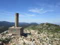
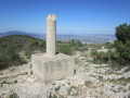
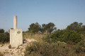
(8) You’ll reach the summit of “Pic de la Blasca” at an altitude of 1,120 metres. It is marked by a triangulation point (a cylinder on a concrete cube).

Head back down the same way you came, until you reach the cairn.

(7) Turn right towards El Real de Dalt. The path is made up of stones and pebbles; it descends quite steeply, so take care not to slip on the small pebbles.

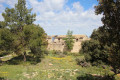
(9) At the post, turn left and follow the path. As you pass, you’ll notice some ruins (perhaps a snow pit?).

(10) Follow the sign for “El Real de Dalt” and head to the right.

(11) Walk round the ruins.

(12) From here, take your time walking round the small hill on the right – “Le Cabeço dels Lorenços” – following the “official” PR®-CV 313 path.

Note: there is another option, which involves walking round the small hill on the left by taking the small dirt track between the two cairns visible at the side of the road. This track joins the route suggested here much further on.

(13) Leave the tarmac road and take the path on the left.

(14) You are now at a place known as “El Real de Dalt”, which is an old, historic farmstead that serves as a local landmark. Leave the wide track you have been following and take the narrower track on the right.

(15) Cross the River Vinalopo over the pretty little bridge, then turn left.

(16) Just before you reach the wall of a house, take the path on the left.

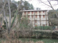
(17) You’ll come to an old lime kiln. Read the information provided on how this type of kiln works. Then turn sharply to the right.

At the old mill (El Moli de l’Ombria), take the path to the left, which will lead you back to the car park. (S/E)

Waypoints

  1. S/E : mi 0 - alt. 2,287 ft - Moli l’Ombria Campsite
  2. 1 : mi 0.12 - alt. 2,283 ft - Stop
  3. 2 : mi 1.41 - alt. 2,470 ft - Route
  4. 3 : mi 1.65 - alt. 2,474 ft - Signpost
  5. 4 : mi 1.74 - alt. 2,520 ft - Fountain
  6. 5 : mi 2.23 - alt. 2,992 ft - Junction
  7. 6 : mi 2.6 - alt. 3,241 ft - Change direction
  8. 7 : mi 2.93 - alt. 3,471 ft - Signpost
  9. 8 : mi 3.16 - alt. 3,638 ft - La Blasca summit
  10. 9 : mi 3.7 - alt. 3,107 ft - Signpost
  11. 10 : mi 4.1 - alt. 3,107 ft - Signpost
  12. 11 : mi 4.21 - alt. 3,222 ft - Ruins
  13. 12 : mi 4.86 - alt. 2,769 ft - Route
  14. 13 : mi 6.19 - alt. 2,526 ft - Route
  15. 14 : mi 6.48 - alt. 2,507 ft - Signpost
  16. 15 : mi 6.79 - alt. 2,320 ft - Bridge
  17. 16 : mi 6.98 - alt. 2,349 ft - House
  18. 17 : mi 7.12 - alt. 2,293 ft - Lime kiln at dr
  19. S/E : mi 7.39 - alt. 2,287 ft - Moli l’Ombria Campsite

Notes

Driving directions to the start of the walk.

From Alicante city centre, take the A31 motorway (from Calle Mexico) towards Madrid and, shortly afterwards, take exit 236A towards Benidorm and Valencia. Then, shortly afterwards, take exit 17 towards Alcoï (or Alcoy). Once past the roundabout towards Alcoy, follow the A77 motorway, which becomes the A7.

Take exit 469 for the CV-80 / Onil / Sax / A31 Albacete.

On the CV-80, take exit 16 towards Onil / Castalla and, at the roundabout, take the second exit towards CV-815 Onil (this is the CV-8153) and continue in this direction at the various roundabouts. When you reach the roundabout marked CV-802 Onil (east) and CV-803 Banyeres, turn right towards Banyeres.

You are now on the CV-803, which becomes a mountain road and climbs to the Puerto Canalis de Onil, which is over 1,000 metres above sea level (and may therefore be snow-covered in winter). You then descend the pass and, after kilometre 9, you come to a junction: turn left towards the CV-795 Banyeres.

Pass the sign marking the entrance to Banyeres. You are now on Carrer del Conqueridor (or the CV-795). When you reach a narrow section with a sign indicating both directions of traffic (two arrows of different colours), turn left before passing this sign onto the small street leading downhill, called Carrer Sant Josep. Turn left opposite the “Embalajes Alero” business. When you see the sign for “Zona d’Acampada Moli l’Ombria”, turn left and park in the car park.

For your information, the journey by car from Alicante is approximately 62 kilometres and takes around 50 minutes.

Always be cautious and plan ahead when you're outdoors. Visorando and the author of this route cannot be held responsible for any accidents occurring on this route.

The GR® and PR® markings are the intellectual property of the Fédération Française de Randonnée Pédestre.

Other walks in the area

For more walks, use our search engine .

The GPS track and description are the property of this route's author. Please do not copy them without permission.