Llobera, Torreta and Pantano in Elda

A walk around Elda to see some of its most characteristic spots. Firstly, the walk takes you up to a few peaks overlooking the town and past the remains of a15th-century defence tower at an altitude of 550 metres. You’ll then stroll along the River Vinalopó via a lovely, secluded path and discover the17th-century dam built across the river, enjoying the experience of walking across it.

Details

93616622
Creation:
Last update:
Last review:
  • Walking
    Activity: Walking
  • ↔
    Distance: 4.63 mi
  • ◔
    Average duration: 2h 35 
  • ▲
    Difficulty: Easy

  • ⚐
    Back to start: Yes
  • ↗
    Ascent: + 522 ft
  • ↘
    Descent: - 525 ft

  • ▲
    Highest point: 1,831 ft
  • ▼
    Lowest point: 1,371 ft
  • ⚐ Country: Spain
  • ⚐ City: Elda 
  • ⚑
    Start/End: N 38.490865° / W 0.807493°
  • Hour-by-hour weather

Photos

Description of the walk

The starting point for this walk is near Avenida Condes de Elda in Elda. To reach this starting point by car, see the “Practical Information” section below.

(S/E) From where you have parked your car, walk a short way down the small road you have just come along and look out for a narrow path on the right, running parallel to the road and leading to some ruins a little further on.

(1) Once past the ruins, head left to easily cross the Rambla del Sapo ravine, then climb back up (on the other side of the ravine) following the path. This path zigzags and continues to climb, using various pylons above as landmarks. Pass under a large pylon and carry on. You’ll reach a very large cairn marking an unnamed peak at an altitude of 561 metres.

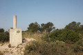
(2) Continue northwards until you reach another very large cairn marking the summit of La Llobera at an altitude of 563 metres. There is also a large pylon here.

(3) Carry on eastwards then northwards until you reach a junction.

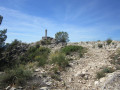
(4) Take the path on the right, descend slightly and then climb back up to the summit of La Torreta.

(5) Descend quite steeply, heading north-east then east.

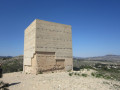
(6) Cross the tarmac road CV-833 (at kilometre 2) with care, as you are crossing at a bend. Head to the left and do not take the wide path straight ahead, but take the very narrow stony path on the right. This will take you to the Torreta de Elda, a restored ancient defence tower.

(7) Head back down towards the east. Climb back up and pass between the aerial masts. Head back down, following the east-southeast path.

(8) At the signpost, turn left towards the Pantano (the dam).

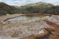
(9) At the signpost, turn right. Follow a path along the River Vinalopo. Then walk alongside the lake as far as the dam.

(10) Turn left and walk along the crest of the dam. On the other side, keep right onto the Camino de Santiago del Sureste (one of the routes to Santiago de Compostela), also known as the Camino de Lana de Alicante.

(11) Go under the road bridge and continue to the right.

(12) At the junction, carry on straight ahead towards Elda. Then, keeping to the pavement and continuing straight ahead, carry on until you reach the town limits and turn right towards the car park (S/E).

Waypoints

  1. S/E : mi 0 - alt. 1,467 ft - Avenida Condes de Elda in Elda
  2. 1 : mi 0.16 - alt. 1,486 ft - Turn left
  3. 2 : mi 0.64 - alt. 1,798 ft - Large cairn
  4. 3 : mi 0.79 - alt. 1,831 ft - Large cairn - La Lobera (563 m)
  5. 4 : mi 0.98 - alt. 1,801 ft - Junction
  6. 5 : mi 1.26 - alt. 1,827 ft - La Torreta (565 m)
  7. 6 : mi 1.54 - alt. 1,660 ft - Journey along the CV-833
  8. 7 : mi 1.7 - alt. 1,762 ft - La Torreta de Elda (548 m)
  9. 8 : mi 2.2 - alt. 1,654 ft - Signpost
  10. 9 : mi 2.46 - alt. 1,407 ft - Signpost
  11. 10 : mi 2.76 - alt. 1,421 ft - Roadblock - Embalse d'Elda
  12. 11 : mi 3.23 - alt. 1,371 ft - Bridge
  13. 12 : mi 3.29 - alt. 1,375 ft - Junction towards Elda
  14. S/E : mi 4.63 - alt. 1,463 ft - Avenida Condes de Elda in Elda

Notes

Directions by car to the start of the walk:
The starting point is situated nearthe Hospital General Universitario de Elda, in the north of the town. On arriving in Elda, follow the signs for ‘Elda Hospital’. At the roundabout by the hospital, take Avenida Condes de Elda. Turn right at the first junction, drive up the road a little way and park in a vacant lot on the right without obstructing other road users (as the hospital is nearby, parking along Avenida Condes de Elda is not permitted).
For your information, the journey by car from Alicante is approximately 44 kilometres and takes around 35 minutes.

Other walks in the area

For more walks, use our search engine .

The GPS track and description are the property of this route's author. Please do not copy them without permission.